
Previsioni:

Previsione a breve terminepioggia leggera (Totale 3mm), per lo più che cade Venerdì mattina. Very mild (Max 18°C Venerdì notte, Min 9°C Sabato mattina). Vento sarà generalmente leggero. | ||||||||||||||||||||||||
Mer 15 | Giovedì 16 | Venerdì 17 | 18 | |||||||||||||||||||||
12 PM | 3 PM | 6 PM | 9 PM | 12 AM | 3 AM | 6 AM | 9 AM | 12 PM | 3 PM | 6 PM | 9 PM | 12 AM | 3 AM | 6 AM | 9 AM | 12 PM | 3 PM | 6 PM | 9 PM | 12 AM | 3 AM | 6 AM | 9 AM | |
Mappa dell'altezza del moto ondoso |  | 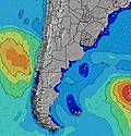 |  | 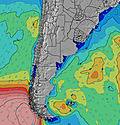 | 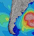 |  | 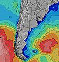 | 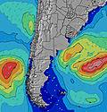 | 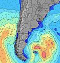 | 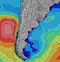 | ||||||||||||||
Onda Altezza (m) Direzione Periodo (s) | E 7 | ENE 7 | NE 4 | NE 4 | NE 5 | ENE 5 | ENE 6 | ENE 7 | ENE 7 | ENE 7 | ENE 7 | NE 5 | NE 5 | NE 6 | NE 6 | ENE 7 | ENE 7 | E 8 | ENE 8 | ENE 8 | ENE 9 | ENE 9 | ENE 9 | E 10 |
Grafico delle onde | ||||||||||||||||||||||||
38 | 37 | 34 | 32 | 47 | 31 | 35 | 47 | 54 | 55 | 73 | 66 | 74 | 100 | 136 | 111 | 86 | 72 | 106 | 98 | 134 | 141 | 147 | 115 | |
Vento (km/h) | ||||||||||||||||||||||||
Stato del vento onshore cross-onshore cross-shore cross-offshore offshore piatto | cross-on | cross-on | cross-on | cross-on | cross-on | cross-on | cross-on | cross-on | cross-on | cross-on | cross-on | cross-on | cross-on | cross-on | cross-on | cross-on | cross-on | cross | cross-off | off | cross-off | cross-off | cross-off | cross-off |
Alta Marea | 9:52AM0.76m | 10:21PM1.38m | 10:44AM0.73m | 11:22PM1.38m | 11:36AM0.72m | 00:21AM1.35m | ||||||||||||||||||
Basso Marea | 3:40PM0.11m | 5:22AM0.08m | 4:36PM0.06m | 6:19AM0.12m | 5:32PM0.04m | 7:13AM0.15m | ||||||||||||||||||
— | — | — | — | — | — | 7:54 | — | — | — | — | — | — | — | 7:54 | — | — | — | — | — | — | — | 7:54 | — | |
— | 5:50 | — | — | — | — | — | — | — | 5:50 | — | — | — | — | — | — | — | 5:51 | — | — | — | — | — | 5:52 | |
mm | — | — | — | — | — | — | — | — | — | — | — | — | — | — | — | — | 2 | 1 | — | — | — | — | — | — |
Temp. °C | 12 | 12 | 12 | 14 | 15 | 14 | 14 | 14 | 15 | 16 | 15 | 15 | 15 | 14 | 15 | 15 | 16 | 17 | 16 | 18 | 17 | 14 | 11 | 9 |
Gelo °C | 8 | 8 | 8 | 10 | 11 | 11 | 10 | 11 | 11 | 13 | 11 | 11 | 11 | 11 | 13 | 12 | 14 | 16 | 16 | 18 | 17 | 11 | 7 | 4 |
Onda 1 Altezza (m) Direzione Periodo (s) | E 7 | ENE 7 | SE 10 | E 8 | S 12 | ENE 5 | ENE 6 | ENE 7 | ENE 7 | ENE 7 | ENE 7 | SSE 9 | ESE 10 | SSE 9 | SSE 8 | ENE 7 | ENE 7 | E 8 | ENE 8 | ENE 8 | ENE 9 | ENE 9 | ENE 9 | E 10 |
38 | 37 | 4 | 10 | 3 | 31 | 35 | 47 | 54 | 55 | 73 | 8 | 20 | 7 | 7 | 111 | 86 | 72 | 106 | 98 | 134 | 141 | 147 | 115 | |
Onda 2 Altezza (m) Direzione Periodo (s) | ESE 10 | SE 10 | S 12 | E 10 | — | S 12 | E 12 | E 12 | E 11 | ESE 11 | SSE 10 | SE 15 | SSE 9 | S 14 | S 13 | SSE 8 | S 8 | NE 6 | S 8 | S 8 | SE 14 | N 5 | — | S 13 |
10 | 4 | 3 | 2 | — | 3 | 3 | 3 | 10 | 12 | 9 | 8 | 8 | 4 | 3 | 7 | 5 | 11 | 5 | 1 | 8 | 4 | — | 12 | |
Onda 3 Altezza (m) Direzione Periodo (s) | S 11 | S 12 | S 12 | — | — | E 12 | S 11 | S 9 | S 10 | SSE 10 | SE 15 | SE 15 | S 14 | — | S 13 | S 13 | S 18 | S 8 | SE 16 | SE 15 | SSE 14 | — | — | — |
3 | 3 | 3 | — | — | 3 | 2 | 1 | 7 | 9 | 9 | 8 | 4 | — | 3 | 3 | 6 | 5 | 10 | 8 | 20 | — | — | — | |
onde vento Altezza (m) Direzione Periodo (s) | N 4 | N 4 | NE 4 | NE 4 | NE 5 | N 4 | N 4 | N 4 | N 4 | N 4 | NNE 4 | NE 5 | NE 5 | NE 6 | NE 6 | N 4 | N 5 | N 5 | — | — | SSW 3 | S 4 | S 4 | S 5 |
11 | 10 | 34 | 32 | 47 | 17 | 12 | 12 | 16 | 16 | 18 | 66 | 74 | 100 | 136 | 33 | 55 | 20 | — | — | 3 | 12 | 28 | 34 | |
Il più vicino Offshore or Glassy | ||||||||||||||||||||||||
Distanza (km) | 237 | 224 | 188 | 229 | 205 | 43 | 176 | 43 | 189 | 189 | 189 | 189 | 189 | 190 | 189 | 189 | 162 | 162 | 0 | 0 | 0 | 235 | 235 | 248 |
Migliori previsioni per le condizioni d'onda in Provincia de Buenos Aires | ||||||||||||||||||||||||
Migliori previsioni per le condizioni d'onda in Argentina | ||||||||||||||||||||||||
Trova Onde Globale | ||||||||||||||||||||||||
- Map Icons:
 Break
Break Live Wave Height (m)
 Live Wind Speed (km/h)
 Surf Rating (10 Max)
 Ocean Swells (m)
- Wind Speed (km/h)
Widget Free Surf-Forecast.com per il tuo sito
La relazione di surf / widget meteo è disponibile qui sotto per incorporare su siti esterni a titolo gratuito e fornisce una sintesi delle nostre Santa Teresita previsione surf. Basta prendere il frammento di codice html da noi fornito e copiarlo nel proprio sito. È possibile scegliere la lingua preferita e unità metriche / imperiali per il feed delle previsioni surf per soddisfare le esigenze degli utenti del vostro sito .... Clicca qui per ottenere il codice.
 Nearest