
Previsioni:

Previsione a breve terminePioggia abbondante (Totale 57mm), più pesante durante martedì notte. Warm (Max 28°C martedì mattina, Min 27°C mercoledì notte). Vento sarà generalmente leggero. | |||||||||||||||||||||||
Martedì 28 | Mercoledì 29 | Giovedì 30 | |||||||||||||||||||||
4 AM | 7 AM | 10 AM | 1 PM | 4 PM | 7 PM | 10 PM | 1 AM | 4 AM | 7 AM | 10 AM | 1 PM | 4 PM | 7 PM | 10 PM | 1 AM | 4 AM | 7 AM | 10 AM | 1 PM | 4 PM | 7 PM | 10 PM | |
Mappa dell'altezza del moto ondoso | 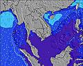 | 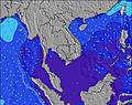 |  | 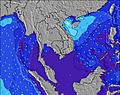 | 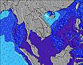 | 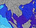 | 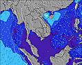 | 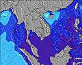 | 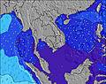 | ||||||||||||||
Onda Altezza (m) Direzione Periodo (s) | W 7 | W 7 | W 7 | W 7 | W 7 | W 7 | W 8 | W 8 | W 8 | W 8 | W 8 | W 8 | W 8 | W 8 | W 8 | W 8 | W 8 | W 8 | W 8 | W 8 | W 8 | W 8 | W 8 |
Grafico delle onde | |||||||||||||||||||||||
195 | 199 | 229 | 236 | 276 | 276 | 291 | 275 | 282 | 282 | 321 | 323 | 287 | 247 | 207 | 181 | 152 | 153 | 157 | 157 | 153 | 149 | 149 | |
Vento (km/h) | |||||||||||||||||||||||
Stato del vento onshore cross-onshore cross-shore cross-offshore offshore piatto | cross-on | on | on | cross-on | on | cross-on | on | on | on | on | cross-on | cross-on | on | cross-on | cross-on | on | cross-on | on | on | on | on | on | cross-on |
Alta Marea | 9:39AM1.98m | 10:06PM1.70m | 10:13AM2.10m | 10:38PM1.82m | 10:44AM2.20m | ||||||||||||||||||
Basso Marea | 3:25AM0.52m | 4:10PM0.34m | 4:00AM0.41m | 4:39PM0.24m | 4:32AM0.33m | 5:07PM0.16m | |||||||||||||||||
6:20 | — | — | — | — | — | — | — | 6:20 | — | — | — | — | — | — | — | 6:20 | — | — | — | — | — | — | |
— | — | — | — | 6:51 | — | — | — | — | — | — | — | 6:51 | — | — | — | — | — | — | — | 6:51 | — | — | |
mm | — | 1 | 3 | — | 3 | 4 | 5 | 2 | 3 | 1 | — | 2 | 3 | 3 | 3 | 3 | 2 | 3 | 2 | 1 | 3 | 2 | 2 |
Temp. °C | 28 | 28 | 28 | 28 | 28 | 28 | 28 | 28 | 28 | 28 | 28 | 28 | 28 | 28 | 28 | 28 | 27 | 27 | 27 | 27 | 27 | 27 | 27 |
Gelo °C | 29 | 29 | 29 | 29 | 29 | 29 | 29 | 29 | 28 | 28 | 28 | 29 | 29 | 29 | 31 | 30 | 28 | 29 | 28 | 28 | 27 | 28 | 29 |
Onda 1 Altezza (m) Direzione Periodo (s) | SW 12 | SW 12 | SW 12 | SW 12 | SW 12 | SW 13 | SW 13 | SW 16 | SW 16 | SW 16 | SW 16 | SW 15 | SW 15 | W 8 | W 8 | W 8 | W 8 | W 8 | W 8 | W 8 | W 8 | W 8 | SW 20 |
23 | 23 | 23 | 23 | 22 | 25 | 27 | 40 | 39 | 39 | 38 | 35 | 34 | 247 | 207 | 181 | 152 | 153 | 157 | 157 | 153 | 149 | 60 | |
Onda 2 Altezza (m) Direzione Periodo (s) | SW 16 | SW 17 | SW 17 | SW 16 | SW 13 | SW 16 | SW 16 | SW 16 | SW 11 | SW 11 | SW 11 | SW 11 | WSW 11 | SW 15 | SW 15 | SW 15 | SW 15 | SW 15 | SW 15 | SW 14 | SW 14 | SW 14 | SW 14 |
10 | 11 | 12 | 10 | 7 | 10 | 10 | 10 | 5 | 5 | 5 | 19 | 12 | 35 | 34 | 34 | 34 | 33 | 33 | 33 | 33 | 33 | 32 | |
Onda 3 Altezza (m) Direzione Periodo (s) | — | — | — | — | SW 16 | SW 16 | SW 13 | SW 13 | SW 13 | SW 11 | SW 11 | — | W 24 | SW 11 | SW 23 | SW 22 | SW 21 | SW 21 | SW 21 | SW 21 | SW 20 | SW 20 | SE 4 |
— | — | — | — | 10 | 10 | 7 | 7 | 7 | 5 | 5 | — | 11 | 20 | 20 | 18 | 18 | 18 | 18 | 17 | 60 | 60 | 1 | |
onde vento Altezza (m) Direzione Periodo (s) | W 7 | W 7 | W 7 | W 7 | W 7 | W 7 | W 8 | W 8 | W 8 | W 8 | W 8 | W 8 | W 8 | — | — | — | — | — | — | — | — | — | W 8 |
195 | 199 | 229 | 236 | 276 | 276 | 291 | 275 | 282 | 282 | 321 | 323 | 287 | — | — | — | — | — | — | — | — | — | 149 | |
Il più vicino Offshore or Glassy | |||||||||||||||||||||||
Distanza (km) | 97 | 97 | 97 | 97 | 97 | 97 | 97 | 97 | 97 | 97 | 97 | 97 | 97 | 97 | 68 | 67 | 67 | 67 | 67 | 97 | 97 | 97 | 68 |
Migliori previsioni per le condizioni d'onda in Andaman Sea | |||||||||||||||||||||||
Migliori previsioni per le condizioni d'onda in Thailand | |||||||||||||||||||||||
Trova Onde Globale | |||||||||||||||||||||||
- Map Icons:
 Break
Break Live Wave Height (m)
 Live Wind Speed (km/h)
 Surf Rating (10 Max)
 Ocean Swells (m)
- Wind Speed (km/h)
Widget Free Surf-Forecast.com per il tuo sito
La relazione di surf / widget meteo è disponibile qui sotto per incorporare su siti esterni a titolo gratuito e fornisce una sintesi delle nostre Similan Islands previsione surf. Basta prendere il frammento di codice html da noi fornito e copiarlo nel proprio sito. È possibile scegliere la lingua preferita e unità metriche / imperiali per il feed delle previsioni surf per soddisfare le esigenze degli utenti del vostro sito .... Clicca qui per ottenere il codice.
 Nearest