
Previsioni:

Previsione a breve terminePioggia abbondante (Totale 48mm), più pesante durante martedì notte. Warm (Max 29°C mercoledì pomeriggio, Min 20°C mercoledì notte). Venti in aumento (venti deboli da ENE Lunedì mattina, raffiche di vento da SSW per martedì notte). | |||||||||||||||||||||||
Lunedì 20 | Martedì 21 | Mercoledì 22 | |||||||||||||||||||||
5 AM | 8 AM | 11 AM | 2 PM | 5 PM | 8 PM | 11 PM | 2 AM | 5 AM | 8 AM | 11 AM | 2 PM | 5 PM | 8 PM | 11 PM | 2 AM | 5 AM | 8 AM | 11 AM | 2 PM | 5 PM | 8 PM | 11 PM | |
Mappa dell'altezza del moto ondoso |  | 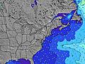 |  |  | 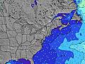 |  |  | 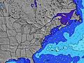 |  | ||||||||||||||
Onda Altezza (m) Direzione Periodo (s) | SSE 7 | SE 7 | SE 7 | SSE 7 | S 6 | SSE 3 | SSE 4 | SSE 4 | SSE 5 | SE 5 | S 5 | S 6 | S 6 | S 6 | SSE 7 | S 7 | S 8 | S 8 | S 8 | S 8 | SSE 9 | SSE 9 | SSE 9 |
Grafico delle onde | |||||||||||||||||||||||
18 | 11 | 11 | 9 | 22 | 7 | 16 | 24 | 37 | 40 | 54 | 77 | 137 | 148 | 121 | 210 | 228 | 318 | 408 | 224 | 297 | 300 | 268 | |
Vento (km/h) | |||||||||||||||||||||||
Stato del vento onshore cross-onshore cross-shore cross-offshore offshore piatto | cross-off | cross-off | cross-off | cross-on | cross-on | cross-on | cross-on | cross-on | cross-on | on | on | on | on | cross-on | cross-on | cross-on | cross-on | cross-on | cross-on | cross-on | cross | on | cross |
Alta Marea | 1:51PM1.45m | 1:57AM1.28m | 2:41PM1.42m | 2:49AM1.17m | 3:36PM1.41m | ||||||||||||||||||
Basso Marea | 7:14AM0.10m | 7:44PM0.28m | 7:58AM0.19m | 8:41PM0.35m | 8:44AM0.27m | 9:44PM0.39m | |||||||||||||||||
5:48 | — | — | — | — | — | — | — | 5:50 | — | — | — | — | — | — | — | 5:50 | — | — | — | — | — | — | |
— | — | — | — | — | 8:21 | — | — | — | — | — | — | — | 8:20 | — | — | — | — | — | — | — | 8:20 | — | |
mm | — | — | — | — | — | — | — | — | — | 1 | — | 1 | — | 23 | 1 | 1 | — | — | 2 | 2 | 7 | 9 | 1 |
Temp. °C | 23 | 22 | 23 | 24 | 24 | 24 | 24 | 24 | 24 | 24 | 25 | 27 | 26 | 24 | 24 | 24 | 23 | 24 | 26 | 29 | 25 | 25 | 24 |
Gelo °C | 24 | 22 | 24 | 25 | 23 | 24 | 23 | 24 | 25 | 26 | 25 | 26 | 23 | 20 | 22 | 22 | 22 | 23 | 26 | 30 | 23 | 25 | 25 |
Onda 1 Altezza (m) Direzione Periodo (s) | SSE 7 | SE 7 | SE 7 | SE 8 | S 6 | SE 12 | SE 12 | SE 12 | — | SE 8 | — | — | E 12 | — | W 3 | — | — | — | S 8 | — | — | SSE 9 | SSE 9 |
18 | 11 | 11 | 3 | 22 | 6 | 6 | 6 | — | 2 | — | — | 3 | — | 1 | — | — | — | 408 | — | — | 300 | 268 | |
Onda 2 Altezza (m) Direzione Periodo (s) | SE 12 | E 12 | SE 8 | E 12 | SE 8 | — | — | — | — | E 12 | E 12 | — | — | — | — | — | — | — | — | — | — | — | — |
6 | 3 | 2 | 3 | 3 | — | — | — | — | 3 | 3 | — | — | — | — | — | — | — | — | — | — | — | — | |
Onda 3 Altezza (m) Direzione Periodo (s) | E 8 | — | E 12 | SE 12 | SE 12 | — | — | — | — | — | — | — | — | — | — | — | — | — | — | — | — | — | — |
1 | — | 3 | 6 | 6 | — | — | — | — | — | — | — | — | — | — | — | — | — | — | — | — | — | — | |
onde vento Altezza (m) Direzione Periodo (s) | — | — | — | SSE 7 | SSE 7 | SSE 3 | SSE 4 | SSE 4 | SSE 5 | SE 5 | S 5 | S 6 | S 6 | S 6 | SSE 7 | S 7 | S 8 | S 8 | S 8 | S 8 | SSE 9 | — | — |
— | — | — | 9 | 17 | 7 | 16 | 24 | 37 | 40 | 54 | 77 | 137 | 148 | 121 | 210 | 228 | 318 | 185 | 224 | 297 | — | — | |
Il più vicino Offshore or Glassy | |||||||||||||||||||||||
Distanza (km) | 102 | 102 | 234 | 1516 | 1042 | 1040 | 400 | 562 | 601 | 29 | 1168 | 1168 | 1168 | 1168 | 245 | 1043 | 24 | 183 | 183 | 24 | 38 | 24 | 2 |
Migliori previsioni per le condizioni d'onda in New Jersey | |||||||||||||||||||||||
Migliori previsioni per le condizioni d'onda in United States | |||||||||||||||||||||||
Trova Onde Globale | |||||||||||||||||||||||
- Map Icons:
 Break
Break Live Wave Height (m)
 Live Wind Speed (km/h)
 Surf Rating (10 Max)
 Ocean Swells (m)
- Wind Speed (km/h)
Widget Free Surf-Forecast.com per il tuo sito
La relazione di surf / widget meteo è disponibile qui sotto per incorporare su siti esterni a titolo gratuito e fornisce una sintesi delle nostre Stockton previsione surf. Basta prendere il frammento di codice html da noi fornito e copiarlo nel proprio sito. È possibile scegliere la lingua preferita e unità metriche / imperiali per il feed delle previsioni surf per soddisfare le esigenze degli utenti del vostro sito .... Clicca qui per ottenere il codice.
 Nearest