
Previsioni:

Previsione a breve terminepioggia leggera (Totale 5mm), per lo più che cade mercoledì pomeriggio. Warm (Max 30°C martedì mattina, Min 27°C martedì notte). Principalmente venti freschi. | |||||||||||||||||||||||
Martedì 21 | Mercoledì 22 | Giovedì 23 | |||||||||||||||||||||
5 AM | 8 AM | 11 AM | 2 PM | 5 PM | 8 PM | 11 PM | 2 AM | 5 AM | 8 AM | 11 AM | 2 PM | 5 PM | 8 PM | 11 PM | 2 AM | 5 AM | 8 AM | 11 AM | 2 PM | 5 PM | 8 PM | 11 PM | |
Mappa dell'altezza del moto ondoso |  |  | 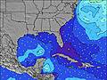 |  | 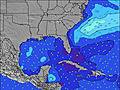 |  |  | 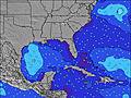 |  | ||||||||||||||
Onda Altezza (m) Direzione Periodo (s) | SSE 5 | SSE 5 | SSE 5 | SSE 5 | SSE 5 | SE 4 | SE 4 | SE 4 | SE 4 | SE 4 | SE 4 | SE 4 | SE 4 | SE 4 | SE 4 | SE 5 | ESE 4 | E 8 | E 8 | E 8 | E 8 | ENE 4 | E 4 |
Grafico delle onde | |||||||||||||||||||||||
49 | 36 | 39 | 37 | 27 | 21 | 21 | 22 | 19 | 15 | 22 | 24 | 24 | 18 | 16 | 18 | 7 | 5 | 4 | 6 | 6 | 6 | 11 | |
Vento (km/h) | |||||||||||||||||||||||
Stato del vento onshore cross-onshore cross-shore cross-offshore offshore piatto | cross | cross | cross-on | cross-on | cross-on | cross-on | cross-on | cross | cross-on | cross-on | cross-on | cross-on | cross-on | cross-on | cross-on | cross-on | cross-on | on | on | on | cross-on | cross-on | on |
Alta Marea | 2:11PM0.87m | 2:15AM0.84m | 3:07PM0.83m | 3:08AM0.80m | 4:04PM0.81m | ||||||||||||||||||
Basso Marea | 8:06AM0.01m | 8:34PM0.17m | 9:00AM0.04m | 9:29PM0.21m | 9:53AM0.07m | 10:23PM0.23m | |||||||||||||||||
6:37 | — | — | — | — | — | — | — | 6:39 | — | — | — | — | — | — | — | 6:39 | — | — | — | — | — | — | |
— | — | — | — | — | 8:15 | — | — | — | — | — | — | — | 8:14 | — | — | — | — | — | — | — | 8:14 | — | |
mm | — | — | — | — | — | — | — | — | — | — | — | 1 | 2 | 1 | — | — | — | — | — | — | — | 1 | — |
Temp. °C | 28 | 28 | 30 | 30 | 29 | 28 | 28 | 28 | 27 | 28 | 29 | 29 | 29 | 28 | 28 | 28 | 28 | 28 | 28 | 29 | 29 | 28 | 28 |
Gelo °C | 31 | 31 | 31 | 29 | 28 | 28 | 29 | 31 | 30 | 31 | 29 | 29 | 30 | 29 | 29 | 31 | 32 | 32 | 30 | 31 | 31 | 31 | 31 |
Onda 1 Altezza (m) Direzione Periodo (s) | E 7 | E 7 | E 7 | E 8 | E 7 | E 7 | E 7 | E 7 | E 7 | E 7 | E 7 | E 7 | E 7 | E 7 | E 7 | E 7 | SSE 5 | SSE 5 | SSE 4 | SE 4 | SE 4 | SE 4 | E 7 |
3 | 4 | 4 | 5 | 4 | 4 | 4 | 4 | 4 | 4 | 4 | 4 | 4 | 4 | 4 | 4 | 8 | 8 | 7 | 3 | 3 | 3 | 4 | |
Onda 2 Altezza (m) Direzione Periodo (s) | NE 8 | — | — | E 7 | E 7 | E 8 | — | E 11 | E 9 | E 9 | E 9 | E 8 | E 8 | E 8 | NE 10 | NE 10 | E 7 | E 8 | E 8 | SSE 5 | E 8 | E 7 | NE 9 |
2 | — | — | 4 | 4 | 1 | — | 2 | 2 | 2 | 2 | 1 | 1 | 1 | 4 | 4 | 4 | 4 | 4 | 4 | 4 | 4 | 3 | |
Onda 3 Altezza (m) Direzione Periodo (s) | — | — | — | E 7 | E 8 | — | — | — | E 11 | E 10 | — | E 10 | E 10 | E 10 | E 8 | E 8 | NE 10 | E 9 | E 9 | E 8 | S 4 | — | — |
— | — | — | 1 | 1 | — | — | — | 2 | 2 | — | 2 | 2 | 2 | 1 | 1 | 4 | 2 | 2 | 5 | 1 | — | — | |
onde vento Altezza (m) Direzione Periodo (s) | SSE 5 | SSE 5 | SSE 5 | SSE 5 | SSE 5 | SE 4 | SE 4 | SE 4 | SE 4 | SE 4 | SE 4 | SE 4 | SE 4 | SE 4 | SE 4 | SE 5 | ESE 4 | ESE 4 | ENE 4 | ENE 4 | ENE 4 | ENE 4 | E 4 |
49 | 36 | 39 | 37 | 27 | 21 | 21 | 22 | 19 | 15 | 22 | 24 | 24 | 18 | 16 | 18 | 7 | 5 | 3 | 6 | 6 | 6 | 11 | |
Il più vicino Offshore or Glassy | |||||||||||||||||||||||
Distanza (km) | 296 | 1101 | 1587 | 1587 | 1587 | 1015 | 230 | 296 | 242 | 103 | 207 | 1076 | 1136 | 1012 | 234 | 234 | 233 | 103 | 234 | 807 | 286 | 884 | 234 |
Migliori previsioni per le condizioni d'onda in South Florida | |||||||||||||||||||||||
Migliori previsioni per le condizioni d'onda in United States | |||||||||||||||||||||||
Trova Onde Globale | |||||||||||||||||||||||
- Map Icons:
 Break
Break Live Wave Height (m)
 Live Wind Speed (km/h)
 Surf Rating (10 Max)
 Ocean Swells (m)
- Wind Speed (km/h)
Widget Free Surf-Forecast.com per il tuo sito
La relazione di surf / widget meteo è disponibile qui sotto per incorporare su siti esterni a titolo gratuito e fornisce una sintesi delle nostre Stuart Public Beach previsione surf. Basta prendere il frammento di codice html da noi fornito e copiarlo nel proprio sito. È possibile scegliere la lingua preferita e unità metriche / imperiali per il feed delle previsioni surf per soddisfare le esigenze degli utenti del vostro sito .... Clicca qui per ottenere il codice.
 Nearest