
Previsioni:

Previsione a breve terminePioggia abbondante (Totale 25mm), più pesante durante lunedì mattina. Warm (Max 20°C Lunedì pomeriggio, Min 17°C Lunedì mattina). Venti in aumento (calma Lunedì mattina, raffiche di vento da SE per mercoledì notte). | |||||||||||||||||||||||
Lunedì 3 | Martedì 4 | Mercoledì 5 | |||||||||||||||||||||
3 AM | 6 AM | 9 AM | 12 PM | 3 PM | 6 PM | 9 PM | 12 AM | 3 AM | 6 AM | 9 AM | 12 PM | 3 PM | 6 PM | 9 PM | 12 AM | 3 AM | 6 AM | 9 AM | 12 PM | 3 PM | 6 PM | 9 PM | |
Mappa dell'altezza del moto ondoso |  | 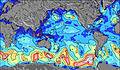 | 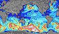 | 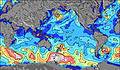 | 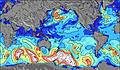 | 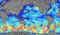 | 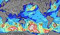 | 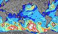 | 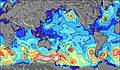 | ||||||||||||||
Onda Altezza (m) Direzione Periodo (s) | SW 13 | SW 13 | SW 17 | SW 16 | SW 16 | SW 16 | SW 16 | SW 15 | SW 15 | SW 14 | SW 14 | NNW 7 | SW 14 | SW 14 | SW 13 | SW 13 | SW 13 | SW 8 | SW 8 | SW 8 | NW 6 | SW 16 | SW 15 |
Grafico delle onde | |||||||||||||||||||||||
757 | 828 | 1489 | 3336 | 3137 | 3059 | 2881 | 2557 | 2061 | 1626 | 1407 | 482 | 1170 | 816 | 632 | 552 | 494 | 528 | 803 | 354 | 363 | 783 | 733 | |
Vento (km/h) | |||||||||||||||||||||||
Stato del vento onshore cross-onshore cross-shore cross-offshore offshore piatto | cross | glassy | glassy | off | cross-off | cross-on | on | cross-on | cross-on | cross | cross-on | cross-on | cross-on | cross-on | cross-on | cross-on | cross-on | cross | cross-off | cross | cross-off | cross-off | cross-off |
Alta Marea | 8:37AM0.57m | 9:10PM0.59m | 9:35AM0.52m | 10:12PM0.59m | 10:43AM0.49m | ||||||||||||||||||
Basso Marea | 2:09AM0.24m | 2:31PM0.22m | 3:13AM0.26m | 3:31PM0.25m | 4:29AM0.27m | 4:41PM0.26m | |||||||||||||||||
— | 7:56 | — | — | — | — | — | — | — | 7:56 | — | — | — | — | — | — | — | 7:54 | — | — | — | — | — | |
— | — | — | — | — | 6:51 | — | — | — | — | — | — | — | 6:51 | — | — | — | — | — | — | — | 6:52 | — | |
mm | 14 | 4 | 6 | 1 | — | 1 | — | 1 | 1 | 1 | 2 | 1 | 2 | 1 | — | — | — | — | — | 2 | 3 | 2 | — |
Temp. °C | 18 | 17 | 17 | 18 | 19 | 20 | 20 | 20 | 20 | 19 | 19 | 20 | 20 | 20 | 20 | 18 | 18 | 19 | 19 | 19 | 20 | 20 | 20 |
Gelo °C | 17 | 18 | 19 | 18 | 18 | 21 | 18 | 17 | 15 | 16 | 12 | 14 | 16 | 17 | 15 | 11 | 13 | 16 | 15 | 15 | 17 | 16 | 15 |
Onda 1 Altezza (m) Direzione Periodo (s) | NNW 7 | NW 7 | SSW 13 | SW 16 | SW 16 | SW 16 | SW 16 | SW 15 | SW 15 | SE 9 | SE 10 | SE 10 | SE 10 | SSE 10 | SSE 10 | SSE 10 | SSE 10 | SE 10 | SE 10 | SE 10 | SSE 10 | SSE 10 | SSE 10 |
220 | 371 | 932 | 3336 | 3137 | 3059 | 2881 | 2557 | 2061 | 965 | 1235 | 1104 | 1200 | 1514 | 1690 | 1856 | 1920 | 1136 | 916 | 849 | 882 | 1126 | 1050 | |
Onda 2 Altezza (m) Direzione Periodo (s) | W 8 | SW 13 | SW 17 | WNW 8 | NW 7 | SSE 8 | SSE 8 | SSE 8 | SSE 9 | NW 8 | SW 14 | SW 14 | SW 14 | SW 14 | SW 13 | SW 13 | SW 13 | SW 13 | SW 12 | SW 8 | SW 8 | SW 16 | SW 15 |
259 | 828 | 1489 | 178 | 340 | 315 | 403 | 551 | 707 | 543 | 1407 | 1303 | 1170 | 816 | 632 | 552 | 494 | 418 | 392 | 354 | 235 | 783 | 733 | |
Onda 3 Altezza (m) Direzione Periodo (s) | SW 13 | SW 16 | SSE 7 | N 7 | SSE 8 | WSW 11 | W 11 | NW 8 | NW 8 | SW 14 | NNW 7 | NW 7 | NNW 7 | NE 8 | NE 8 | NNW 6 | N 5 | S 12 | S 12 | SW 12 | SW 13 | SW 8 | SW 8 |
757 | 1097 | 132 | 131 | 191 | 23 | 20 | 358 | 461 | 1626 | 382 | 312 | 209 | 16 | 15 | 55 | 21 | 138 | 100 | 325 | 238 | 125 | 77 | |
onde vento Altezza (m) Direzione Periodo (s) | NW 7 | — | NW 7 | NW 7 | — | NW 7 | NW 8 | — | — | — | — | NNW 7 | NNW 7 | NNW 6 | NNW 6 | NNW 6 | NW 6 | SW 8 | SW 8 | WNW 6 | NW 6 | N 6 | N 6 |
396 | — | 346 | 418 | — | 349 | 358 | — | — | — | — | 482 | 352 | 118 | 100 | 212 | 137 | 528 | 803 | 211 | 363 | 314 | 463 | |
Il più vicino Offshore or Glassy | |||||||||||||||||||||||
Distanza (km) | 3641 | 0 | 0 | 0 | 0 | 4 | 5 | 6 | 13 | 7 | 3547 | 3547 | 3531 | 3531 | 3531 | 3531 | 3594 | 4 | 4 | 3643 | 4 | 3610 | 3610 |
Migliori previsioni per le condizioni d'onda in Easter Island | |||||||||||||||||||||||
Migliori previsioni per le condizioni d'onda in Chile | |||||||||||||||||||||||
Trova Onde Globale | |||||||||||||||||||||||
- Map Icons:
 Break
Break Live Wave Height (m)
 Live Wind Speed (km/h)
 Surf Rating (10 Max)
 Ocean Swells (m)
- Wind Speed (km/h)
Widget Free Surf-Forecast.com per il tuo sito
La relazione di surf / widget meteo è disponibile qui sotto per incorporare su siti esterni a titolo gratuito e fornisce una sintesi delle nostre Tahai previsione surf. Basta prendere il frammento di codice html da noi fornito e copiarlo nel proprio sito. È possibile scegliere la lingua preferita e unità metriche / imperiali per il feed delle previsioni surf per soddisfare le esigenze degli utenti del vostro sito .... Clicca qui per ottenere il codice.
 Nearest