
Tanjung Batu Surf Guide
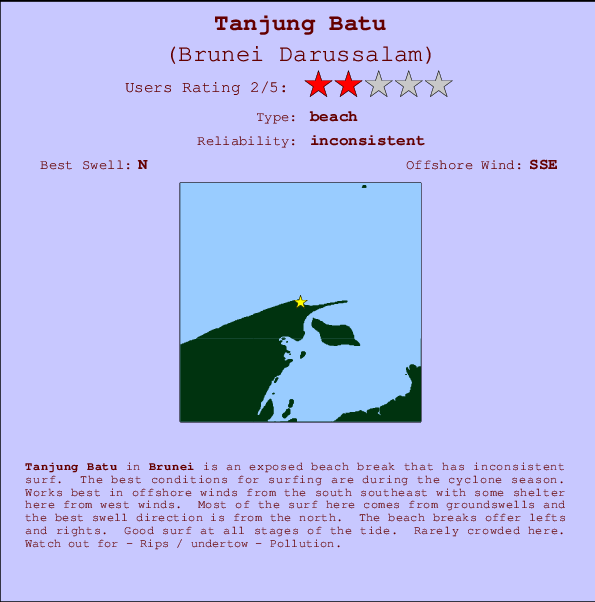
Tanjung Batu in Brunei is an exposed river break that has unreliable waves. The best conditions for surfing are during the cyclone season. The best wind direction is from the south southeast with some shelter here from west winds. Waves just as likely from local windswells as from distant groundswells and the best swell direction is from the north. The river break offers both left and right hand waves. Good surf at all stages of the tide. Unlikely to be too crowded, even when the surf is up. Beware of - Rips / undertow - Pollution.
Tanjung Batu Spot Info
| Type: | Rating: | Reliability: | Todays Sea Temp*: |
|---|---|---|---|
| inconsistent | 30.5°C*ocean temperature recorded from satellite |
Surfing Tanjung Batu:
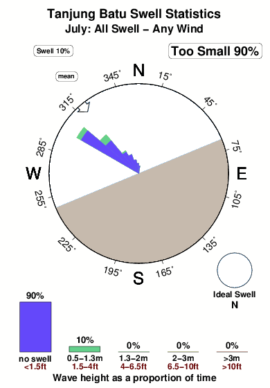
The best conditions reported for surf at Tanjung Batu occur when a North swell combines with an offshore wind direction from the South-southeast.
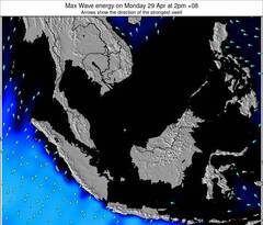
Previsioni Energia d'onda (Potenza): 12hrs
Tanjung Batu Surf:
Tuesday, 28 July 2026, 23:52 Local time| Mar | Mercoledì 29 | |||
| 11PM | 2AM | 5AM | 8AM | |
| Wave (m) | ||||
| Periodo (s) | 6 | 6 | 6 | 5 |
| Vento (km/h) | ||||
| Stato del vento | glass | glass | glass | off |
- /breaks/Tanjung-Batu/forecasts/latest
Tanjung Batu Surf Guide
Tanjung Batu in Brunei is an exposed river break that has unreliable waves. The best conditions for surfing are during the cyclone season. The best wind direction is from the south southeast with some shelter here from west winds. Waves just as likely from local windswells as from distant groundswells and the best swell direction is from the north. The river break offers both left and right hand waves. Good surf at all stages of the tide. Unlikely to be too crowded, even when the surf is up. Beware of - Rips / undertow - Pollution.
Tanjung Batu Spot Info
Type: Rating: Reliability: Todays Sea Temp*:  River
River 2
2inconsistent 30.5°C*ocean temperature recorded from satelliteSurfing Tanjung Batu:
The best conditions reported for surf at Tanjung Batu occur when a North swell combines with an offshore wind direction from the South-southeast.
Previsioni Energia d'onda (Potenza): 12hrs
Utilizzare la scheda di navigazione in alto per visualizzare Tanjung Batu temperatura del mare, Tanjung Batu fotografie, Tanjung Batu dettagliate previsioni onde, il vento e le previsioni meteo, Tanjung Batu webcam, vento corrente da Brunei stazioni meteo e Tanjung Batu previsioni marea. Il link Brunei Darussalam mappe maree apre l'immagine grande, che mostra Brunei Darussalam e dei mari circostanti. Queste mappe possono essere animate per mostrare le diverse componenti del moto ondoso, energia delle onde, periodo d'onda, altezza delle onde, insieme con le previsioni del vento e meteo, meteo corrente e osservazioni sullo stato del mare dal Brunei Darussalam onda-boe, le navi passanti e stazioni meteo costiere. Ciascuna delle pagine di previsioni per questo surf break rappresenta uno strumento di wavefinder globale e regionale per individuare le migliori condizioni di surf nella zona intorno Tanjung Batu.
Tanjung Batu Surf:
Tuesday, 28 July 2026, 23:52 Local timeMar Mercoledì 29 11PM 2AM 5AM 8AM Wave (m) Periodo (s) 6 6 6 5 Vento (km/h) Stato del vento glass glass glass off - /breaks/Tanjung-Batu/forecasts/latest
- /breaks/Tanjung-Batu/forecasts/latest/six_day
Tanjung Batu Surf Guide
Tanjung Batu in Brunei is an exposed river break that has unreliable waves. The best conditions for surfing are during the cyclone season. The best wind direction is from the south southeast with some shelter here from west winds. Waves just as likely from local windswells as from distant groundswells and the best swell direction is from the north. The river break offers both left and right hand waves. Good surf at all stages of the tide. Unlikely to be too crowded, even when the surf is up. Beware of - Rips / undertow - Pollution.
Tanjung Batu Spot Info
Type: Rating: Reliability: Todays Sea Temp*: River2inconsistent 30.5°C*ocean temperature recorded from satelliteSurfing Tanjung Batu:
The best conditions reported for surf at Tanjung Batu occur when a North swell combines with an offshore wind direction from the South-southeast.
Previsioni Energia d'onda (Potenza): 12hrs
Utilizzare la scheda di navigazione in alto per visualizzare Tanjung Batu temperatura del mare, Tanjung Batu fotografie, Tanjung Batu dettagliate previsioni onde, il vento e le previsioni meteo, Tanjung Batu webcam, vento corrente da Brunei stazioni meteo e Tanjung Batu previsioni marea. Il link Brunei Darussalam mappe maree apre l'immagine grande, che mostra Brunei Darussalam e dei mari circostanti. Queste mappe possono essere animate per mostrare le diverse componenti del moto ondoso, energia delle onde, periodo d'onda, altezza delle onde, insieme con le previsioni del vento e meteo, meteo corrente e osservazioni sullo stato del mare dal Brunei Darussalam onda-boe, le navi passanti e stazioni meteo costiere. Ciascuna delle pagine di previsioni per questo surf break rappresenta uno strumento di wavefinder globale e regionale per individuare le migliori condizioni di surf nella zona intorno Tanjung Batu.
Tanjung Batu Surf:
Tuesday, 28 July 2026, 23:52 Local timeMar Mercoledì 29 11PM 2AM 5AM 8AM Wave (m) Periodo (s) 6 6 6 5 Vento (km/h) Stato del vento glass glass glass off - /breaks/Tanjung-Batu/forecasts/latest
Tanjung Batu Surf Guide
Tanjung Batu in Brunei is an exposed river break that has unreliable waves. The best conditions for surfing are during the cyclone season. The best wind direction is from the south southeast with some shelter here from west winds. Waves just as likely from local windswells as from distant groundswells and the best swell direction is from the north. The river break offers both left and right hand waves. Good surf at all stages of the tide. Unlikely to be too crowded, even when the surf is up. Beware of - Rips / undertow - Pollution.
Tanjung Batu Spot Info
Type: Rating: Reliability: Todays Sea Temp*: River2inconsistent 30.5°C*ocean temperature recorded from satelliteSurfing Tanjung Batu:
The best conditions reported for surf at Tanjung Batu occur when a North swell combines with an offshore wind direction from the South-southeast.
Previsioni Energia d'onda (Potenza): 12hrs
Utilizzare la scheda di navigazione in alto per visualizzare Tanjung Batu temperatura del mare, Tanjung Batu fotografie, Tanjung Batu dettagliate previsioni onde, il vento e le previsioni meteo, Tanjung Batu webcam, vento corrente da Brunei stazioni meteo e Tanjung Batu previsioni marea. Il link Brunei Darussalam mappe maree apre l'immagine grande, che mostra Brunei Darussalam e dei mari circostanti. Queste mappe possono essere animate per mostrare le diverse componenti del moto ondoso, energia delle onde, periodo d'onda, altezza delle onde, insieme con le previsioni del vento e meteo, meteo corrente e osservazioni sullo stato del mare dal Brunei Darussalam onda-boe, le navi passanti e stazioni meteo costiere. Ciascuna delle pagine di previsioni per questo surf break rappresenta uno strumento di wavefinder globale e regionale per individuare le migliori condizioni di surf nella zona intorno Tanjung Batu.
Tanjung Batu Surf:
Tuesday, 28 July 2026, 23:52 Local timeMar Mercoledì 29 11PM 2AM 5AM 8AM Wave (m) Periodo (s) 6 6 6 5 Vento (km/h) Stato del vento glass glass glass off Tide Times:
A Tanjung Batu (0 km).
PROSSIMA È ALLE (ora locale) rimanente alta marea bassa marea Tanjung Batu Tide Times and Tide Chart
Live Weather:
At Brunei International Airport, 21 km from Tanjung Batu.
calm
(km/h)
Dry and partly cloudyAir temperature
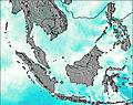
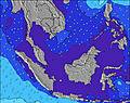
27°COverall Tanjung Batu Surf Consistency and Wind Distribution in Luglio
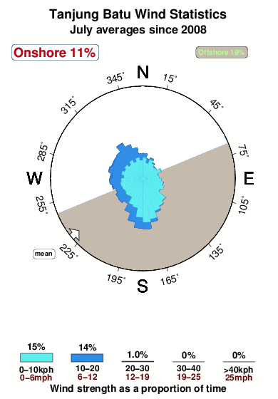


Wind stats for Tanjung Batu: see the variation in direction and stength by month.
foto dall' album
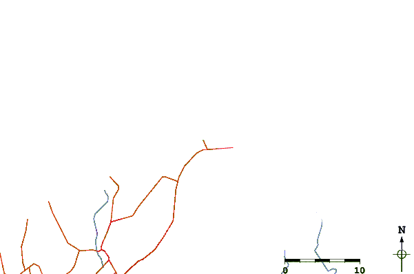
Contorni: Strade e fiumi: seleziona un surf break dal menu 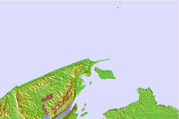
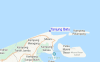
Utilizzare questa mappa sollievo per navigare Brunei surf breaks e stazioni di marea che si trovano nella zona diTanjung Batu
Altri surf breaks più vicini al Tanjung Batu:
(clicca sul nome del luogo per maggiori informazioni)- Closest località surf10 mi
- Second closest località surf14 mi
- Third closest località surf91 mi
- Fourth closest località surf91 mi
- Fifth closest località surf103 mi
Onda boe più vicina a Tanjung Batu:
- Closest Onda boa1465 mi
- Second closest Onda boa1526 mi
- Third closest Onda boa1686 mi
- Fourth closest Onda boa1695 mi
- Fifth closest Onda boa1768 mi
Stazioni di marea più vicina alla Tanjung Batu:
- Closest marea stazioneBandar Seri Begawan10 mi
- Second closest marea stazioneVictoria (Labuan)20 mi
- Third closest marea stazioneTutong33 mi
- Fourth closest marea stazioneSeria62 mi
- Fifth closest marea stazioneKuala Belait68 mi
Airports
- The closest passenger airport to Tanjung Batu is Brunei International Airport (BWN) in Brunei, 18 km (11 miles) away (directly).
- The second nearest airport to Tanjung Batu is Labuan Airport (LBU) in Malaysia, 35 km (22 miles) away.
- Third is Marudi Airport (MUR) in Malaysia, 126 km (78 miles) away.
- Miri Airport (MYY) in Malaysia is 143 km (89 miles) away.
- Kota Kinabalu International Airport (BKI), also in Malaysia is the fifth nearest airport to Tanjung Batu and is 148 km (92 miles) away.
- /breaks/Tanjung-Batu/forecasts/latest


 Nearest