

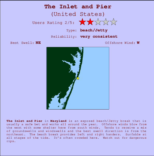
The Inlet and Pier Surf Guide
The Inlet and Pier in Maryland is an exposed beach/Jetty break that has very consistent waves and works all around the year. Works best in offshore winds from the west with some shelter here from south winds. Waves just as likely from local windswells as from distant groundswells and the ideal swell angle is from the northeast. Waves at the beach break both left and right. The quality of the surf isn't affected by the tide. Likely to be crowded if working. Take care of the strong rips here.
The Inlet and Pier Spot Info
| Type: | Rating: | Reliability: | Todays Sea Temp*: |
|---|---|---|---|
| very consistent | 24.6°C*ocean temperature recorded from satellite |
Surfing The Inlet and Pier:
The best conditions reported for surf at The Inlet and Pier occur when a Northeast swell combines with an offshore wind direction from the West.

Previsioni Energia d'onda (Potenza): 12hrs


The Inlet and Pier Surf:
Monday, 3 August 2026, 12:35 Local time| Lunedì 03 | ||||
| 11AM | 2PM | 5PM | 8PM | |
| Wave (m) | ||||
| Periodo (s) | - | - | - | - |
| Vento (km/h) | ||||
| Stato del vento | cross- off |
cross- off |
cross- off |
cross- off |
- /breaks/The-Inlet-and-Pier/forecasts/latest
The Inlet and Pier Surf Guide
The Inlet and Pier in Maryland is an exposed beach/Jetty break that has very consistent waves and works all around the year. Works best in offshore winds from the west with some shelter here from south winds. Waves just as likely from local windswells as from distant groundswells and the ideal swell angle is from the northeast. Waves at the beach break both left and right. The quality of the surf isn't affected by the tide. Likely to be crowded if working. Take care of the strong rips here.
The Inlet and Pier Spot Info
Type: Rating: Reliability: Todays Sea Temp*:  Beach/jetty
 2
2very consistent 24.6°C*ocean temperature recorded from satelliteSurfing The Inlet and Pier:
The best conditions reported for surf at The Inlet and Pier occur when a Northeast swell combines with an offshore wind direction from the West.
Previsioni Energia d'onda (Potenza): 12hrs
Utilizzare la scheda di navigazione in alto per visualizzare The Inlet and Pier temperatura del mare, The Inlet and Pier fotografie, The Inlet and Pier dettagliate previsioni onde, il vento e le previsioni meteo, The Inlet and Pier webcam, vento corrente da Maryland stazioni meteo e The Inlet and Pier previsioni marea. Il link United States mappe maree apre l'immagine grande, che mostra United States e dei mari circostanti. Queste mappe possono essere animate per mostrare le diverse componenti del moto ondoso, energia delle onde, periodo d'onda, altezza delle onde, insieme con le previsioni del vento e meteo, meteo corrente e osservazioni sullo stato del mare dal United States onda-boe, le navi passanti e stazioni meteo costiere. Ciascuna delle pagine di previsioni per questo surf break rappresenta uno strumento di wavefinder globale e regionale per individuare le migliori condizioni di surf nella zona intorno The Inlet and Pier.
The Inlet and Pier Surf:
Monday, 3 August 2026, 12:35 Local timeLunedì 03 11AM 2PM 5PM 8PM Wave (m) Periodo (s) - - - - Vento (km/h) Stato del vento cross-
offcross-
offcross-
offcross-
off- /breaks/The-Inlet-and-Pier/forecasts/latest
- /breaks/The-Inlet-and-Pier/forecasts/latest/six_day
The Inlet and Pier Surf Guide
The Inlet and Pier in Maryland is an exposed beach/Jetty break that has very consistent waves and works all around the year. Works best in offshore winds from the west with some shelter here from south winds. Waves just as likely from local windswells as from distant groundswells and the ideal swell angle is from the northeast. Waves at the beach break both left and right. The quality of the surf isn't affected by the tide. Likely to be crowded if working. Take care of the strong rips here.
The Inlet and Pier Spot Info
Type: Rating: Reliability: Todays Sea Temp*: Beach/jetty2very consistent 24.6°C*ocean temperature recorded from satelliteSurfing The Inlet and Pier:
The best conditions reported for surf at The Inlet and Pier occur when a Northeast swell combines with an offshore wind direction from the West.
Previsioni Energia d'onda (Potenza): 12hrs
Utilizzare la scheda di navigazione in alto per visualizzare The Inlet and Pier temperatura del mare, The Inlet and Pier fotografie, The Inlet and Pier dettagliate previsioni onde, il vento e le previsioni meteo, The Inlet and Pier webcam, vento corrente da Maryland stazioni meteo e The Inlet and Pier previsioni marea. Il link United States mappe maree apre l'immagine grande, che mostra United States e dei mari circostanti. Queste mappe possono essere animate per mostrare le diverse componenti del moto ondoso, energia delle onde, periodo d'onda, altezza delle onde, insieme con le previsioni del vento e meteo, meteo corrente e osservazioni sullo stato del mare dal United States onda-boe, le navi passanti e stazioni meteo costiere. Ciascuna delle pagine di previsioni per questo surf break rappresenta uno strumento di wavefinder globale e regionale per individuare le migliori condizioni di surf nella zona intorno The Inlet and Pier.
The Inlet and Pier Surf:
Monday, 3 August 2026, 12:35 Local timeLunedì 03 11AM 2PM 5PM 8PM Wave (m) Periodo (s) - - - - Vento (km/h) Stato del vento cross-
offcross-
offcross-
offcross-
off- /breaks/The-Inlet-and-Pier/forecasts/latest
The Inlet and Pier Surf Guide
The Inlet and Pier in Maryland is an exposed beach/Jetty break that has very consistent waves and works all around the year. Works best in offshore winds from the west with some shelter here from south winds. Waves just as likely from local windswells as from distant groundswells and the ideal swell angle is from the northeast. Waves at the beach break both left and right. The quality of the surf isn't affected by the tide. Likely to be crowded if working. Take care of the strong rips here.
The Inlet and Pier Spot Info
Type: Rating: Reliability: Todays Sea Temp*: Beach/jetty2very consistent 24.6°C*ocean temperature recorded from satelliteSurfing The Inlet and Pier:
The best conditions reported for surf at The Inlet and Pier occur when a Northeast swell combines with an offshore wind direction from the West.
Previsioni Energia d'onda (Potenza): 12hrs
Utilizzare la scheda di navigazione in alto per visualizzare The Inlet and Pier temperatura del mare, The Inlet and Pier fotografie, The Inlet and Pier dettagliate previsioni onde, il vento e le previsioni meteo, The Inlet and Pier webcam, vento corrente da Maryland stazioni meteo e The Inlet and Pier previsioni marea. Il link United States mappe maree apre l'immagine grande, che mostra United States e dei mari circostanti. Queste mappe possono essere animate per mostrare le diverse componenti del moto ondoso, energia delle onde, periodo d'onda, altezza delle onde, insieme con le previsioni del vento e meteo, meteo corrente e osservazioni sullo stato del mare dal United States onda-boe, le navi passanti e stazioni meteo costiere. Ciascuna delle pagine di previsioni per questo surf break rappresenta uno strumento di wavefinder globale e regionale per individuare le migliori condizioni di surf nella zona intorno The Inlet and Pier.
The Inlet and Pier Surf:
Monday, 3 August 2026, 12:35 Local timeLunedì 03 11AM 2PM 5PM 8PM Wave (m) Periodo (s) - - - - Vento (km/h) Stato del vento cross-
offcross-
offcross-
offcross-
offTide Times:
A Ocean City (fishing pier), Maryland (0 km).
PROSSIMA È ALLE (ora locale) rimanente alta marea bassa marea The Inlet and Pier Tide Times and Tide Chart
Live Weather:
At BUOY-OCIM2, 1 km from The Inlet and Pier.
fresh winds from the SSW
(km/h)Air temperature
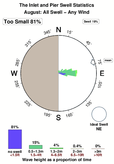
23.5°COverall The Inlet and Pier Surf Consistency and Wind Distribution in Agosto
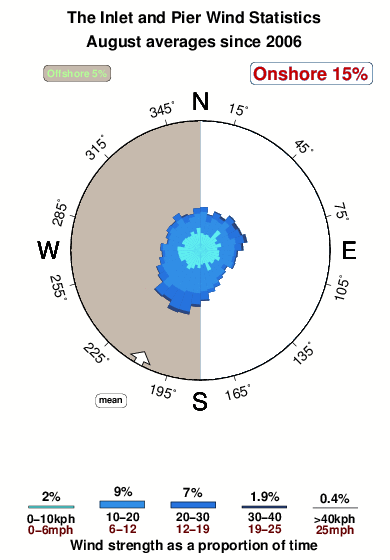


Wind stats for The Inlet and Pier: see the variation in direction and stength by month.
foto dall' album
Contorni: Strade e fiumi: seleziona un surf break dal menu 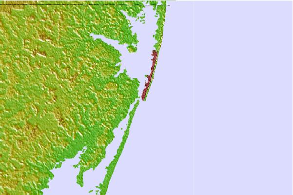
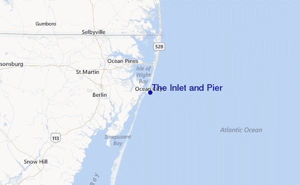
Utilizzare questa mappa sollievo per navigare Maryland surf breaks e stazioni di marea che si trovano nella zona diThe Inlet and Pier
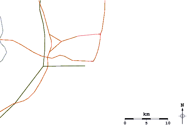
Altri surf breaks più vicini al The Inlet and Pier:
(clicca sul nome del luogo per maggiori informazioni)- Closest località surf1 mi
- Second closest località surf2 mi
- Third closest località surf2 mi
- Fourth closest località surf5 mi
- Fifth closest località surf6 mi
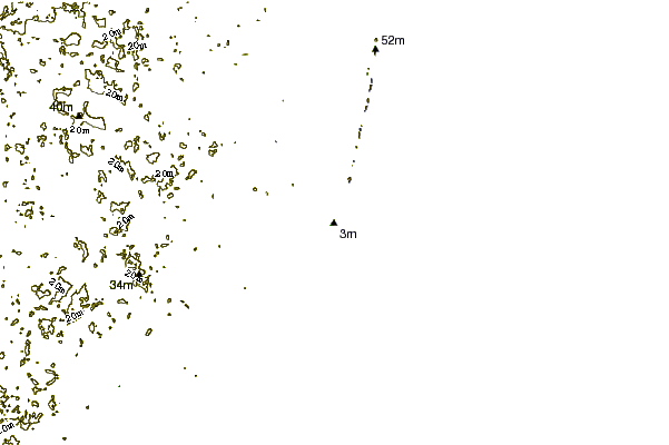
Onda boe più vicina a The Inlet and Pier:
- Closest Onda boa22 mi
- Second closest Onda boa42 mi
- Third closest Onda boa71 mi
- Fourth closest Onda boa74 mi
- Fifth closest Onda boa83 mi
Stazioni di marea più vicina alla The Inlet and Pier:
- Closest marea stazioneOcean City (fishing pier)0 mi
- Second closest marea stazioneOcean City Inlet1 mi
- Third closest marea stazioneOcean City, Isle of Wight Bay1 mi
- Fourth closest marea stazioneKeydash, Isle of Wight Bay1 mi
- Fifth closest marea stazioneOcean Pines6 mi
Airports
- The closest passenger airport to The Inlet and Pier is Salisbury Ocean City Wicomico Rgnl Airport (SBY) in USA, 37 km (23 miles) away (directly).
- The second nearest airport to The Inlet and Pier is Wallops Flight Facility Airport (WAL), also in USA, 55 km (34 miles) away.
- Third is Cape May Co (Wildwood) Airport (WWD) in USA, 77 km (48 miles) away.
- Dover Afb Airport (DOV) in USA is 95 km (59 miles) away.
- Millville Muni Airport (MIV), also in USA is the fifth nearest airport to The Inlet and Pier and is 116 km (72 miles) away.
- /breaks/The-Inlet-and-Pier/forecasts/latest


 Nearest