

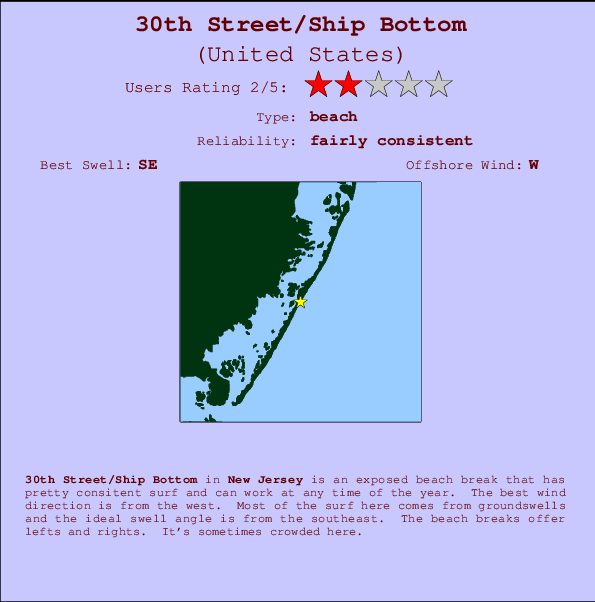
30th Street/Ship Bottom Surf Guide
30th Street/Ship Bottom in New Jersey is an exposed beach break that has fairly consistent surf and can work at any time of the year. Offshore winds are from the west. Most of the surf here comes from groundswells and the best swell direction is from the southeast. Waves at the beach break both left and right. When it's working here, it can get crowded.
30th Street/Ship Bottom Spot Info
| Type: | Rating: | Reliability: | Todays Sea Temp*: |
|---|---|---|---|
| fairly consistent | 25.0°C*ocean temperature recorded from satellite |
Surfing 30th Street/Ship Bottom:
The best conditions reported for surf at 30th Street/Ship Bottom occur when a Southeast swell combines with an offshore wind direction from the West.

Previsioni Energia d'onda (Potenza): 12hrs


30th Street/Ship Bottom Surf:
Saturday, 18 July 2026, 17:22 Local time| Sabato 18 | Dom | |||
| 5PM | 8PM | 11PM | 2AM | |
| Wave (m) | ||||
| Periodo (s) | 13 | 13 | 13 | 6 |
| Vento (km/h) | ||||
| Stato del vento | cross | off | cross- off |
cross- off |
- /breaks/Thirtith-Street/forecasts/latest
30th Street/Ship Bottom Surf Guide
30th Street/Ship Bottom in New Jersey is an exposed beach break that has fairly consistent surf and can work at any time of the year. Offshore winds are from the west. Most of the surf here comes from groundswells and the best swell direction is from the southeast. Waves at the beach break both left and right. When it's working here, it can get crowded.
30th Street/Ship Bottom Spot Info
Type: Rating: Reliability: Todays Sea Temp*:  Beach
Beach 2
2fairly consistent 25.0°C*ocean temperature recorded from satelliteSurfing 30th Street/Ship Bottom:
The best conditions reported for surf at 30th Street/Ship Bottom occur when a Southeast swell combines with an offshore wind direction from the West.
Previsioni Energia d'onda (Potenza): 12hrs
Utilizzare la scheda di navigazione in alto per visualizzare 30th Street/Ship Bottom temperatura del mare, 30th Street/Ship Bottom fotografie, 30th Street/Ship Bottom dettagliate previsioni onde, il vento e le previsioni meteo, 30th Street/Ship Bottom webcam, vento corrente da New Jersey stazioni meteo e 30th Street/Ship Bottom previsioni marea. Il link United States mappe maree apre l'immagine grande, che mostra United States e dei mari circostanti. Queste mappe possono essere animate per mostrare le diverse componenti del moto ondoso, energia delle onde, periodo d'onda, altezza delle onde, insieme con le previsioni del vento e meteo, meteo corrente e osservazioni sullo stato del mare dal United States onda-boe, le navi passanti e stazioni meteo costiere. Ciascuna delle pagine di previsioni per questo surf break rappresenta uno strumento di wavefinder globale e regionale per individuare le migliori condizioni di surf nella zona intorno 30th Street/Ship Bottom.
30th Street/Ship Bottom Surf:
Saturday, 18 July 2026, 17:22 Local timeSabato 18 Dom 5PM 8PM 11PM 2AM Wave (m) Periodo (s) 13 13 13 6 Vento (km/h) Stato del vento cross off cross-
offcross-
off- /breaks/Thirtith-Street/forecasts/latest
- /breaks/Thirtith-Street/forecasts/latest/six_day
30th Street/Ship Bottom Surf Guide
30th Street/Ship Bottom in New Jersey is an exposed beach break that has fairly consistent surf and can work at any time of the year. Offshore winds are from the west. Most of the surf here comes from groundswells and the best swell direction is from the southeast. Waves at the beach break both left and right. When it's working here, it can get crowded.
30th Street/Ship Bottom Spot Info
Type: Rating: Reliability: Todays Sea Temp*: Beach2fairly consistent 25.0°C*ocean temperature recorded from satelliteSurfing 30th Street/Ship Bottom:
The best conditions reported for surf at 30th Street/Ship Bottom occur when a Southeast swell combines with an offshore wind direction from the West.
Previsioni Energia d'onda (Potenza): 12hrs
Utilizzare la scheda di navigazione in alto per visualizzare 30th Street/Ship Bottom temperatura del mare, 30th Street/Ship Bottom fotografie, 30th Street/Ship Bottom dettagliate previsioni onde, il vento e le previsioni meteo, 30th Street/Ship Bottom webcam, vento corrente da New Jersey stazioni meteo e 30th Street/Ship Bottom previsioni marea. Il link United States mappe maree apre l'immagine grande, che mostra United States e dei mari circostanti. Queste mappe possono essere animate per mostrare le diverse componenti del moto ondoso, energia delle onde, periodo d'onda, altezza delle onde, insieme con le previsioni del vento e meteo, meteo corrente e osservazioni sullo stato del mare dal United States onda-boe, le navi passanti e stazioni meteo costiere. Ciascuna delle pagine di previsioni per questo surf break rappresenta uno strumento di wavefinder globale e regionale per individuare le migliori condizioni di surf nella zona intorno 30th Street/Ship Bottom.
30th Street/Ship Bottom Surf:
Saturday, 18 July 2026, 17:22 Local timeSabato 18 Dom 5PM 8PM 11PM 2AM Wave (m) Periodo (s) 13 13 13 6 Vento (km/h) Stato del vento cross off cross-
offcross-
off- /breaks/Thirtith-Street/forecasts/latest
30th Street/Ship Bottom Surf Guide
30th Street/Ship Bottom in New Jersey is an exposed beach break that has fairly consistent surf and can work at any time of the year. Offshore winds are from the west. Most of the surf here comes from groundswells and the best swell direction is from the southeast. Waves at the beach break both left and right. When it's working here, it can get crowded.
30th Street/Ship Bottom Spot Info
Type: Rating: Reliability: Todays Sea Temp*: Beach2fairly consistent 25.0°C*ocean temperature recorded from satelliteSurfing 30th Street/Ship Bottom:
The best conditions reported for surf at 30th Street/Ship Bottom occur when a Southeast swell combines with an offshore wind direction from the West.
Previsioni Energia d'onda (Potenza): 12hrs
Utilizzare la scheda di navigazione in alto per visualizzare 30th Street/Ship Bottom temperatura del mare, 30th Street/Ship Bottom fotografie, 30th Street/Ship Bottom dettagliate previsioni onde, il vento e le previsioni meteo, 30th Street/Ship Bottom webcam, vento corrente da New Jersey stazioni meteo e 30th Street/Ship Bottom previsioni marea. Il link United States mappe maree apre l'immagine grande, che mostra United States e dei mari circostanti. Queste mappe possono essere animate per mostrare le diverse componenti del moto ondoso, energia delle onde, periodo d'onda, altezza delle onde, insieme con le previsioni del vento e meteo, meteo corrente e osservazioni sullo stato del mare dal United States onda-boe, le navi passanti e stazioni meteo costiere. Ciascuna delle pagine di previsioni per questo surf break rappresenta uno strumento di wavefinder globale e regionale per individuare le migliori condizioni di surf nella zona intorno 30th Street/Ship Bottom.
30th Street/Ship Bottom Surf:
Saturday, 18 July 2026, 17:22 Local timeSabato 18 Dom 5PM 8PM 11PM 2AM Wave (m) Periodo (s) 13 13 13 6 Vento (km/h) Stato del vento cross off cross-
offcross-
offTide Times:
Per Seaside Heights, ocean, New Jersey, %{dist} %{km} da %{location}.
PROSSIMA È ALLE (ora locale) rimanente alta marea bassa marea 30th Street/Ship Bottom Tide Times and Tide Chart
Live Weather:
At thunderstorm affecting Forked River, 24 km from 30th Street/Ship Bottom.

ThunderstormAir temperature
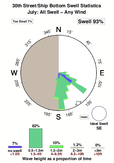
°COverall 30th Street/Ship Bottom Surf Consistency and Wind Distribution in Luglio
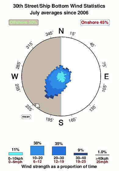


Wind stats for 30th Street/Ship Bottom: see the variation in direction and stength by month.
foto dall' album
Contorni: Strade e fiumi: seleziona un surf break dal menu 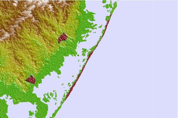
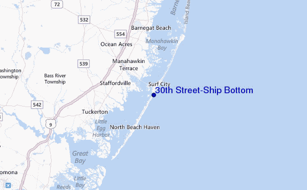
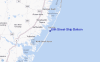
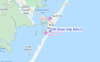
Utilizzare questa mappa sollievo per navigare New Jersey surf breaks e stazioni di marea che si trovano nella zona di30th Street/Ship Bottom
Altri surf breaks più vicini al 30th Street/Ship Bottom:
(clicca sul nome del luogo per maggiori informazioni)- Closest località surf1 mi
- Second closest località surf2 mi
- Third closest località surf2 mi
- Fourth closest località surf4 mi
- Fifth closest località surf4 mi
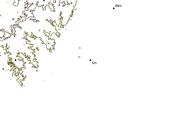
Onda boe più vicina a 30th Street/Ship Bottom:
- Closest Onda boa2 mi
- Second closest Onda boa24 mi
- Third closest Onda boa57 mi
- Fourth closest Onda boa68 mi
- Fifth closest Onda boa85 mi
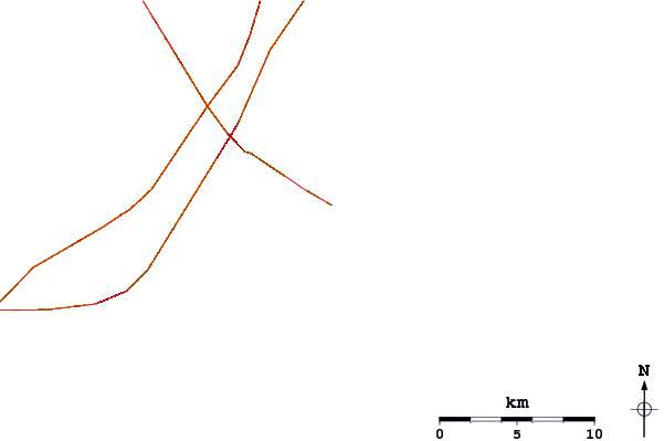
Stazioni di marea più vicina alla 30th Street/Ship Bottom:
- Closest marea stazioneManahawkin Drawbridge, Manahawkin Bay1 mi
- Second closest marea stazioneBeach Haven Crest2 mi
- Third closest marea stazioneManahawkin Creek, Manahawkin Bay2 mi
- Fourth closest marea stazioneMill Creek, 1 nautical miles above entrance3 mi
- Fifth closest marea stazioneNorth Beach, Manahawkin Bay3 mi
Airports
- The closest passenger airport to 30th Street/Ship Bottom is Atlantic City International Airport (ACY) in USA, 39 km (24 miles) away (directly).
- The second nearest airport to 30th Street/Ship Bottom is Lakehurst Naes Airport (NEL), also in USA, 46 km (29 miles) away.
- Third is Mc Guire Afb (Wrightstown) Airport (WRI) in USA, 55 km (34 miles) away.
- Millville Muni Airport (MIV) in USA is 82 km (51 miles) away.
- Northeast Philadelphia Airport (PNE), also in USA is the fifth nearest airport to 30th Street/Ship Bottom and is 86 km (53 miles) away.
- /breaks/Thirtith-Street/forecasts/latest
 Nearest