
Previsioni:

Previsione a breve termineper lo più asciutto. Warm (Max 26°C martedì mattina, Min 24°C Domenica mattina). Venti decrescenti (venti freschi da ESE Domenica mattina, venti deboli da ENE per martedì notte). | |||||||||||||||||||||||
Domenica 19 | Lunedì 20 | Martedì 21 | |||||||||||||||||||||
4 AM | 7 AM | 10 AM | 1 PM | 4 PM | 7 PM | 10 PM | 1 AM | 4 AM | 7 AM | 10 AM | 1 PM | 4 PM | 7 PM | 10 PM | 1 AM | 4 AM | 7 AM | 10 AM | 1 PM | 4 PM | 7 PM | 10 PM | |
Mappa dell'altezza del moto ondoso |  |  |  |  | 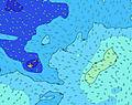 |  |  | 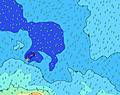 |  | ||||||||||||||
Onda Altezza (m) Direzione Periodo (s) | SE 7 | SE 7 | E 7 | E 7 | E 7 | E 7 | E 7 | E 7 | E 7 | E 7 | ESE 7 | ESE 7 | ESE 7 | ESE 7 | E 7 | E 7 | E 7 | E 7 | E 8 | ESE 8 | E 8 | E 8 | E 7 |
Grafico delle onde | |||||||||||||||||||||||
704 | 704 | 267 | 243 | 236 | 267 | 260 | 229 | 230 | 269 | 365 | 355 | 355 | 355 | 277 | 285 | 205 | 210 | 216 | 300 | 216 | 186 | 181 | |
Vento (km/h) | |||||||||||||||||||||||
Stato del vento onshore cross-onshore cross-shore cross-offshore offshore piatto | on | on | on | on | cross-on | cross-on | cross-on | cross-on | cross-on | cross-on | cross-on | cross-on | cross-on | cross-on | cross-on | cross-on | cross-on | cross-on | cross-on | cross-on | cross-on | cross-on | cross-on |
Alta Marea | 11:29AM0.92m | 00:04AM0.93m | 12:28PM0.85m | 1:00AM0.90m | 1:27PM0.80m | ||||||||||||||||||
Basso Marea | 5:16AM0.22m | 5:41PM0.22m | 6:19AM0.27m | 6:36PM0.27m | 7:23AM0.29m | 7:31PM0.30m | |||||||||||||||||
6:47 | — | — | — | — | — | — | — | 6:47 | — | — | — | — | — | — | — | 6:46 | — | — | — | — | — | — | |
— | — | — | — | 6:09 | — | — | — | — | — | — | — | 6:09 | — | — | — | — | — | — | — | 6:09 | — | — | |
mm | — | — | — | — | — | — | — | — | — | — | — | — | — | — | — | — | — | — | — | — | — | — | — |
Temp. °C | 24 | 24 | 24 | 24 | 24 | 24 | 25 | 24 | 24 | 25 | 25 | 25 | 25 | 25 | 25 | 25 | 25 | 25 | 25 | 26 | 26 | 25 | 26 |
Gelo °C | 19 | 20 | 20 | 19 | 20 | 20 | 21 | 20 | 20 | 21 | 21 | 22 | 22 | 23 | 23 | 24 | 24 | 24 | 24 | 26 | 26 | 26 | 28 |
Onda 1 Altezza (m) Direzione Periodo (s) | SW 15 | SW 16 | SSE 13 | SSE 13 | SSE 13 | SSE 13 | SSE 13 | SSE 12 | SSE 13 | SSE 12 | SSW 20 | SSW 20 | SSW 19 | SSW 18 | SSW 18 | SSW 18 | SSE 11 | SSE 11 | SSE 11 | ESE 8 | SSE 11 | E 8 | E 7 |
221 | 236 | 1326 | 1487 | 1491 | 1236 | 1217 | 876 | 853 | 645 | 1188 | 1141 | 1094 | 872 | 817 | 790 | 359 | 302 | 286 | 300 | 242 | 186 | 181 | |
Onda 2 Altezza (m) Direzione Periodo (s) | SSW 19 | SSW 18 | SW 16 | SW 16 | SSW 24 | SSW 24 | SSW 23 | SSW 22 | SSW 22 | SSW 21 | SSE 12 | SSE 12 | SSE 12 | SSE 12 | SSE 12 | SSE 12 | SSW 18 | SSW 17 | S 17 | SSW 16 | SSW 16 | SSE 11 | S 20 |
36 | 64 | 302 | 310 | 781 | 936 | 1111 | 1234 | 1413 | 1103 | 393 | 269 | 322 | 317 | 317 | 256 | 655 | 640 | 569 | 575 | 443 | 242 | 1010 | |
Onda 3 Altezza (m) Direzione Periodo (s) | S 28 | SSW 28 | SSW 26 | SSW 26 | SW 16 | SW 16 | SW 16 | SW 16 | S 12 | S 12 | SW 15 | S 12 | S 11 | SW 17 | SW 16 | SW 16 | SW 16 | SW 16 | SW 16 | SSE 11 | S 21 | SSW 21 | SSE 11 |
16 | 74 | 225 | 514 | 306 | 302 | 295 | 291 | 180 | 174 | 273 | 171 | 123 | 241 | 314 | 302 | 302 | 248 | 201 | 146 | 326 | 742 | 238 | |
onde vento Altezza (m) Direzione Periodo (s) | SE 7 | SE 7 | E 7 | E 7 | E 7 | E 7 | E 7 | E 7 | E 7 | E 7 | ESE 7 | ESE 7 | ESE 7 | ESE 7 | E 7 | E 7 | E 7 | E 7 | E 8 | E 7 | E 8 | — | — |
704 | 704 | 267 | 243 | 236 | 267 | 260 | 229 | 230 | 269 | 365 | 355 | 355 | 355 | 277 | 285 | 205 | 210 | 216 | 212 | 216 | — | — | |
Il più vicino Offshore or Glassy | |||||||||||||||||||||||
Distanza (km) | 910 | 910 | 1358 | 910 | 910 | 910 | 1319 | 1319 | 1305 | 1302 | 1308 | 624 | 624 | 624 | 4 | 4 | 4 | 4 | 4 | 4 | 4 | 4 | 4 |
Migliori previsioni per le condizioni d'onda in American-Samoa - Tutuila | |||||||||||||||||||||||
Migliori previsioni per le condizioni d'onda in American Samoa | |||||||||||||||||||||||
Trova Onde Globale | |||||||||||||||||||||||
- Map Icons:
 Break
Break Live Wave Height (m)
 Live Wind Speed (km/h)
 Surf Rating (10 Max)
 Ocean Swells (m)
- Wind Speed (km/h)
Widget Free Surf-Forecast.com per il tuo sito
La relazione di surf / widget meteo è disponibile qui sotto per incorporare su siti esterni a titolo gratuito e fornisce una sintesi delle nostre Tula previsione surf. Basta prendere il frammento di codice html da noi fornito e copiarlo nel proprio sito. È possibile scegliere la lingua preferita e unità metriche / imperiali per il feed delle previsioni surf per soddisfare le esigenze degli utenti del vostro sito .... Clicca qui per ottenere il codice.
 Nearest