

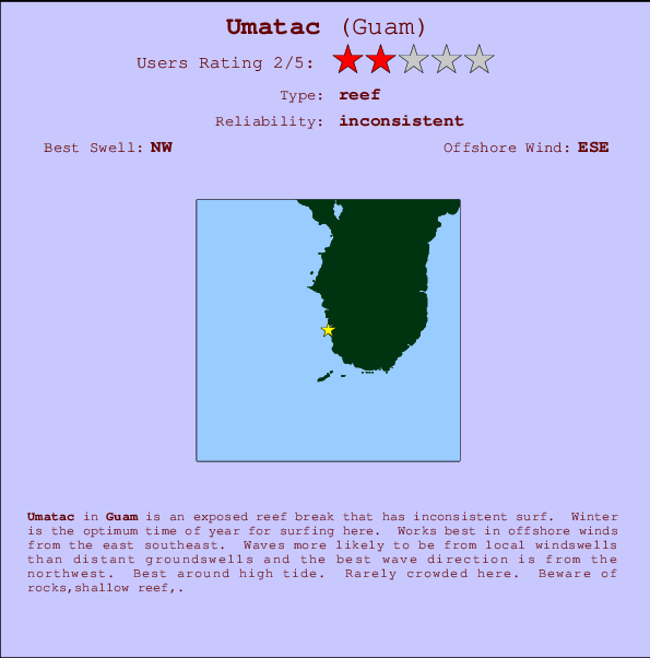
Umatac Surf Guide
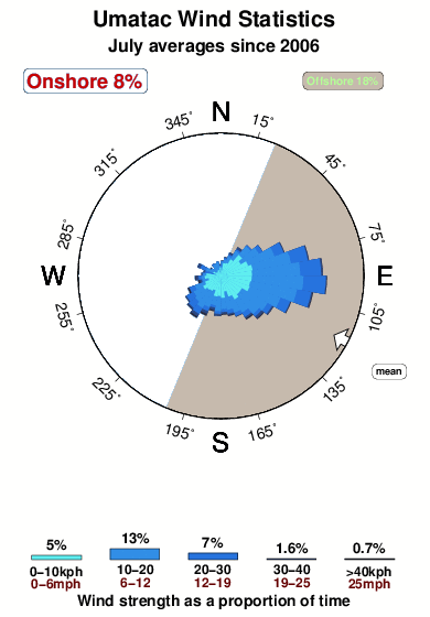
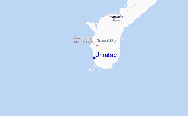
Umatac in - is an exposed reef break that only works once in a while. Winter is the optimum time of year for surfing here. Offshore winds are from the east southeast. Windswells are much more common than groundswells and the best wave direction is from the northwest. There is a left hand reef break. Best around high tide. Even when there are waves, it's not likley to be crowded. Beware of rocks,shallow reef,.
Umatac Spot Info
| Type: | Rating: | Reliability: | Todays Sea Temp*: |
|---|---|---|---|
| inconsistent | 28.8°C*ocean temperature recorded from satellite |
Surfing Umatac:
The best conditions reported for surf at Umatac occur when a Northwest swell combines with an offshore wind direction from the East-southeast.
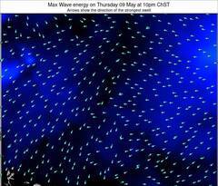
Previsioni Energia d'onda (Potenza): 12hrs
Umatac Surf:
Tuesday, 21 July 2026, 10:01 Local time| Martedì 21 | ||||
| 7AM | 10AM | 1PM | 4PM | |
| Wave (m) | ||||
| Periodo (s) | 7 | 7 | 7 | 7 |
| Vento (km/h) | ||||
| Stato del vento | cross- off |
cross- off |
cross- off |
cross |
- /breaks/Umatac/forecasts/latest
Umatac Surf Guide
Umatac in - is an exposed reef break that only works once in a while. Winter is the optimum time of year for surfing here. Offshore winds are from the east southeast. Windswells are much more common than groundswells and the best wave direction is from the northwest. There is a left hand reef break. Best around high tide. Even when there are waves, it's not likley to be crowded. Beware of rocks,shallow reef,.
Umatac Spot Info
Type: Rating: Reliability: Todays Sea Temp*:  Reef
Reef 2
2inconsistent 28.8°C*ocean temperature recorded from satelliteSurfing Umatac:
The best conditions reported for surf at Umatac occur when a Northwest swell combines with an offshore wind direction from the East-southeast.
Previsioni Energia d'onda (Potenza): 12hrs
Utilizzare la scheda di navigazione in alto per visualizzare Umatac temperatura del mare, Umatac fotografie, Umatac dettagliate previsioni onde, il vento e le previsioni meteo, Umatac webcam, vento corrente da Guam stazioni meteo e Umatac previsioni marea. Il link Guam mappe maree apre l'immagine grande, che mostra Guam e dei mari circostanti. Queste mappe possono essere animate per mostrare le diverse componenti del moto ondoso, energia delle onde, periodo d'onda, altezza delle onde, insieme con le previsioni del vento e meteo, meteo corrente e osservazioni sullo stato del mare dal Guam onda-boe, le navi passanti e stazioni meteo costiere. Ciascuna delle pagine di previsioni per questo surf break rappresenta uno strumento di wavefinder globale e regionale per individuare le migliori condizioni di surf nella zona intorno Umatac.
Umatac Surf:
Tuesday, 21 July 2026, 10:01 Local timeMartedì 21 7AM 10AM 1PM 4PM Wave (m) Periodo (s) 7 7 7 7 Vento (km/h) Stato del vento cross-
offcross-
offcross-
offcross - /breaks/Umatac/forecasts/latest
- /breaks/Umatac/forecasts/latest/six_day
Umatac Surf Guide
Umatac in - is an exposed reef break that only works once in a while. Winter is the optimum time of year for surfing here. Offshore winds are from the east southeast. Windswells are much more common than groundswells and the best wave direction is from the northwest. There is a left hand reef break. Best around high tide. Even when there are waves, it's not likley to be crowded. Beware of rocks,shallow reef,.
Umatac Spot Info
Type: Rating: Reliability: Todays Sea Temp*: Reef2inconsistent 28.8°C*ocean temperature recorded from satelliteSurfing Umatac:
The best conditions reported for surf at Umatac occur when a Northwest swell combines with an offshore wind direction from the East-southeast.
Previsioni Energia d'onda (Potenza): 12hrs
Utilizzare la scheda di navigazione in alto per visualizzare Umatac temperatura del mare, Umatac fotografie, Umatac dettagliate previsioni onde, il vento e le previsioni meteo, Umatac webcam, vento corrente da Guam stazioni meteo e Umatac previsioni marea. Il link Guam mappe maree apre l'immagine grande, che mostra Guam e dei mari circostanti. Queste mappe possono essere animate per mostrare le diverse componenti del moto ondoso, energia delle onde, periodo d'onda, altezza delle onde, insieme con le previsioni del vento e meteo, meteo corrente e osservazioni sullo stato del mare dal Guam onda-boe, le navi passanti e stazioni meteo costiere. Ciascuna delle pagine di previsioni per questo surf break rappresenta uno strumento di wavefinder globale e regionale per individuare le migliori condizioni di surf nella zona intorno Umatac.
Umatac Surf:
Tuesday, 21 July 2026, 10:01 Local timeMartedì 21 7AM 10AM 1PM 4PM Wave (m) Periodo (s) 7 7 7 7 Vento (km/h) Stato del vento cross-
offcross-
offcross-
offcross - /breaks/Umatac/forecasts/latest
Umatac Surf Guide
Umatac in - is an exposed reef break that only works once in a while. Winter is the optimum time of year for surfing here. Offshore winds are from the east southeast. Windswells are much more common than groundswells and the best wave direction is from the northwest. There is a left hand reef break. Best around high tide. Even when there are waves, it's not likley to be crowded. Beware of rocks,shallow reef,.
Umatac Spot Info
Type: Rating: Reliability: Todays Sea Temp*: Reef2inconsistent 28.8°C*ocean temperature recorded from satelliteSurfing Umatac:
The best conditions reported for surf at Umatac occur when a Northwest swell combines with an offshore wind direction from the East-southeast.
Previsioni Energia d'onda (Potenza): 12hrs
Utilizzare la scheda di navigazione in alto per visualizzare Umatac temperatura del mare, Umatac fotografie, Umatac dettagliate previsioni onde, il vento e le previsioni meteo, Umatac webcam, vento corrente da Guam stazioni meteo e Umatac previsioni marea. Il link Guam mappe maree apre l'immagine grande, che mostra Guam e dei mari circostanti. Queste mappe possono essere animate per mostrare le diverse componenti del moto ondoso, energia delle onde, periodo d'onda, altezza delle onde, insieme con le previsioni del vento e meteo, meteo corrente e osservazioni sullo stato del mare dal Guam onda-boe, le navi passanti e stazioni meteo costiere. Ciascuna delle pagine di previsioni per questo surf break rappresenta uno strumento di wavefinder globale e regionale per individuare le migliori condizioni di surf nella zona intorno Umatac.
Umatac Surf:
Tuesday, 21 July 2026, 10:01 Local timeMartedì 21 7AM 10AM 1PM 4PM Wave (m) Periodo (s) 7 7 7 7 Vento (km/h) Stato del vento cross-
offcross-
offcross-
offcross Tide Times:
Per Guam, Marianas, %{dist} %{km} da %{location}.
PROSSIMA È ALLE (ora locale) rimanente alta marea bassa marea Umatac Tide Times and Tide Chart
Live Weather:
At Windward Hills wx, 13 km from Umatac.
light winds from the SSE
(km/h)
dryAir temperature
28°COverall Umatac Surf Consistency and Wind Distribution in Luglio
foto dall' album
Contorni: Strade e fiumi: seleziona un surf break dal menu 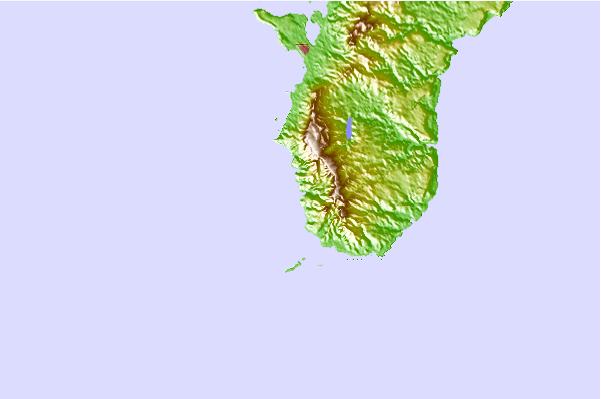
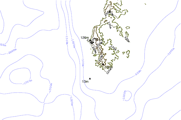
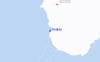
Utilizzare questa mappa sollievo per navigare Guam surf breaks e stazioni di marea che si trovano nella zona diUmatac
Altri surf breaks più vicini al Umatac:
(clicca sul nome del luogo per maggiori informazioni)- Closest località surf1 mi
- Second closest località surf2 mi
- Third closest località surf3 mi
- Fourth closest località surf6 mi
- Fifth closest località surf7 mi
Onda boe più vicina a Umatac:
- Closest Onda boa10 mi
- Second closest Onda boa29 mi
- Third closest Onda boa152 mi
- Fourth closest Onda boa749 mi
- Fifth closest Onda boa1405 mi
Stazioni di marea più vicina alla Umatac:
- Closest marea stazioneGuam2 mi
- Second closest marea stazioneApra Harbor10 mi
- Third closest marea stazionePago Bay13 mi
- Fourth closest marea stazioneTamuning16 mi
- Fifth closest marea stazioneDededo20 mi
Airports
- The closest passenger airport to Umatac is Guam International (Agana) Airport (GUM) in Mariana Islands, which is 26 km (16 miles) away (directly).
- The second nearest airport to Umatac is Andersen Afb Airport (UAM), also in Mariana Islands, 44 km (27 miles) away.
- The third closest airport is Rota International Airport (ROP), also in Mariana Islands, 117 km (73 miles) away.
- /breaks/Umatac/forecasts/latest


 Nearest