
Previsioni:

Previsione a breve terminepioggia leggera (Totale 4mm), per lo più che cade giovedì mattina. Warm (Max 28°C giovedì pomeriggio, Min 27°C giovedì mattina). Principalmente raffiche di vento. | ||||||||||||||||||||||||
Giovedì 16 | Venerdì 17 | Sabato 18 | Dom 19 | |||||||||||||||||||||
4 AM | 7 AM | 10 AM | 1 PM | 4 PM | 7 PM | 10 PM | 1 AM | 4 AM | 7 AM | 10 AM | 1 PM | 4 PM | 7 PM | 10 PM | 1 AM | 4 AM | 7 AM | 10 AM | 1 PM | 4 PM | 7 PM | 10 PM | 1 AM | |
Mappa dell'altezza del moto ondoso |  |  |  |  | 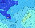 |  |  | 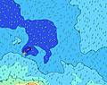 |  | 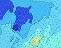 | ||||||||||||||
Onda Altezza (m) Direzione Periodo (s) | SSE 8 | SSE 8 | SSE 8 | SE 8 | SE 8 | SE 8 | SE 8 | SE 8 | SE 8 | SE 8 | SE 8 | SE 8 | SE 9 | SE 9 | SE 9 | SE 9 | SE 9 | SE 9 | SE 9 | SE 9 | SE 9 | SE 9 | SE 9 | SE 9 |
Grafico delle onde | ||||||||||||||||||||||||
1018 | 1056 | 1219 | 1179 | 1159 | 1069 | 1033 | 1003 | 1003 | 1164 | 1280 | 1310 | 1440 | 1684 | 1945 | 1792 | 1643 | 1503 | 1342 | 1248 | 1306 | 1575 | 1762 | 1798 | |
Vento (km/h) | ||||||||||||||||||||||||
Stato del vento onshore cross-onshore cross-shore cross-offshore offshore piatto | cross-on | cross-on | cross-on | cross-on | cross-on | cross-on | cross-on | cross-on | cross-on | cross-on | cross-on | cross-on | cross-on | cross-on | cross-on | cross-on | cross-on | cross-on | cross-on | cross-on | cross-on | cross-on | cross-on | cross-on |
Alta Marea | 7:10AM1.46m | 7:37PM1.27m | 7:57AM1.40m | 8:24PM1.23m | 8:44AM1.31m | 9:12PM1.18m | ||||||||||||||||||
Basso Marea | 1:30PM0.00m | 1:39AM0.06m | 2:16PM0.06m | 2:27AM0.13m | 3:01PM0.15m | |||||||||||||||||||
6:45 | — | — | — | — | — | — | — | 6:45 | — | — | — | — | — | — | — | 6:45 | — | — | — | — | — | — | 6:45 | |
— | — | — | — | 6:25 | — | — | — | — | — | — | — | 6:25 | — | — | — | — | — | — | — | 6:25 | — | — | 6:25 | |
mm | 1 | 1 | — | 1 | — | — | — | — | 1 | 1 | — | — | — | — | — | — | — | — | — | — | — | — | — | — |
Temp. °C | 27 | 27 | 27 | 27 | 27 | 28 | 28 | 27 | 27 | 27 | 27 | 27 | 27 | 27 | 27 | 27 | 27 | 27 | 27 | 27 | 27 | 27 | 27 | 27 |
Gelo °C | 24 | 23 | 23 | 24 | 23 | 25 | 25 | 24 | 23 | 23 | 23 | 23 | 23 | 22 | 22 | 22 | 23 | 22 | 23 | 23 | 23 | 23 | 23 | 22 |
Onda 1 Altezza (m) Direzione Periodo (s) | WNW 14 | WNW 14 | WNW 14 | WNW 15 | WNW 14 | WNW 14 | WNW 14 | WNW 14 | WNW 14 | WNW 14 | WNW 14 | WNW 14 | WNW 14 | WNW 14 | SSW 19 | SSE 19 | SSE 19 | SSE 18 | SSE 18 | SSE 18 | SSE 17 | SSE 16 | SSE 16 | SSE 16 |
183 | 183 | 186 | 188 | 165 | 163 | 116 | 118 | 118 | 116 | 116 | 113 | 76 | 73 | 145 | 146 | 243 | 289 | 395 | 390 | 459 | 412 | 487 | 481 | |
Onda 2 Altezza (m) Direzione Periodo (s) | SSW 14 | SSW 14 | SSW 14 | SSW 14 | NE 9 | NE 9 | NE 9 | NE 9 | NE 8 | NE 8 | NE 8 | NE 8 | NE 9 | SSW 20 | WNW 13 | SW 19 | SSW 19 | SW 18 | SSW 18 | SSW 18 | SSW 16 | SSW 16 | SSW 16 | SSW 17 |
81 | 78 | 76 | 76 | 19 | 21 | 20 | 20 | 18 | 18 | 18 | 18 | 20 | 157 | 70 | 91 | 137 | 164 | 216 | 204 | 179 | 177 | 181 | 190 | |
Onda 3 Altezza (m) Direzione Periodo (s) | NNE 8 | NE 8 | NE 8 | NE 8 | SW 14 | SW 14 | SW 13 | SSW 14 | SSW 13 | SSW 14 | SW 20 | SSW 21 | SW 21 | NE 9 | SE 18 | WNW 13 | WNW 13 | WNW 13 | WNW 13 | WNW 13 | NE 9 | NE 9 | NE 9 | WNW 13 |
26 | 17 | 18 | 18 | 49 | 47 | 46 | 18 | 17 | 18 | 16 | 42 | 109 | 20 | 86 | 70 | 70 | 35 | 35 | 35 | 21 | 21 | 13 | 33 | |
onde vento Altezza (m) Direzione Periodo (s) | SSE 8 | SSE 8 | SSE 8 | SE 8 | SE 8 | SE 8 | SE 8 | SE 8 | SE 8 | SE 8 | SE 8 | SE 8 | SE 9 | SE 9 | SE 9 | SE 9 | SE 9 | SE 9 | SE 9 | SE 9 | SE 9 | SE 9 | SE 9 | SE 9 |
1018 | 1056 | 1219 | 1179 | 1159 | 1069 | 1033 | 1003 | 1003 | 1164 | 1280 | 1310 | 1440 | 1684 | 1945 | 1792 | 1643 | 1503 | 1342 | 1248 | 1306 | 1575 | 1762 | 1798 | |
Il più vicino Offshore or Glassy | ||||||||||||||||||||||||
Distanza (km) | 1521 | 1521 | 1521 | 1521 | 1521 | 1521 | 1521 | 1521 | 1521 | 1521 | 1956 | 1521 | 1521 | 1521 | 1521 | 1523 | 1523 | 2002 | 1523 | 1521 | 1521 | 1961 | 1521 | 1521 |
Migliori previsioni per le condizioni d'onda in Tokelau | ||||||||||||||||||||||||
Migliori previsioni per le condizioni d'onda in Tokelau | ||||||||||||||||||||||||
Trova Onde Globale | ||||||||||||||||||||||||
- Map Icons:
 Break
Break Live Wave Height (m)
 Live Wind Speed (km/h)
 Surf Rating (10 Max)
 Ocean Swells (m)
- Wind Speed (km/h)
Widget Free Surf-Forecast.com per il tuo sito
La relazione di surf / widget meteo è disponibile qui sotto per incorporare su siti esterni a titolo gratuito e fornisce una sintesi delle nostre Utua Mamao (Atafu) previsione surf. Basta prendere il frammento di codice html da noi fornito e copiarlo nel proprio sito. È possibile scegliere la lingua preferita e unità metriche / imperiali per il feed delle previsioni surf per soddisfare le esigenze degli utenti del vostro sito .... Clicca qui per ottenere il codice.
 Nearest