
Previsioni:

Previsione a breve terminepioggia leggera (Totale 9mm), per lo più che cade Venerdì mattina. Warm (Max 27°C mercoledì mattina, Min 26°C mercoledì notte). Principalmente venti freschi. | ||||||||||||||||||||||||
Mercoledì 22 | Giovedì 23 | Venerdì 24 | ||||||||||||||||||||||
2 AM | 5 AM | 8 AM | 11 AM | 2 PM | 5 PM | 8 PM | 11 PM | 2 AM | 5 AM | 8 AM | 11 AM | 2 PM | 5 PM | 8 PM | 11 PM | 2 AM | 5 AM | 8 AM | 11 AM | 2 PM | 5 PM | 8 PM | 11 PM | |
Mappa dell'altezza del moto ondoso |  |  |  |  |  |  |  | 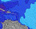 |  | |||||||||||||||
Onda Altezza (m) Direzione Periodo (s) | ENE 7 | ENE 7 | ENE 7 | E 7 | E 7 | E 7 | NE 7 | ENE 7 | ENE 7 | ENE 7 | NE 7 | NE 7 | NE 7 | NE 7 | ENE 7 | ENE 7 | ENE 7 | ENE 7 | ENE 7 | ENE 7 | E 7 | E 7 | E 7 | E 8 |
Grafico delle onde | ||||||||||||||||||||||||
0 | 0 | 0 | 0 | 0 | 0 | 0 | 0 | 0 | 0 | 0 | 0 | 0 | 0 | 0 | 0 | 0 | 0 | 0 | 0 | 0 | 0 | 0 | 0 | |
Vento (km/h) | ||||||||||||||||||||||||
Stato del vento onshore cross-onshore cross-shore cross-offshore offshore piatto | off | cross-off | cross-off | cross-off | off | off | off | off | off | off | cross-off | cross-off | cross-off | off | off | off | off | off | off | off | off | off | off | off |
Alta Marea | 00:31AM0.26m | 3:37PM0.31m | 00:43AM0.24m | 4:46PM0.31m | 00:42AM0.23m | 5:51PM0.31m | ||||||||||||||||||
Basso Marea | 7:51AM0.06m | 10:14PM0.24m | 8:34AM0.05m | 00:06AM0.23m | 9:21AM0.03m | |||||||||||||||||||
— | 5:50 | — | — | — | — | — | — | — | 5:52 | — | — | — | — | — | — | — | 5:52 | — | — | — | — | — | — | |
— | — | — | — | — | 6:55 | — | — | — | — | — | — | — | 6:54 | — | — | — | — | — | — | — | 6:54 | — | — | |
mm | 1 | — | — | 1 | 1 | — | 1 | — | 1 | 1 | 1 | — | — | — | — | — | — | — | 1 | 2 | — | — | — | — |
Temp. °C | 27 | 27 | 27 | 27 | 27 | 27 | 27 | 27 | 27 | 26 | 26 | 27 | 27 | 27 | 27 | 27 | 27 | 27 | 27 | 27 | 27 | 27 | 27 | 27 |
Gelo °C | 27 | 26 | 26 | 27 | 27 | 27 | 27 | 26 | 27 | 26 | 25 | 26 | 27 | 27 | 27 | 27 | 28 | 27 | 26 | 26 | 26 | 27 | 27 | 27 |
Onda 1 Altezza (m) Direzione Periodo (s) | NE 6 | NE 6 | NE 6 | — | — | NE 7 | NE 7 | — | — | — | NE 7 | NE 7 | NE 7 | NE 7 | S 5 | S 5 | SSE 6 | SSE 6 | SSE 6 | SSE 5 | SSE 6 | NE 8 | NE 8 | SSE 6 |
68 | 68 | 66 | — | — | 61 | 89 | — | — | — | 109 | 102 | 79 | 79 | 13 | 14 | 17 | 18 | 10 | 11 | 6 | 11 | 53 | 3 | |
Onda 2 Altezza (m) Direzione Periodo (s) | — | — | — | — | — | — | — | — | — | — | — | — | — | S 5 | — | — | — | — | — | — | — | SSE 6 | SSE 6 | — |
— | — | — | — | — | — | — | — | — | — | — | — | — | 13 | — | — | — | — | — | — | — | 6 | 6 | — | |
Onda 3 Altezza (m) Direzione Periodo (s) | — | — | — | — | — | — | — | — | — | — | — | — | — | — | — | — | — | — | — | — | — | — | — | — |
— | — | — | — | — | — | — | — | — | — | — | — | — | — | — | — | — | — | — | — | — | — | — | — | |
onde vento Altezza (m) Direzione Periodo (s) | ENE 7 | ENE 7 | ENE 7 | E 7 | E 7 | E 7 | ESE 5 | ENE 7 | ENE 7 | ENE 7 | ESE 6 | ESE 7 | ESE 5 | ESE 6 | ENE 7 | ENE 7 | ENE 7 | ENE 7 | ENE 7 | ENE 7 | E 7 | E 7 | E 7 | E 8 |
132 | 149 | 161 | 157 | 157 | 157 | 42 | 186 | 186 | 186 | 64 | 96 | 66 | 64 | 143 | 166 | 161 | 161 | 180 | 175 | 202 | 220 | 188 | 287 | |
Il più vicino Offshore or Glassy | ||||||||||||||||||||||||
Distanza (km) | 31 | 164 | 173 | 609 | 901 | 1890 | 279 | 194 | 176 | 164 | 179 | 609 | 289 | 26 | 246 | 170 | 170 | 176 | 583 | 921 | 771 | 771 | 592 | 584 |
Migliori previsioni per le condizioni d'onda in Necker Island - BVI | ||||||||||||||||||||||||
Migliori previsioni per le condizioni d'onda in British Virgin Islands | ||||||||||||||||||||||||
Trova Onde Globale | ||||||||||||||||||||||||
- Map Icons:
 Break
Break Live Wave Height (m)
 Live Wind Speed (km/h)
 Surf Rating (10 Max)
 Ocean Swells (m)
- Wind Speed (km/h)
Widget Free Surf-Forecast.com per il tuo sito
La relazione di surf / widget meteo è disponibile qui sotto per incorporare su siti esterni a titolo gratuito e fornisce una sintesi delle nostre Virgin Gorda Pass previsione surf. Basta prendere il frammento di codice html da noi fornito e copiarlo nel proprio sito. È possibile scegliere la lingua preferita e unità metriche / imperiali per il feed delle previsioni surf per soddisfare le esigenze degli utenti del vostro sito .... Clicca qui per ottenere il codice.
 Nearest