
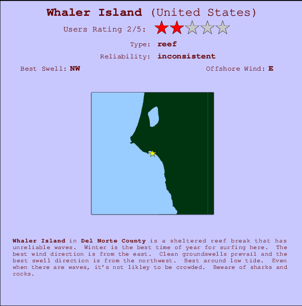
Whaler Island Surf Guide
Whaler Island in Del Norte County is a sheltered reef break that has inconsistent surf. Winter is the best time of year for surfing here. Offshore winds are from the east. Most of the surf here comes from groundswells and the optimum swell angle is from the northwest. A right hand reef break. Best around low tide. Unlikely to be too crowded, even when the surf is up. Watch out for sharks and rocks.
Whaler Island Spot Info
| Type: | Rating: | Reliability: | Todays Sea Temp*: |
|---|---|---|---|
| inconsistent | 11.8°C*ocean temperature recorded from satellite |
Surfing Whaler Island:
The best conditions reported for surf at Whaler Island occur when a Northwest swell combines with an offshore wind direction from the East.

Previsioni Energia d'onda (Potenza): 12hrs


Whaler Island Surf:
Thursday, 16 July 2026, 13:32 Local time| Giovedì 16 | ||||
| 2PM | 5PM | 8PM | 11PM | |
| Wave (m) | ||||
| Periodo (s) | 19 | 19 | 18 | 18 |
| Vento (km/h) | ||||
| Stato del vento | cross- on |
cross- on |
cross- on |
cross |
- /breaks/Whaler-Island/forecasts/latest
Whaler Island Surf Guide
Whaler Island in Del Norte County is a sheltered reef break that has inconsistent surf. Winter is the best time of year for surfing here. Offshore winds are from the east. Most of the surf here comes from groundswells and the optimum swell angle is from the northwest. A right hand reef break. Best around low tide. Unlikely to be too crowded, even when the surf is up. Watch out for sharks and rocks.
Whaler Island Spot Info
Type: Rating: Reliability: Todays Sea Temp*:  Reef
Reef 2
2inconsistent 11.8°C*ocean temperature recorded from satelliteSurfing Whaler Island:
The best conditions reported for surf at Whaler Island occur when a Northwest swell combines with an offshore wind direction from the East.
Previsioni Energia d'onda (Potenza): 12hrs
Utilizzare la scheda di navigazione in alto per visualizzare Whaler Island temperatura del mare, Whaler Island fotografie, Whaler Island dettagliate previsioni onde, il vento e le previsioni meteo, Whaler Island webcam, vento corrente da CAL - Del Norte County stazioni meteo e Whaler Island previsioni marea. Il link United States mappe maree apre l'immagine grande, che mostra United States e dei mari circostanti. Queste mappe possono essere animate per mostrare le diverse componenti del moto ondoso, energia delle onde, periodo d'onda, altezza delle onde, insieme con le previsioni del vento e meteo, meteo corrente e osservazioni sullo stato del mare dal United States onda-boe, le navi passanti e stazioni meteo costiere. Ciascuna delle pagine di previsioni per questo surf break rappresenta uno strumento di wavefinder globale e regionale per individuare le migliori condizioni di surf nella zona intorno Whaler Island.
Whaler Island Surf:
Thursday, 16 July 2026, 13:32 Local timeGiovedì 16 2PM 5PM 8PM 11PM Wave (m) Periodo (s) 19 19 18 18 Vento (km/h) Stato del vento cross-
oncross-
oncross-
oncross - /breaks/Whaler-Island/forecasts/latest
- /breaks/Whaler-Island/forecasts/latest/six_day
Whaler Island Surf Guide
Whaler Island in Del Norte County is a sheltered reef break that has inconsistent surf. Winter is the best time of year for surfing here. Offshore winds are from the east. Most of the surf here comes from groundswells and the optimum swell angle is from the northwest. A right hand reef break. Best around low tide. Unlikely to be too crowded, even when the surf is up. Watch out for sharks and rocks.
Whaler Island Spot Info
Type: Rating: Reliability: Todays Sea Temp*: Reef2inconsistent 11.8°C*ocean temperature recorded from satelliteSurfing Whaler Island:
The best conditions reported for surf at Whaler Island occur when a Northwest swell combines with an offshore wind direction from the East.
Previsioni Energia d'onda (Potenza): 12hrs
Utilizzare la scheda di navigazione in alto per visualizzare Whaler Island temperatura del mare, Whaler Island fotografie, Whaler Island dettagliate previsioni onde, il vento e le previsioni meteo, Whaler Island webcam, vento corrente da CAL - Del Norte County stazioni meteo e Whaler Island previsioni marea. Il link United States mappe maree apre l'immagine grande, che mostra United States e dei mari circostanti. Queste mappe possono essere animate per mostrare le diverse componenti del moto ondoso, energia delle onde, periodo d'onda, altezza delle onde, insieme con le previsioni del vento e meteo, meteo corrente e osservazioni sullo stato del mare dal United States onda-boe, le navi passanti e stazioni meteo costiere. Ciascuna delle pagine di previsioni per questo surf break rappresenta uno strumento di wavefinder globale e regionale per individuare le migliori condizioni di surf nella zona intorno Whaler Island.
Whaler Island Surf:
Thursday, 16 July 2026, 13:32 Local timeGiovedì 16 2PM 5PM 8PM 11PM Wave (m) Periodo (s) 19 19 18 18 Vento (km/h) Stato del vento cross-
oncross-
oncross-
oncross - /breaks/Whaler-Island/forecasts/latest
Whaler Island Surf Guide
Whaler Island in Del Norte County is a sheltered reef break that has inconsistent surf. Winter is the best time of year for surfing here. Offshore winds are from the east. Most of the surf here comes from groundswells and the optimum swell angle is from the northwest. A right hand reef break. Best around low tide. Unlikely to be too crowded, even when the surf is up. Watch out for sharks and rocks.
Whaler Island Spot Info
Type: Rating: Reliability: Todays Sea Temp*: Reef2inconsistent 11.8°C*ocean temperature recorded from satelliteSurfing Whaler Island:
The best conditions reported for surf at Whaler Island occur when a Northwest swell combines with an offshore wind direction from the East.
Previsioni Energia d'onda (Potenza): 12hrs
Utilizzare la scheda di navigazione in alto per visualizzare Whaler Island temperatura del mare, Whaler Island fotografie, Whaler Island dettagliate previsioni onde, il vento e le previsioni meteo, Whaler Island webcam, vento corrente da CAL - Del Norte County stazioni meteo e Whaler Island previsioni marea. Il link United States mappe maree apre l'immagine grande, che mostra United States e dei mari circostanti. Queste mappe possono essere animate per mostrare le diverse componenti del moto ondoso, energia delle onde, periodo d'onda, altezza delle onde, insieme con le previsioni del vento e meteo, meteo corrente e osservazioni sullo stato del mare dal United States onda-boe, le navi passanti e stazioni meteo costiere. Ciascuna delle pagine di previsioni per questo surf break rappresenta uno strumento di wavefinder globale e regionale per individuare le migliori condizioni di surf nella zona intorno Whaler Island.
Whaler Island Surf:
Thursday, 16 July 2026, 13:32 Local timeGiovedì 16 2PM 5PM 8PM 11PM Wave (m) Periodo (s) 19 19 18 18 Vento (km/h) Stato del vento cross-
oncross-
oncross-
oncross Tide Times:
A Crescent City, California (0 km).
PROSSIMA È ALLE (ora locale) rimanente alta marea bassa marea Whaler Island Tide Times and Tide Chart
Live Weather:
At BUOY-CECC1, 1 km from Whaler Island.
light winds from the NNW
(km/h)Air temperature
15.8°CCurrent weather near Whaler Island
Buoy Data:
At St Georges Buoy, 12 miles from Whaler Island.
8AM 9AM 10AM 11AM Attualità dei dati 4 hr 3 hr 2 hr 1 hr Altezza delle onde (m) 


Periodo dominante (s) 9 9 - - Overall Whaler Island Surf Consistency and Wind Distribution in Luglio
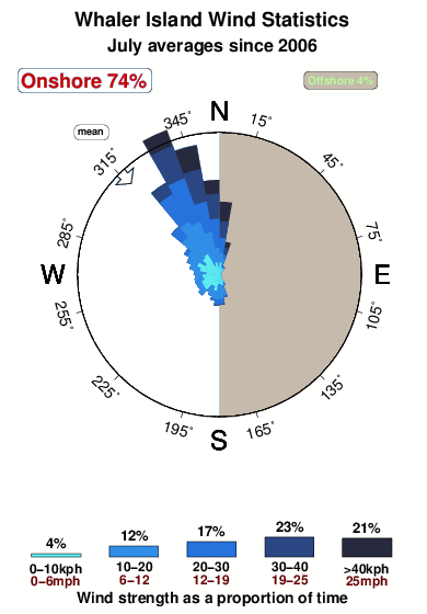


Wind stats for Whaler Island: see the variation in direction and stength by month.
foto dall' album
Contorni: Strade e fiumi: seleziona un surf break dal menu 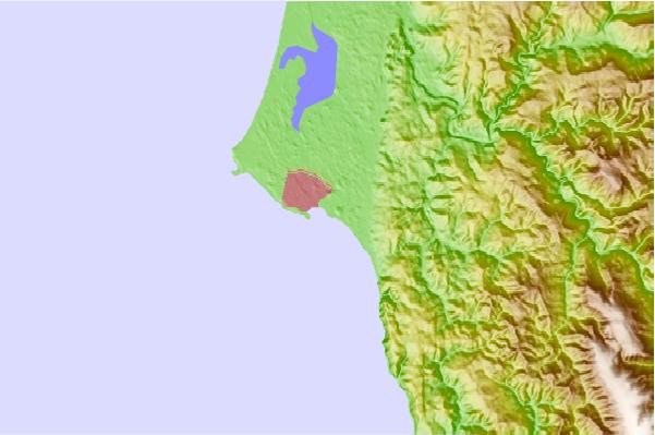
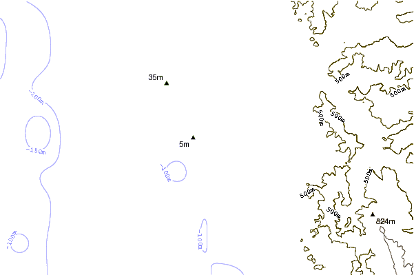
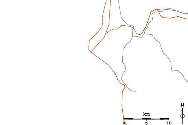
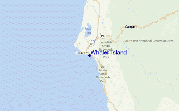
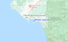
Utilizzare questa mappa sollievo per navigare CAL - Del Norte County surf breaks e stazioni di marea che si trovano nella zona diWhaler Island
Altri surf breaks più vicini al Whaler Island:
(clicca sul nome del luogo per maggiori informazioni)- Closest località surf1 mi
- Second closest località surf2 mi
- Third closest località surf4 mi
- Fourth closest località surf5 mi
- Fifth closest località surf11 mi
Onda boe più vicina a Whaler Island:
- Closest Onda boa12 mi
- Second closest Onda boa59 mi
- Third closest Onda boa72 mi
- Fourth closest Onda boa77 mi
- Fifth closest Onda boa104 mi
Stazioni di marea più vicina alla Whaler Island:
- Closest marea stazioneCrescent City0 mi
- Second closest marea stazioneBrookings, Chetco Cove22 mi
- Third closest marea stazioneTrinidad Harbor48 mi
- Fourth closest marea stazioneWedderburn, Rogue River49 mi
- Fifth closest marea stazioneMcKinleyville55 mi
Airports
- The nearest passenger airport to Whaler Island is Chico Muni Airport (CIC) in USA, which is 292 km (181 miles) away (directly).
- The second closest airport to Whaler Island is Beale Afb (Marysville) Airport (BAB), also in USA, 372 km (231 miles) away.
- /breaks/Whaler-Island/forecasts/latest

 Nearest