
Previsioni:

Previsione a breve termineper lo più asciutto. Warm (Max 23°C martedì mattina, Min 11°C Domenica mattina). Principalmente venti freschi. | ||||||||||||||||||||
1 | Domenica 2 | Lunedì 3 | ||||||||||||||||||
2 PM | 5 PM | 8 PM | 11 PM | 2 AM | 5 AM | 8 AM | 11 AM | 2 PM | 5 PM | 8 PM | 11 PM | 2 AM | 5 AM | 8 AM | 11 AM | 2 PM | 5 PM | 8 PM | 11 PM | |
Mappa dell'altezza del moto ondoso |  |  | 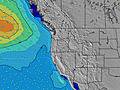 | 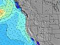 |  |  | 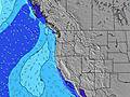 | 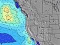 | ||||||||||||
Onda Altezza (m) Direzione Periodo (s) | SW 14 | WNW 8 | WNW 8 | WNW 8 | WNW 8 | WNW 8 | WNW 8 | WNW 9 | WNW 9 | NW 9 | NW 9 | WNW 9 | WNW 8 | NW 8 | NW 8 | NW 7 | NW 7 | NW 7 | NW 7 | NW 7 |
Grafico delle onde | ||||||||||||||||||||
137 | 163 | 155 | 151 | 181 | 250 | 313 | 405 | 459 | 516 | 612 | 454 | 326 | 393 | 304 | 239 | 276 | 342 | 362 | 352 | |
Vento (km/h) | ||||||||||||||||||||
Stato del vento onshore cross-onshore cross-shore cross-offshore offshore piatto | cross | cross-on | cross | cross | cross-off | cross-off | cross-off | cross | cross | cross | cross | cross | cross-off | cross-off | cross-off | cross | cross | cross | cross | cross |
Alta Marea | 3:06PM2.93m | 2:41AM2.87m | 3:35PM2.99m | 3:27AM2.69m | 4:06PM3.03m | |||||||||||||||
Basso Marea | 8:55PM1.29m | 9:05AM0.70m | 9:40PM1.19m | 9:36AM0.90m | 10:30PM1.09m | |||||||||||||||
— | — | — | — | — | 6:03 | — | — | — | — | — | — | — | 6:05 | — | — | — | — | — | — | |
— | — | 8:40 | — | — | — | — | — | — | — | 8:39 | — | — | — | — | — | — | — | 8:37 | — | |
mm | — | — | — | — | — | — | — | — | — | — | — | — | — | — | — | — | — | — | — | — |
Temp. °C | 16 | 17 | 15 | 13 | 13 | 12 | 14 | 17 | 17 | 17 | 15 | 13 | 11 | 11 | 13 | 18 | 19 | 18 | 16 | 14 |
Gelo °C | 15 | 15 | 13 | 11 | 12 | 11 | 13 | 14 | 13 | 12 | 11 | 9 | 8 | 8 | 11 | 14 | 14 | 14 | 13 | 12 |
Onda 1 Altezza (m) Direzione Periodo (s) | WNW 8 | WNW 8 | WNW 8 | WNW 8 | WNW 8 | WNW 8 | WNW 8 | WNW 9 | WNW 9 | SW 14 | SW 13 | WNW 9 | WNW 8 | NW 8 | NW 8 | SW 13 | SW 13 | SW 13 | WSW 16 | SW 16 |
137 | 163 | 155 | 151 | 181 | 250 | 313 | 405 | 459 | 64 | 46 | 454 | 326 | 393 | 304 | 27 | 27 | 27 | 26 | 41 | |
Onda 2 Altezza (m) Direzione Periodo (s) | SW 14 | SW 14 | SW 14 | SW 14 | SW 14 | SW 14 | SW 14 | SW 14 | SW 14 | WSW 18 | WSW 18 | SW 13 | SW 13 | SW 13 | SW 13 | WSW 18 | WSW 17 | WSW 17 | SW 13 | SW 13 |
127 | 97 | 97 | 99 | 99 | 97 | 67 | 65 | 65 | 31 | 31 | 46 | 45 | 45 | 27 | 30 | 30 | 27 | 27 | 27 | |
Onda 3 Altezza (m) Direzione Periodo (s) | W 20 | W 20 | W 10 | WSW 19 | WSW 19 | WSW 19 | SW 19 | SW 19 | SW 19 | SW 18 | — | WSW 18 | SW 18 | SW 18 | WSW 18 | WSW 18 | — | — | — | — |
8 | 8 | 2 | 37 | 37 | 37 | 15 | 15 | 14 | 12 | — | 61 | 80 | 80 | 30 | 30 | — | — | — | — | |
onde vento Altezza (m) Direzione Periodo (s) | — | — | — | — | — | — | — | — | — | NW 9 | NW 9 | N 5 | N 6 | — | — | NW 7 | NW 7 | NW 7 | NW 7 | NW 7 |
— | — | — | — | — | — | — | — | — | 516 | 612 | 52 | 72 | — | — | 239 | 276 | 342 | 362 | 352 | |
Il più vicino Offshore or Glassy | ||||||||||||||||||||
Distanza (km) | 735 | 836 | 430 | 48 | 48 | 48 | 48 | 433 | 455 | 1160 | 429 | 429 | 48 | 48 | 48 | 218 | 448 | 455 | 368 | 48 |
Migliori previsioni per le condizioni d'onda in South Oregon | ||||||||||||||||||||
Migliori previsioni per le condizioni d'onda in United States | ||||||||||||||||||||
Trova Onde Globale | ||||||||||||||||||||
- Map Icons:
 Break
Break Live Wave Height (m)
 Live Wind Speed (km/h)
 Surf Rating (10 Max)
 Ocean Swells (m)
- Wind Speed (km/h)
Widget Free Surf-Forecast.com per il tuo sito
La relazione di surf / widget meteo è disponibile qui sotto per incorporare su siti esterni a titolo gratuito e fornisce una sintesi delle nostre Yachats previsione surf. Basta prendere il frammento di codice html da noi fornito e copiarlo nel proprio sito. È possibile scegliere la lingua preferita e unità metriche / imperiali per il feed delle previsioni surf per soddisfare le esigenze degli utenti del vostro sito .... Clicca qui per ottenere il codice.
 Nearest