
Previsioni:

Previsione a breve termineper lo più asciutto. Warm (Max 22°C Sabato pomeriggio, Min 14°C Venerdì notte). Vento sarà generalmente leggero. | ||||||||||||||||||||||||
Mer 15 | Giovedì 16 | Venerdì 17 | 18 | |||||||||||||||||||||
5 PM | 8 PM | 11 PM | 2 AM | 5 AM | 8 AM | 11 AM | 2 PM | 5 PM | 8 PM | 11 PM | 2 AM | 5 AM | 8 AM | 11 AM | 2 PM | 5 PM | 8 PM | 11 PM | 2 AM | 5 AM | 8 AM | 11 AM | 2 PM | |
Mappa dell'altezza del moto ondoso |  |  |  |  |  |  |  |  | 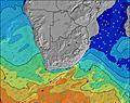 | |||||||||||||||
Onda Altezza (m) Direzione Periodo (s) | E 10 | E 10 | E 10 | SW 10 | SW 10 | SW 10 | E 11 | E 11 | SSW 14 | SSW 13 | SSW 13 | SSW 12 | SSW 13 | SSW 13 | SSW 13 | SSW 13 | SSW 12 | SSW 11 | SSW 11 | SSW 11 | SSW 10 | S 13 | S 12 | S 12 |
Grafico delle onde | ||||||||||||||||||||||||
392 | 338 | 345 | 1008 | 665 | 614 | 329 | 323 | 267 | 396 | 307 | 220 | 238 | 242 | 307 | 433 | 429 | 337 | 280 | 198 | 146 | 398 | 461 | 517 | |
Vento (km/h) | ||||||||||||||||||||||||
Stato del vento onshore cross-onshore cross-shore cross-offshore offshore piatto | cross-off | off | off | off | off | off | cross-off | cross | cross | cross-off | cross-off | cross-off | off | off | cross-off | cross-off | cross | cross | cross | cross | cross-off | off | cross-off | cross-off |
Alta Marea | 4:42PM1.64m | 4:54AM1.61m | 5:23PM1.67m | 5:33AM1.56m | 6:02PM1.65m | 6:10AM1.47m | ||||||||||||||||||
Basso Marea | 10:49PM0.10m | 11:05AM0.00m | 11:30PM0.13m | 11:42AM0.03m | 00:11AM0.19m | 12:17PM0.10m | ||||||||||||||||||
— | — | — | — | 7:07 | — | — | — | — | — | — | — | 7:07 | — | — | — | — | — | — | — | 7:07 | — | — | — | |
5:17 | — | — | — | — | — | — | — | 5:19 | — | — | — | — | — | — | — | 5:19 | — | — | — | — | — | — | 5:20 | |
mm | — | — | — | — | — | — | — | — | — | — | — | — | — | — | — | — | — | — | — | — | — | — | — | — |
Temp. °C | 18 | 16 | 16 | 16 | 16 | 15 | 18 | 20 | 17 | 16 | 16 | 15 | 15 | 15 | 19 | 20 | 17 | 15 | 15 | 14 | 15 | 17 | 21 | 22 |
Gelo °C | 17 | 14 | 14 | 14 | 14 | 14 | 17 | 19 | 17 | 16 | 16 | 15 | 14 | 13 | 18 | 19 | 17 | 14 | 14 | 13 | 13 | 14 | 18 | 19 |
Onda 1 Altezza (m) Direzione Periodo (s) | E 10 | E 10 | E 10 | SSW 9 | E 11 | E 11 | E 11 | E 11 | E 11 | E 10 | E 10 | E 10 | E 10 | E 10 | E 10 | SSW 13 | SSW 12 | SSW 11 | SSW 11 | SSW 11 | SSW 10 | S 13 | S 12 | S 12 |
392 | 338 | 345 | 299 | 387 | 329 | 329 | 323 | 267 | 257 | 247 | 200 | 200 | 196 | 159 | 433 | 429 | 337 | 280 | 198 | 146 | 398 | 461 | 517 | |
Onda 2 Altezza (m) Direzione Periodo (s) | SSE 10 | SSE 9 | SSW 8 | E 10 | SSW 10 | SSW 10 | SSW 11 | SSW 10 | SSW 14 | SSW 13 | SSW 13 | SSW 12 | SSW 13 | SSW 13 | SSW 13 | E 10 | E 10 | E 10 | E 10 | E 10 | E 10 | E 10 | E 10 | E 10 |
10 | 9 | 145 | 365 | 314 | 212 | 186 | 115 | 261 | 396 | 307 | 220 | 238 | 242 | 307 | 159 | 159 | 159 | 125 | 125 | 125 | 123 | 123 | 94 | |
Onda 3 Altezza (m) Direzione Periodo (s) | SSW 8 | SW 12 | SSE 10 | SSW 18 | SSW 17 | SW 16 | SSW 15 | SSW 14 | SSW 9 | SE 10 | S 10 | S 10 | S 10 | — | — | — | — | S 15 | S 15 | SSE 14 | S 13 | SSW 11 | E 10 | SW 11 |
7 | 6 | 9 | 30 | 29 | 66 | 128 | 233 | 84 | 4 | 2 | 2 | 2 | — | — | — | — | 18 | 39 | 69 | 130 | 76 | 127 | 110 | |
onde vento Altezza (m) Direzione Periodo (s) | SSW 6 | SSW 6 | SW 7 | SW 10 | SW 10 | SW 10 | — | — | — | — | — | — | — | — | — | — | — | — | — | — | — | — | — | SW 3 |
22 | 82 | 289 | 1008 | 665 | 614 | — | — | — | — | — | — | — | — | — | — | — | — | — | — | — | — | — | 3 | |
Il più vicino Offshore or Glassy | ||||||||||||||||||||||||
Distanza (km) | 0 | 0 | 0 | 0 | 0 | 0 | 0 | 29 | 27 | 0 | 0 | 0 | 0 | 0 | 0 | 0 | 1 | 1 | 1 | 1 | 0 | 0 | 0 | 0 |
Migliori previsioni per le condizioni d'onda in Eastern Cape - Wild Coast | ||||||||||||||||||||||||
Migliori previsioni per le condizioni d'onda in South Africa | ||||||||||||||||||||||||
Trova Onde Globale | ||||||||||||||||||||||||
- Map Icons:
 Break
Break Live Wave Height (m)
 Live Wind Speed (km/h)
 Surf Rating (10 Max)
 Ocean Swells (m)
- Wind Speed (km/h)
Widget Free Surf-Forecast.com per il tuo sito
La relazione di surf / widget meteo è disponibile qui sotto per incorporare su siti esterni a titolo gratuito e fornisce una sintesi delle nostre Yellowsands Beach previsione surf. Basta prendere il frammento di codice html da noi fornito e copiarlo nel proprio sito. È possibile scegliere la lingua preferita e unità metriche / imperiali per il feed delle previsioni surf per soddisfare le esigenze degli utenti del vostro sito .... Clicca qui per ottenere il codice.
 Nearest