
Previsioni:

Aggiornamento in hr min s Forecast update imminent
Previsione a breve terminePioggia abbondante (Totale 23mm), più pesante durante sabato notte. Very mild (Max 19°C Domenica mattina, Min 15°C Sabato notte). Vento sarà generalmente leggero. | ||||||||||||||||||||||||
27 | Domenica 28 | Lunedì 29 | Martedì 30 | |||||||||||||||||||||
7 PM | 10 PM | 1 AM | 4 AM | 7 AM | 10 AM | 1 PM | 4 PM | 7 PM | 10 PM | 1 AM | 4 AM | 7 AM | 10 AM | 1 PM | 4 PM | 7 PM | 10 PM | 1 AM | 4 AM | 7 AM | 10 AM | 1 PM | 4 PM | |
Mappa dell'altezza del moto ondoso |  |  |  |  |  |  |  |  | 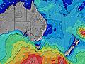 | |||||||||||||||
Onda Altezza (m) Direzione Periodo (s) | SE 9 | SE 9 | SE 9 | SE 9 | SE 10 | SE 10 | SE 9 | SE 9 | SE 9 | SE 9 | SE 9 | SE 9 | SE 9 | SE 9 | SE 9 | SE 8 | SE 8 | SE 8 | SE 8 | SE 8 | SE 8 | SE 8 | SE 8 | SE 8 |
Grafico delle onde | ||||||||||||||||||||||||
314 | 418 | 396 | 423 | 399 | 399 | 359 | 281 | 275 | 225 | 367 | 325 | 318 | 275 | 262 | 227 | 196 | 216 | 268 | 232 | 173 | 129 | 94 | 94 | |
Vento (km/h) | ||||||||||||||||||||||||
Stato del vento onshore cross-onshore cross-shore cross-offshore offshore piatto | cross-on | cross-on | glassy | glassy | cross | cross | cross | cross-on | cross | cross-on | cross-on | cross | cross-off | cross-off | glassy | cross-on | on | on | cross-on | cross-on | glassy | glassy | cross-on | on |
Alta Marea | 6:58PM1.51m | 6:52AM0.93m | 7:36PM1.58m | 7:37AM0.95m | 8:12PM1.62m | 8:20AM0.96m | ||||||||||||||||||
Basso Marea | 1:41AM0.46m | 12:32PM0.28m | 2:22AM0.41m | 1:13PM0.28m | 3:00AM0.36m | 1:54PM0.28m | ||||||||||||||||||
— | — | — | 6:39 | — | — | — | — | — | — | — | 6:39 | — | — | — | — | — | — | — | 6:39 | — | — | — | — | |
— | — | — | — | — | — | — | 4:58 | — | — | — | — | — | — | — | 4:58 | — | — | — | — | — | — | — | 4:58 | |
mm | 2 | 3 | 2 | 2 | 3 | 2 | 1 | — | 1 | — | 2 | 2 | — | — | 1 | 1 | 1 | 1 | 1 | — | — | — | — | — |
Temp. °C | 17 | 16 | 15 | 15 | 15 | 15 | 18 | 19 | 18 | 17 | 16 | 16 | 15 | 16 | 18 | 18 | 17 | 17 | 17 | 17 | 16 | 17 | 18 | 18 |
Gelo °C | 15 | 15 | 15 | 15 | 14 | 14 | 16 | 16 | 16 | 15 | 15 | 15 | 14 | 16 | 18 | 17 | 16 | 16 | 16 | 16 | 16 | 17 | 17 | 17 |
Onda 1 Altezza (m) Direzione Periodo (s) | SE 9 | SE 9 | SE 9 | SE 9 | SE 10 | SE 10 | SE 9 | SE 9 | SE 9 | SE 9 | SE 9 | SE 9 | SE 9 | SE 9 | SE 9 | SE 8 | SE 8 | S 19 | ESE 10 | ESE 11 | SE 8 | SE 8 | SE 8 | SE 8 |
314 | 418 | 396 | 423 | 399 | 399 | 359 | 281 | 275 | 225 | 367 | 325 | 318 | 275 | 262 | 227 | 196 | 7 | 42 | 24 | 173 | 129 | 94 | 94 | |
Onda 2 Altezza (m) Direzione Periodo (s) | SE 12 | S 18 | ESE 13 | ESE 13 | ESE 12 | ESE 12 | ESE 11 | ESE 11 | ESE 11 | ESE 11 | SSE 15 | SSE 14 | S 14 | S 14 | S 14 | ESE 11 | ESE 11 | ESE 11 | S 18 | SE 10 | SE 9 | ESE 11 | NE 5 | ENE 5 |
89 | 7 | 35 | 68 | 86 | 99 | 113 | 160 | 149 | 143 | 22 | 21 | 4 | 4 | 4 | 13 | 24 | 23 | 6 | 16 | 23 | 40 | 13 | 18 | |
Onda 3 Altezza (m) Direzione Periodo (s) | S 19 | E 15 | S 18 | SSE 18 | SSE 18 | SSE 18 | SSE 18 | SSE 17 | SSE 16 | SSE 16 | N 10 | N 10 | E 10 | S 11 | — | S 13 | S 19 | S 19 | S 18 | S 18 | ESE 11 | SE 10 | ESE 11 | ESE 11 |
7 | 4 | 25 | 31 | 30 | 30 | 30 | 29 | 26 | 24 | 2 | 2 | 2 | 2 | — | 13 | 7 | 7 | 26 | 6 | 40 | 23 | 40 | 39 | |
onde vento Altezza (m) Direzione Periodo (s) | — | — | — | — | — | — | — | — | — | — | — | — | — | — | — | — | — | SE 8 | SE 8 | SE 8 | — | — | — | — |
— | — | — | — | — | — | — | — | — | — | — | — | — | — | — | — | — | 216 | 268 | 232 | — | — | — | — | |
Il più vicino Offshore or Glassy | ||||||||||||||||||||||||
Distanza (km) | 4 | 4 | 0 | 0 | 4 | 4 | 4 | 4 | 4 | 4 | 23 | 4 | 0 | 0 | 0 | 15 | 23 | 23 | 23 | 4 | 0 | 0 | 23 | 23 |
Migliori previsioni per le condizioni d'onda in North Coast - New South Wales | ||||||||||||||||||||||||
Migliori previsioni per le condizioni d'onda in Australia | ||||||||||||||||||||||||
Trova Onde Globale | ||||||||||||||||||||||||
- Map Icons:
 Break
Break Live Wave Height (m)
 Live Wind Speed (km/h)
 Surf Rating (10 Max)
 Ocean Swells (m)
- Wind Speed (km/h)
Widget Free Surf-Forecast.com per il tuo sito
La relazione di surf / widget meteo è disponibile qui sotto per incorporare su siti esterni a titolo gratuito e fornisce una sintesi delle nostre Backsides previsione surf. Basta prendere il frammento di codice html da noi fornito e copiarlo nel proprio sito. È possibile scegliere la lingua preferita e unità metriche / imperiali per il feed delle previsioni surf per soddisfare le esigenze degli utenti del vostro sito .... Clicca qui per ottenere il codice.
 Nearest