
Previsioni:

Previsione a breve termineQualche pioggerella, più pesante durante venerdì notte. Warm (Max 21°C giovedì notte, Min 14°C Sabato notte). Venti decrescenti (venti freschi da N giovedì notte, calma per venerdì notte). | |||||||||||||||||||
Gio 16 | Venerdì 17 | Sabato 18 | |||||||||||||||||
5 PM | 8 PM | 11 PM | 2 AM | 5 AM | 8 AM | 11 AM | 2 PM | 5 PM | 8 PM | 11 PM | 2 AM | 5 AM | 8 AM | 11 AM | 2 PM | 5 PM | 8 PM | 11 PM | |
Mappa dell'altezza del moto ondoso |  |  | 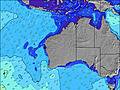 |  |  | 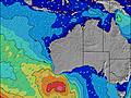 |  | ||||||||||||
Onda Altezza (m) Direzione Periodo (s) | SSW 16 | SSW 15 | SSW 14 | SSW 14 | SSW 14 | SSW 13 | SSW 13 | SSW 13 | SW 13 | SW 13 | SSW 13 | SSW 12 | SSW 12 | SSW 12 | SSW 14 | SSW 20 | SW 19 | SSW 18 | SW 13 |
Grafico delle onde | |||||||||||||||||||
966 | 773 | 647 | 630 | 474 | 440 | 362 | 299 | 331 | 604 | 202 | 190 | 184 | 93 | 264 | 253 | 1564 | 644 | 796 | |
Vento (km/h) | |||||||||||||||||||
Stato del vento onshore cross-onshore cross-shore cross-offshore offshore piatto | off | off | off | off | off | off | cross-off | cross-off | cross-off | cross | glassy | cross-off | off | cross-off | cross-off | cross | cross | cross | cross-off |
Alta Marea | 1:27AM0.55m | 12:37PM1.08m | 1:26AM0.60m | 12:48PM0.96m | |||||||||||||||
Basso Marea | 8:02PM0.35m | 5:03AM0.49m | 8:09PM0.43m | 5:34AM0.51m | 7:59PM0.49m | ||||||||||||||
— | — | — | — | 6:54 | — | — | — | — | — | — | — | 6:54 | — | — | — | — | — | — | |
5:00 | — | — | — | — | — | — | — | 5:01 | — | — | — | — | — | — | — | 5:02 | — | — | |
mm | — | — | — | — | — | — | — | — | — | 1 | — | — | — | — | — | — | — | — | — |
Temp. °C | 24 | 21 | 20 | 20 | 19 | 19 | 20 | 18 | 20 | 16 | 15 | 17 | 18 | 19 | 18 | 20 | 17 | 16 | 16 |
Gelo °C | 19 | 15 | 13 | 13 | 13 | 12 | 14 | 14 | 18 | 13 | 15 | 12 | 12 | 13 | 13 | 14 | 13 | 14 | 14 |
Onda 1 Altezza (m) Direzione Periodo (s) | SSW 16 | SSW 15 | SSW 14 | SSW 14 | SSW 14 | SSW 13 | SSW 13 | SSW 13 | SW 13 | SSW 13 | SSW 13 | SSW 12 | SSW 12 | SSW 12 | SSW 14 | SSW 14 | SSW 14 | SW 13 | SW 13 |
966 | 773 | 647 | 630 | 474 | 440 | 362 | 299 | 331 | 321 | 202 | 190 | 184 | 93 | 264 | 236 | 290 | 600 | 796 | |
Onda 2 Altezza (m) Direzione Periodo (s) | — | S 12 | S 12 | E 6 | E 6 | E 6 | SE 11 | SE 11 | SE 11 | E 7 | SW 5 | WSW 5 | S 22 | SSW 15 | SSW 21 | SSW 20 | SSW 19 | SSW 18 | SSW 17 |
— | 12 | 11 | 3 | 7 | 7 | 5 | 5 | 5 | 4 | 30 | 11 | 9 | 84 | 84 | 253 | 572 | 644 | 742 | |
Onda 3 Altezza (m) Direzione Periodo (s) | — | — | — | S 12 | S 11 | S 11 | S 11 | S 11 | S 11 | — | E 7 | — | E 7 | SSW 21 | E 6 | S 10 | S 10 | SE 9 | SE 10 |
— | — | — | 11 | 10 | 2 | 2 | 2 | 2 | — | 4 | — | 4 | 45 | 3 | 17 | 8 | 23 | 14 | |
onde vento Altezza (m) Direzione Periodo (s) | N 4 | N 4 | N 4 | NNW 4 | N 3 | N 3 | NW 4 | WNW 4 | WNW 4 | SW 13 | — | NE 2 | N 3 | NW 4 | WNW 4 | W 4 | SW 19 | WSW 9 | — |
7 | 9 | 14 | 11 | 6 | 6 | 13 | 12 | 5 | 604 | — | 1 | 4 | 10 | 20 | 15 | 1564 | 548 | — | |
Il più vicino Offshore or Glassy | |||||||||||||||||||
Distanza (km) | 1048 | 168 | 0 | 383 | 7 | 0 | 168 | 7 | 0 | 0 | 0 | 112 | 0 | 9 | 441 | 1007 | 1007 | 1155 | 241 |
Migliori previsioni per le condizioni d'onda in Far South of Western Australia | |||||||||||||||||||
Migliori previsioni per le condizioni d'onda in Australia | |||||||||||||||||||
Trova Onde Globale | |||||||||||||||||||
- Map Icons:
 Break
Break Live Wave Height (m)
 Live Wind Speed (km/h)
 Surf Rating (10 Max)
 Ocean Swells (m)
- Wind Speed (km/h)
Widget Free Surf-Forecast.com per il tuo sito
La relazione di surf / widget meteo è disponibile qui sotto per incorporare su siti esterni a titolo gratuito e fornisce una sintesi delle nostre Bandy Creek groyne previsione surf. Basta prendere il frammento di codice html da noi fornito e copiarlo nel proprio sito. È possibile scegliere la lingua preferita e unità metriche / imperiali per il feed delle previsioni surf per soddisfare le esigenze degli utenti del vostro sito .... Clicca qui per ottenere il codice.
 Nearest