
Previsioni:

Previsione a breve terminePioggia moderata (Totale 18mm), più pesante mercoledì notte. Very mild (Max 17°C mercoledì notte, Min 14°C giovedì mattina). Principalmente venti freschi. | ||||||||||||||||||||||||
Mer 15 | Giovedì 16 | Venerdì 17 | Sabato 18 | |||||||||||||||||||||
7 PM | 10 PM | 1 AM | 4 AM | 7 AM | 10 AM | 1 PM | 4 PM | 7 PM | 10 PM | 1 AM | 4 AM | 7 AM | 10 AM | 1 PM | 4 PM | 7 PM | 10 PM | 1 AM | 4 AM | 7 AM | 10 AM | 1 PM | 4 PM | |
Mappa dell'altezza del moto ondoso |  |  |  |  |  |  |  |  | 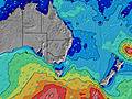 | |||||||||||||||
Onda Altezza (m) Direzione Periodo (s) | S 9 | S 9 | S 8 | S 8 | S 8 | S 8 | S 8 | S 8 | S 8 | S 8 | S 8 | S 8 | ESE 7 | ESE 7 | ESE 7 | ESE 7 | ESE 7 | ESE 7 | ESE 7 | ESE 7 | ESE 7 | ESE 8 | ESE 8 | E 8 |
Grafico delle onde | ||||||||||||||||||||||||
1263 | 875 | 628 | 588 | 558 | 378 | 418 | 351 | 302 | 223 | 181 | 126 | 144 | 171 | 171 | 168 | 224 | 243 | 274 | 286 | 319 | 331 | 357 | 411 | |
Vento (km/h) | ||||||||||||||||||||||||
Stato del vento onshore cross-onshore cross-shore cross-offshore offshore piatto | cross | cross | cross | cross | cross | cross-on | glassy | cross-on | cross-on | cross-on | cross-on | cross-on | cross-on | cross-on | cross-on | cross-on | cross-on | cross-on | cross-on | cross-on | cross-on | cross-on | cross-on | cross-on |
Alta Marea | 9:08PM2.01m | 9:55AM1.39m | 9:55PM1.94m | 10:41AM1.41m | 10:40PM1.83m | 11:27AM1.41m | ||||||||||||||||||
Basso Marea | 3:54AM0.06m | 3:30PM0.35m | 4:38AM0.10m | 4:21PM0.39m | 5:20AM0.17m | |||||||||||||||||||
— | — | — | 6:50 | — | — | — | — | — | — | — | 6:50 | — | — | — | — | — | — | — | 6:50 | — | — | — | — | |
— | — | — | — | — | — | — | 5:02 | — | — | — | — | — | — | — | 5:02 | — | — | — | — | — | — | — | 5:04 | |
mm | 1 | 1 | 1 | 1 | 3 | 3 | 2 | 1 | — | — | 1 | — | — | — | 1 | 1 | — | — | 1 | 2 | — | — | — | — |
Temp. °C | 16 | 17 | 16 | 17 | 16 | 16 | 14 | 17 | 17 | 16 | 16 | 16 | 17 | 17 | 16 | 16 | 17 | 17 | 16 | 17 | 17 | 17 | 17 | 17 |
Gelo °C | 9 | 11 | 8 | 10 | 10 | 13 | 14 | 14 | 12 | 12 | 13 | 12 | 13 | 13 | 13 | 14 | 13 | 13 | 12 | 11 | 11 | 11 | 12 | 12 |
Onda 1 Altezza (m) Direzione Periodo (s) | — | S 16 | S 16 | S 15 | S 15 | S 8 | S 8 | S 8 | S 8 | S 8 | S 8 | S 8 | S 8 | S 7 | S 7 | S 7 | S 9 | SSW 8 | S 9 | S 11 | S 11 | S 11 | S 10 | E 8 |
— | 5 | 5 | 5 | 4 | 378 | 418 | 351 | 302 | 223 | 181 | 118 | 111 | 83 | 62 | 45 | 23 | 23 | 23 | 85 | 83 | 82 | 77 | 411 | |
Onda 2 Altezza (m) Direzione Periodo (s) | — | — | — | — | — | ESE 6 | ESE 6 | ESE 6 | ESE 6 | E 8 | E 8 | E 8 | E 8 | S 17 | S 10 | S 9 | S 11 | S 11 | S 11 | S 21 | S 21 | S 21 | S 20 | S 10 |
— | — | — | — | — | 61 | 73 | 82 | 97 | 22 | 34 | 34 | 13 | 52 | 19 | 14 | 22 | 22 | 40 | 34 | 35 | 78 | 32 | 48 | |
Onda 3 Altezza (m) Direzione Periodo (s) | — | — | — | — | — | S 15 | S 18 | E 8 | E 8 | S 18 | S 18 | S 18 | S 18 | S 11 | S 16 | S 11 | S 15 | — | NE 8 | — | — | — | — | S 20 |
— | — | — | — | — | 5 | 25 | 5 | 12 | 54 | 55 | 58 | 56 | 23 | 43 | 22 | 18 | — | 2 | — | — | — | — | 30 | |
onde vento Altezza (m) Direzione Periodo (s) | S 9 | S 9 | S 8 | S 8 | S 8 | — | — | — | — | ESE 6 | ESE 6 | ESE 6 | ESE 7 | ESE 7 | ESE 7 | ESE 7 | ESE 7 | ESE 7 | ESE 7 | ESE 7 | ESE 7 | ESE 8 | ESE 8 | SSE 5 |
1263 | 875 | 628 | 588 | 558 | — | — | — | — | 97 | 126 | 126 | 144 | 171 | 171 | 168 | 224 | 243 | 274 | 286 | 319 | 331 | 357 | 45 | |
Il più vicino Offshore or Glassy | ||||||||||||||||||||||||
Distanza (km) | 83 | 51 | 83 | 110 | 83 | 57 | 0 | 51 | 70 | 70 | 70 | 70 | 41 | 41 | 83 | 127 | 70 | 41 | 52 | 83 | 83 | 82 | 238 | 216 |
Migliori previsioni per le condizioni d'onda in Newcastle | ||||||||||||||||||||||||
Migliori previsioni per le condizioni d'onda in Australia | ||||||||||||||||||||||||
Trova Onde Globale | ||||||||||||||||||||||||
- Map Icons:
 Break
Break Live Wave Height (m)
 Live Wind Speed (km/h)
 Surf Rating (10 Max)
 Ocean Swells (m)
- Wind Speed (km/h)
Widget Free Surf-Forecast.com per il tuo sito
La relazione di surf / widget meteo è disponibile qui sotto per incorporare su siti esterni a titolo gratuito e fornisce una sintesi delle nostre Box Beach previsione surf. Basta prendere il frammento di codice html da noi fornito e copiarlo nel proprio sito. È possibile scegliere la lingua preferita e unità metriche / imperiali per il feed delle previsioni surf per soddisfare le esigenze degli utenti del vostro sito .... Clicca qui per ottenere il codice.
 Nearest