
Previsioni:

Previsione a breve terminepioggia leggera (Totale 5mm), per lo più che cade mercoledì pomeriggio. Very mild (Max 14°C mercoledì mattina, Min 10°C giovedì mattina). Vento sarà generalmente leggero. | ||||||||||||||||||||||||
Mercoledì 22 | Giovedì 23 | Venerdì 24 | ||||||||||||||||||||||
12 AM | 3 AM | 6 AM | 9 AM | 12 PM | 3 PM | 6 PM | 9 PM | 12 AM | 3 AM | 6 AM | 9 AM | 12 PM | 3 PM | 6 PM | 9 PM | 12 AM | 3 AM | 6 AM | 9 AM | 12 PM | 3 PM | 6 PM | 9 PM | |
Mappa dell'altezza del moto ondoso |  | 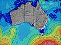 | 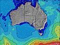 | 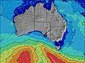 | 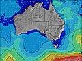 |  |  |  |  | |||||||||||||||
Onda Altezza (m) Direzione Periodo (s) | SW 12 | SW 12 | SW 12 | SW 13 | SW 12 | SW 11 | SW 14 | SW 14 | SW 14 | SW 14 | SW 14 | SW 14 | SW 14 | SW 15 | SW 16 | SSW 16 | SSW 16 | SSW 16 | SSW 16 | SSW 15 | SSW 15 | SSW 14 | SW 14 | SSW 14 |
Grafico delle onde | ||||||||||||||||||||||||
1042 | 794 | 1037 | 1756 | 1544 | 1365 | 2570 | 4168 | 6945 | 6770 | 6415 | 6415 | 7141 | 7946 | 8159 | 8597 | 8941 | 6795 | 6795 | 6440 | 5678 | 4803 | 4222 | 3762 | |
Vento (km/h) | ||||||||||||||||||||||||
Stato del vento onshore cross-onshore cross-shore cross-offshore offshore piatto | cross | cross | cross | cross-on | cross-on | cross | cross-on | cross-on | cross-on | cross-on | cross-on | cross-on | cross-on | cross-on | cross-on | cross-on | cross-on | cross-on | cross-on | cross | cross | cross | cross | cross |
Alta Marea | 4:29AM0.79m | 2:40PM0.76m | 5:50AM0.79m | 1:51PM0.73m | 9:00AM0.83m | |||||||||||||||||||
Basso Marea | 9:33PM0.28m | 9:47AM0.62m | 9:56PM0.27m | 11:02AM0.71m | 10:23PM0.29m | |||||||||||||||||||
— | — | 7:26 | — | — | — | — | — | — | — | 7:24 | — | — | — | — | — | — | — | 7:24 | — | — | — | — | — | |
— | — | — | — | — | 5:29 | — | — | — | — | — | — | — | 5:30 | — | — | — | — | — | — | — | 5:30 | — | — | |
mm | — | — | — | — | — | — | 1 | 1 | — | — | — | 1 | — | — | — | — | — | — | — | — | — | — | — | — |
Temp. °C | 13 | 13 | 13 | 13 | 14 | 13 | 12 | 12 | 11 | 11 | 11 | 11 | 10 | 11 | 12 | 12 | 12 | 12 | 12 | 12 | 12 | 12 | 12 | 12 |
Gelo °C | 9 | 9 | 9 | 7 | 8 | 7 | 8 | 6 | 4 | 5 | 6 | 4 | 3 | 5 | 6 | 7 | 7 | 7 | 7 | 7 | 6 | 6 | 7 | 8 |
Onda 1 Altezza (m) Direzione Periodo (s) | SSW 12 | SW 14 | SW 11 | SW 13 | SSW 12 | SW 15 | SSW 14 | — | SW 14 | SW 14 | SW 14 | SW 14 | SW 14 | SW 15 | SW 15 | SSW 16 | SSW 16 | SSW 16 | SSW 16 | SSW 15 | SSW 15 | SSW 14 | SW 14 | SSW 14 |
647 | 245 | 278 | 878 | 534 | 54 | 672 | — | 6945 | 6770 | 6415 | 6415 | 7141 | 7946 | 8159 | 8597 | 8941 | 6795 | 6795 | 6440 | 5678 | 4720 | 4222 | 3762 | |
Onda 2 Altezza (m) Direzione Periodo (s) | S 14 | SW 15 | SSW 14 | — | — | — | — | — | — | — | — | — | — | — | — | — | — | — | — | — | — | — | — | — |
4 | 57 | 285 | — | — | — | — | — | — | — | — | — | — | — | — | — | — | — | — | — | — | — | — | — | |
Onda 3 Altezza (m) Direzione Periodo (s) | — | S 14 | — | — | — | — | — | — | — | — | — | — | — | — | — | — | — | — | — | — | — | — | — | — |
— | 4 | — | — | — | — | — | — | — | — | — | — | — | — | — | — | — | — | — | — | — | — | — | — | |
onde vento Altezza (m) Direzione Periodo (s) | SW 12 | SW 12 | SW 12 | SW 13 | SW 12 | SW 11 | SW 14 | SW 14 | SW 14 | SW 14 | SW 14 | SW 14 | SW 15 | SW 15 | SW 16 | SW 16 | SW 16 | — | — | — | — | SSW 14 | — | — |
1042 | 794 | 1037 | 1756 | 1544 | 1365 | 2570 | 4168 | 5285 | 5285 | 5156 | 5156 | 5785 | 6353 | 6807 | 6690 | 6776 | — | — | — | — | 4803 | — | — | |
Il più vicino Offshore or Glassy | ||||||||||||||||||||||||
Distanza (km) | 117 | 142 | 117 | 154 | 653 | 653 | 145 | 45 | 115 | 115 | 115 | 653 | 1164 | 688 | 45 | 45 | 45 | 45 | 45 | 45 | 384 | 581 | 668 | 145 |
Migliori previsioni per le condizioni d'onda in Kangaroo Island | ||||||||||||||||||||||||
Migliori previsioni per le condizioni d'onda in Australia | ||||||||||||||||||||||||
Trova Onde Globale | ||||||||||||||||||||||||
- Map Icons:
 Break
Break Live Wave Height (m)
 Live Wind Speed (km/h)
 Surf Rating (10 Max)
 Ocean Swells (m)
- Wind Speed (km/h)
Widget Free Surf-Forecast.com per il tuo sito
La relazione di surf / widget meteo è disponibile qui sotto per incorporare su siti esterni a titolo gratuito e fornisce una sintesi delle nostre Cape Kersaint previsione surf. Basta prendere il frammento di codice html da noi fornito e copiarlo nel proprio sito. È possibile scegliere la lingua preferita e unità metriche / imperiali per il feed delle previsioni surf per soddisfare le esigenze degli utenti del vostro sito .... Clicca qui per ottenere il codice.
 Nearest