
Previsioni:

Previsione a breve terminePioggia abbondante (Totale 59mm), più pesante durante giovedì pomeriggio. Very mild (Max 19°C Venerdì mattina, Min 15°C giovedì mattina). Venti in aumento (venti freschi da S giovedì pomeriggio, bufere nelle prossimità da S per sabato pomeriggio). | ||||||||||||||||||||||||
Giovedì 16 | Venerdì 17 | Sabato 18 | ||||||||||||||||||||||
1 AM | 4 AM | 7 AM | 10 AM | 1 PM | 4 PM | 7 PM | 10 PM | 1 AM | 4 AM | 7 AM | 10 AM | 1 PM | 4 PM | 7 PM | 10 PM | 1 AM | 4 AM | 7 AM | 10 AM | 1 PM | 4 PM | 7 PM | 10 PM | |
Mappa dell'altezza del moto ondoso |  | 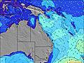 | 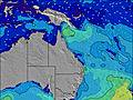 | 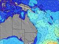 | 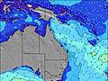 | 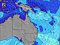 | 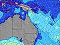 | 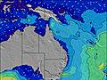 | 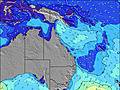 | |||||||||||||||
Onda Altezza (m) Direzione Periodo (s) | SSE 8 | SSE 8 | SSE 8 | SSE 8 | SSE 8 | SSE 8 | SSE 8 | SSE 8 | SSE 8 | SE 8 | SE 7 | SE 7 | SSE 7 | SSE 7 | SSE 7 | SSE 7 | SSE 8 | SSE 8 | SSE 8 | SSE 9 | SE 10 | SE 10 | SE 10 | SE 10 |
Grafico delle onde | ||||||||||||||||||||||||
673 | 913 | 1055 | 998 | 910 | 1363 | 1639 | 1475 | 969 | 675 | 529 | 440 | 361 | 444 | 493 | 615 | 789 | 785 | 864 | 1433 | 2694 | 3294 | 3994 | 4058 | |
Vento (km/h) | ||||||||||||||||||||||||
Stato del vento onshore cross-onshore cross-shore cross-offshore offshore piatto | off | off | cross-off | off | cross-off | cross-off | cross-off | cross-off | cross-off | cross-off | cross-off | cross-off | cross-off | cross-off | cross-off | cross-off | off | off | off | off | off | cross-off | cross-off | cross-off |
Alta Marea | 9:16AM1.23m | 9:44PM2.03m | 10:05AM1.25m | 10:26PM1.91m | 10:54AM1.26m | |||||||||||||||||||
Basso Marea | 3:43AM0.08m | 3:02PM-0.00m | 4:25AM0.08m | 3:49PM0.09m | 5:05AM0.11m | 4:37PM0.21m | ||||||||||||||||||
— | 6:33 | — | — | — | — | — | — | — | 6:33 | — | — | — | — | — | — | — | 6:33 | — | — | — | — | — | — | |
— | — | — | — | — | 5:09 | — | — | — | — | — | — | — | 5:09 | — | — | — | — | — | — | — | 5:10 | — | — | |
mm | 2 | 2 | — | 1 | 4 | 14 | 7 | 3 | 2 | 2 | 1 | 1 | 1 | 1 | 1 | 2 | 2 | 1 | — | 1 | 1 | 3 | 2 | 2 |
Temp. °C | 16 | 17 | 17 | 15 | 16 | 16 | 16 | 18 | 18 | 18 | 18 | 19 | 19 | 19 | 18 | 17 | 17 | 17 | 16 | 17 | 17 | 18 | 18 | 18 |
Gelo °C | 7 | 7 | 6 | 5 | 6 | 9 | 11 | 10 | 10 | 10 | 11 | 12 | 11 | 10 | 9 | 9 | 8 | 8 | 7 | 7 | 8 | 8 | 8 | 8 |
Onda 1 Altezza (m) Direzione Periodo (s) | NE 10 | NE 10 | NE 10 | NE 9 | NE 8 | NE 8 | NE 8 | NE 8 | NE 8 | NE 8 | NE 8 | NE 7 | NE 7 | S 19 | S 19 | — | — | NE 9 | — | NE 9 | E 20 | E 20 | E 19 | E 19 |
4 | 4 | 4 | 3 | 11 | 11 | 11 | 11 | 23 | 21 | 20 | 18 | 12 | 7 | 7 | — | — | 3 | — | 3 | 8 | 7 | 7 | 7 | |
Onda 2 Altezza (m) Direzione Periodo (s) | — | — | — | — | — | — | — | — | — | — | — | — | S 19 | S 19 | — | — | — | — | E 21 | E 21 | — | — | — | — |
— | — | — | — | — | — | — | — | — | — | — | — | 7 | 7 | — | — | — | — | 9 | 9 | — | — | — | — | |
Onda 3 Altezza (m) Direzione Periodo (s) | — | — | — | — | — | — | — | — | — | — | — | — | — | — | — | — | — | — | — | — | — | — | — | — |
— | — | — | — | — | — | — | — | — | — | — | — | — | — | — | — | — | — | — | — | — | — | — | — | |
onde vento Altezza (m) Direzione Periodo (s) | SSE 8 | SSE 8 | SSE 8 | SSE 8 | SSE 8 | SSE 8 | SSE 8 | SSE 8 | SSE 8 | SE 8 | SE 7 | SE 7 | SSE 7 | SSE 7 | SSE 7 | SSE 7 | SSE 8 | SSE 8 | SSE 8 | SSE 9 | SE 10 | SE 10 | SE 10 | SE 10 |
673 | 913 | 1055 | 998 | 910 | 1363 | 1639 | 1475 | 969 | 675 | 529 | 440 | 361 | 444 | 493 | 615 | 789 | 785 | 864 | 1433 | 2694 | 3294 | 3994 | 4058 | |
Il più vicino Offshore or Glassy | ||||||||||||||||||||||||
Distanza (km) | 118 | 122 | 122 | 402 | 579 | 579 | 560 | 127 | 560 | 127 | 80 | 80 | 674 | 739 | 560 | 122 | 122 | 50 | 52 | 762 | 762 | 885 | 851 | 762 |
Migliori previsioni per le condizioni d'onda in Brisbane | ||||||||||||||||||||||||
Migliori previsioni per le condizioni d'onda in Australia | ||||||||||||||||||||||||
Trova Onde Globale | ||||||||||||||||||||||||
- Map Icons:
 Break
Break Live Wave Height (m)
 Live Wind Speed (km/h)
 Surf Rating (10 Max)
 Ocean Swells (m)
- Wind Speed (km/h)
Widget Free Surf-Forecast.com per il tuo sito
La relazione di surf / widget meteo è disponibile qui sotto per incorporare su siti esterni a titolo gratuito e fornisce una sintesi delle nostre Moreton Island - Cape Moreton previsione surf. Basta prendere il frammento di codice html da noi fornito e copiarlo nel proprio sito. È possibile scegliere la lingua preferita e unità metriche / imperiali per il feed delle previsioni surf per soddisfare le esigenze degli utenti del vostro sito .... Clicca qui per ottenere il codice.
 Nearest