
Previsioni:

Previsione a breve termineQualche pioggerella, più pesante durante martedì notte. Warm (Max 26°C Lunedì notte, Min 25°C mercoledì notte). Principalmente venti freschi. | ||||||||||||||||||
Lun 20 | Martedì 21 | Mercoledì 22 | ||||||||||||||||
7 PM | 10 PM | 1 AM | 4 AM | 7 AM | 10 AM | 1 PM | 4 PM | 7 PM | 10 PM | 1 AM | 4 AM | 7 AM | 10 AM | 1 PM | 4 PM | 7 PM | 10 PM | |
Mappa dell'altezza del moto ondoso | 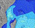 | 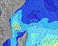 | 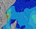 | 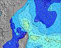 | 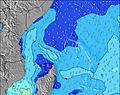 | 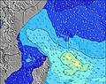 | 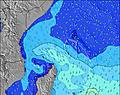 | |||||||||||
Onda Altezza (m) Direzione Periodo (s) | SE 8 | SE 8 | SE 8 | SE 7 | SE 7 | SE 7 | SE 7 | SE 7 | SE 7 | SE 7 | SE 7 | NE 10 | NE 10 | W 14 | W 13 | W 13 | NE 10 | NE 10 |
Grafico delle onde | ||||||||||||||||||
0 | 0 | 0 | 0 | 0 | 0 | 0 | 0 | 0 | 0 | 0 | 4 | 4 | 4 | 4 | 4 | 4 | 4 | |
Vento (km/h) | ||||||||||||||||||
Stato del vento onshore cross-onshore cross-shore cross-offshore offshore piatto | cross-off | cross-off | cross-off | cross-off | cross-off | cross-off | cross-off | cross-off | cross-off | cross-off | cross-off | cross-off | cross-off | cross-off | cross-off | cross-off | cross-off | cross-off |
Alta Marea | 8:46PM1.00m | 9:51AM1.19m | 9:26PM0.84m | 10:45AM1.15m | ||||||||||||||
Basso Marea | 3:05AM0.19m | 4:20PM0.48m | 3:40AM0.27m | 5:43PM0.51m | ||||||||||||||
— | — | — | 6:26 | — | — | — | — | — | — | — | 6:26 | — | — | — | — | — | — | |
— | — | — | — | — | — | — | 6:21 | — | — | — | — | — | — | — | 6:21 | — | — | |
mm | — | — | — | — | — | — | — | — | — | — | — | 1 | — | — | — | — | — | — |
Temp. °C | 26 | 26 | 26 | 26 | 26 | 26 | 26 | 26 | 26 | 26 | 26 | 26 | 26 | 26 | 26 | 26 | 26 | 26 |
Gelo °C | 26 | 26 | 25 | 25 | 25 | 26 | 26 | 26 | 27 | 27 | 26 | 26 | 25 | 25 | 25 | 25 | 26 | 24 |
Onda 1 Altezza (m) Direzione Periodo (s) | S 12 | S 11 | SSW 11 | SSW 11 | SSW 11 | SSW 18 | SSW 18 | SSW 17 | S 16 | SSW 15 | SSW 15 | SSW 14 | SSW 14 | SSW 13 | SSW 13 | SSW 14 | SSW 13 | SSW 13 |
41 | 39 | 23 | 22 | 22 | 61 | 60 | 92 | 129 | 128 | 123 | 163 | 145 | 141 | 141 | 143 | 135 | 135 | |
Onda 2 Altezza (m) Direzione Periodo (s) | SW 7 | SW 7 | SW 7 | S 19 | SSW 19 | SSW 10 | SSW 10 | S 10 | SSE 16 | SSE 16 | ESE 9 | SSE 15 | SSE 14 | SSE 15 | SSE 14 | SSE 14 | SSE 14 | SSE 14 |
2 | 2 | 2 | 28 | 36 | 20 | 20 | 8 | 51 | 49 | 28 | 42 | 41 | 47 | 38 | 66 | 38 | 36 | |
Onda 3 Altezza (m) Direzione Periodo (s) | SE 14 | S 18 | S 18 | SW 7 | SW 7 | S 18 | SSE 18 | S 16 | S 10 | S 10 | SSE 15 | NE 10 | NE 10 | W 14 | W 13 | W 13 | NE 10 | NE 10 |
8 | 6 | 6 | 2 | 2 | 6 | 30 | 21 | 18 | 8 | 44 | 4 | 4 | 4 | 4 | 4 | 4 | 4 | |
onde vento Altezza (m) Direzione Periodo (s) | SE 8 | SE 8 | SE 8 | SE 7 | SE 7 | SE 7 | SE 7 | SE 7 | SE 7 | SE 7 | SE 7 | SE 9 | SE 6 | ESE 6 | ESE 7 | ESE 8 | ESE 8 | ESE 8 |
187 | 227 | 221 | 233 | 246 | 240 | 228 | 216 | 216 | 200 | 174 | 314 | 154 | 229 | 297 | 374 | 403 | 403 | |
Il più vicino Offshore or Glassy | ||||||||||||||||||
Distanza (km) | 1731 | 1731 | 1731 | 1731 | 1731 | 20 | 1731 | 20 | 20 | 20 | 1731 | 1731 | 1731 | 1741 | 1741 | 1741 | 1741 | 1741 |
Migliori previsioni per le condizioni d'onda in Mahe | ||||||||||||||||||
Migliori previsioni per le condizioni d'onda in Seychelles | ||||||||||||||||||
Trova Onde Globale | ||||||||||||||||||
- Map Icons:
 Break
Break Live Wave Height (m)
 Live Wind Speed (km/h)
 Surf Rating (10 Max)
 Ocean Swells (m)
- Wind Speed (km/h)
Widget Free Surf-Forecast.com per il tuo sito
La relazione di surf / widget meteo è disponibile qui sotto per incorporare su siti esterni a titolo gratuito e fornisce una sintesi delle nostre Carana previsione surf. Basta prendere il frammento di codice html da noi fornito e copiarlo nel proprio sito. È possibile scegliere la lingua preferita e unità metriche / imperiali per il feed delle previsioni surf per soddisfare le esigenze degli utenti del vostro sito .... Clicca qui per ottenere il codice.
 Nearest