
Previsioni:

Previsione a breve termineper lo più asciutto. Warm (Max 24°C mercoledì pomeriggio, Min 19°C Venerdì mattina). Principalmente venti freschi. | ||||||||||||||||||||||||
Mercoledì 22 | Giovedì 23 | Venerdì 24 | ||||||||||||||||||||||
2 AM | 5 AM | 8 AM | 11 AM | 2 PM | 5 PM | 8 PM | 11 PM | 2 AM | 5 AM | 8 AM | 11 AM | 2 PM | 5 PM | 8 PM | 11 PM | 2 AM | 5 AM | 8 AM | 11 AM | 2 PM | 5 PM | 8 PM | 11 PM | |
Mappa dell'altezza del moto ondoso |  | 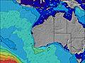 |  |  | 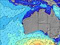 |  |  | 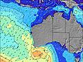 |  | |||||||||||||||
Onda Altezza (m) Direzione Periodo (s) | SW 10 | SW 10 | SW 9 | SW 14 | SW 14 | SW 14 | SW 14 | SW 13 | SW 13 | SW 13 | SW 13 | SW 13 | SW 12 | SW 12 | SW 13 | SW 12 | SW 14 | SW 14 | SW 14 | SW 14 | SW 14 | SW 13 | SW 13 | SW 13 |
Grafico delle onde | ||||||||||||||||||||||||
68 | 120 | 83 | 102 | 100 | 97 | 179 | 171 | 208 | 168 | 202 | 161 | 151 | 124 | 171 | 93 | 164 | 164 | 160 | 151 | 114 | 111 | 109 | 109 | |
Vento (km/h) | ||||||||||||||||||||||||
Stato del vento onshore cross-onshore cross-shore cross-offshore offshore piatto | off | off | off | cross-off | cross | cross-on | cross | cross-off | off | cross-off | cross-off | cross-off | cross-off | glassy | cross | off | cross-off | cross-off | cross-off | cross-off | cross-off | glassy | glassy | cross-off |
Alta Marea | 3:59AM1.75m | 4:09PM1.32m | 4:33AM1.70m | 4:53PM1.16m | 5:14AM1.65m | 6:08PM1.03m | ||||||||||||||||||
Basso Marea | 10:33AM0.69m | 9:46PM0.71m | 11:32AM0.76m | 10:05PM0.82m | 12:56PM0.78m | 10:25PM0.92m | ||||||||||||||||||
— | 7:00 | — | — | — | — | — | — | — | 7:00 | — | — | — | — | — | — | — | 6:58 | — | — | — | — | — | — | |
— | — | — | — | — | 5:59 | — | — | — | — | — | — | — | 6:00 | — | — | — | — | — | — | — | 6:00 | — | — | |
mm | — | — | — | — | — | — | — | — | — | — | — | — | — | — | — | — | — | — | — | — | — | — | — | — |
Temp. °C | 21 | 21 | 20 | 23 | 24 | 24 | 24 | 24 | 23 | 21 | 20 | 22 | 24 | 24 | 23 | 22 | 22 | 20 | 19 | 20 | 22 | 23 | 23 | 23 |
Gelo °C | 13 | 14 | 14 | 18 | 20 | 22 | 21 | 20 | 15 | 13 | 13 | 15 | 19 | 22 | 21 | 14 | 15 | 12 | 11 | 14 | 18 | 22 | 21 | 19 |
Onda 1 Altezza (m) Direzione Periodo (s) | SW 6 | SW 10 | SW 9 | SW 9 | SW 9 | NE 5 | NE 6 | SW 13 | SW 13 | SW 13 | SW 13 | SW 13 | NE 6 | NE 7 | NE 7 | NE 8 | SW 14 | SW 14 | SW 14 | SW 14 | SW 14 | NE 8 | NE 8 | NE 8 |
33 | 120 | 83 | 67 | 67 | 28 | 40 | 171 | 208 | 168 | 202 | 161 | 64 | 86 | 67 | 73 | 164 | 164 | 160 | 151 | 114 | 169 | 187 | 156 | |
Onda 2 Altezza (m) Direzione Periodo (s) | SW 10 | SW 14 | SW 14 | SW 14 | SW 14 | SW 14 | SW 14 | NE 6 | WSW 13 | WSW 16 | SW 16 | SW 16 | SW 12 | SW 12 | SW 13 | SW 12 | SW 12 | NE 8 | WSW 18 | WSW 18 | W 18 | SW 13 | SW 13 | SW 13 |
68 | 50 | 72 | 102 | 100 | 97 | 179 | 37 | 34 | 26 | 41 | 41 | 151 | 124 | 171 | 93 | 6 | 17 | 31 | 31 | 24 | 111 | 109 | 109 | |
Onda 3 Altezza (m) Direzione Periodo (s) | SW 14 | NNE 7 | NE 7 | NE 7 | SW 18 | SW 9 | SW 18 | W 18 | — | — | — | — | SSW 16 | SW 16 | W 20 | SW 15 | W 19 | WSW 18 | — | — | W 18 | WSW 16 | WSW 16 | WSW 16 |
66 | 5 | 2 | 2 | 12 | 42 | 12 | 6 | — | — | — | — | 26 | 39 | 7 | 76 | 7 | 31 | — | — | 6 | 52 | 51 | 51 | |
onde vento Altezza (m) Direzione Periodo (s) | SSE 5 | SE 5 | SE 4 | ESE 4 | ENE 4 | — | — | SW 2 | NE 6 | E 4 | E 4 | ENE 5 | SE 4 | SE 3 | SE 3 | ESE 3 | E 4 | E 5 | ENE 5 | ENE 6 | NE 7 | — | — | — |
52 | 47 | 34 | 17 | 22 | — | — | 1 | 37 | 32 | 36 | 58 | 2 | 4 | 5 | 3 | 33 | 50 | 91 | 145 | 167 | — | — | — | |
Il più vicino Offshore or Glassy | ||||||||||||||||||||||||
Distanza (km) | 660 | 660 | 660 | 753 | 753 | 753 | 258 | 0 | 772 | 753 | 772 | 1020 | 1020 | 1071 | 0 | 0 | 15 | 753 | 766 | 766 | 835 | 1023 | 251 | 0 |
Migliori previsioni per le condizioni d'onda in North West WA | ||||||||||||||||||||||||
Migliori previsioni per le condizioni d'onda in Australia | ||||||||||||||||||||||||
Trova Onde Globale | ||||||||||||||||||||||||
- Map Icons:
 Break
Break Live Wave Height (m)
 Live Wind Speed (km/h)
 Surf Rating (10 Max)
 Ocean Swells (m)
- Wind Speed (km/h)
Widget Free Surf-Forecast.com per il tuo sito
La relazione di surf / widget meteo è disponibile qui sotto per incorporare su siti esterni a titolo gratuito e fornisce una sintesi delle nostre Dunes previsione surf. Basta prendere il frammento di codice html da noi fornito e copiarlo nel proprio sito. È possibile scegliere la lingua preferita e unità metriche / imperiali per il feed delle previsioni surf per soddisfare le esigenze degli utenti del vostro sito .... Clicca qui per ottenere il codice.
 Nearest