
Previsioni:

Previsione a breve terminepioggia leggera (Totale 6mm), per lo più che cade mercoledì pomeriggio. Very mild (Max 14°C martedì pomeriggio, Min 7°C mercoledì notte). Vento sarà generalmente leggero. | ||||||||||||||||||||||
Martedì 21 | Mercoledì 22 | Giovedì 23 | ||||||||||||||||||||
7 AM | 10 AM | 1 PM | 4 PM | 7 PM | 10 PM | 1 AM | 4 AM | 7 AM | 10 AM | 1 PM | 4 PM | 7 PM | 10 PM | 1 AM | 4 AM | 7 AM | 10 AM | 1 PM | 4 PM | 7 PM | 10 PM | |
Mappa dell'altezza del moto ondoso |  |  |  | 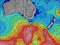 |  |  | 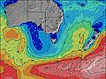 |  | ||||||||||||||
Onda Altezza (m) Direzione Periodo (s) | WSW 14 | SW 13 | WSW 13 | SW 13 | WSW 13 | WSW 12 | SW 13 | SW 13 | SW 12 | SW 12 | SW 12 | SW 13 | SW 12 | SW 11 | SW 13 | SW 16 | SW 14 | SW 14 | SW 14 | SW 14 | SW 14 | SW 13 |
Grafico delle onde | ||||||||||||||||||||||
1095 | 1144 | 946 | 841 | 476 | 406 | 527 | 527 | 335 | 522 | 540 | 864 | 1392 | 1467 | 2515 | 7635 | 7342 | 5530 | 5796 | 5823 | 5487 | 4311 | |
Vento (km/h) | ||||||||||||||||||||||
Stato del vento onshore cross-onshore cross-shore cross-offshore offshore piatto | cross-off | cross-off | cross-off | cross-off | cross-off | cross-off | cross-off | cross-off | cross-off | cross-off | cross-off | cross | cross-off | cross | cross | cross-off | cross | cross | cross | cross | cross | cross |
Alta Marea | 4:20AM1.76m | 4:19PM1.88m | 5:07AM1.72m | 4:51PM1.79m | 5:54AM1.66m | 5:22PM1.68m | ||||||||||||||||
Basso Marea | 10:13AM0.48m | 10:47PM0.22m | 10:55AM0.63m | 11:25PM0.25m | 11:35AM0.76m | |||||||||||||||||
7:33 | — | — | — | — | — | — | — | 7:33 | — | — | — | — | — | — | — | 7:33 | — | — | — | — | — | |
— | — | — | 5:24 | — | — | — | — | — | — | — | 5:25 | — | — | — | — | — | — | — | 5:25 | — | — | |
mm | — | — | — | — | — | — | — | — | — | — | — | 2 | — | 2 | 1 | — | — | 1 | — | — | — | — |
Temp. °C | 10 | 10 | 13 | 14 | 12 | 11 | 10 | 11 | 11 | 11 | 13 | 12 | 9 | 9 | 9 | 7 | 7 | 8 | 10 | 10 | 9 | 10 |
Gelo °C | 7 | 6 | 9 | 11 | 9 | 7 | 6 | 7 | 7 | 7 | 8 | 8 | 6 | 6 | 4 | 3 | 3 | 2 | 3 | 3 | 3 | 4 |
Onda 1 Altezza (m) Direzione Periodo (s) | WSW 14 | SW 13 | WSW 13 | SW 13 | WSW 13 | WSW 12 | SW 13 | SW 13 | SW 12 | SW 12 | SW 12 | E 10 | SW 12 | SW 11 | SW 13 | SW 13 | SW 14 | SW 14 | SW 14 | SW 14 | — | SW 16 |
1095 | 1144 | 946 | 841 | 476 | 406 | 527 | 527 | 335 | 522 | 540 | 2 | 1094 | 1204 | 2340 | 2429 | 4362 | 4619 | 4873 | 4608 | — | 2042 | |
Onda 2 Altezza (m) Direzione Periodo (s) | — | — | E 11 | E 11 | SW 14 | SW 14 | WSW 12 | WSW 12 | WSW 12 | E 10 | E 10 | E 10 | — | — | SW 18 | SW 16 | — | — | — | — | — | — |
— | — | 2 | 2 | 257 | 308 | 119 | 83 | 256 | 2 | 2 | 2 | — | — | 164 | 1271 | — | — | — | — | — | — | |
Onda 3 Altezza (m) Direzione Periodo (s) | — | — | — | — | E 11 | E 11 | E 11 | E 10 | E 10 | E 10 | — | — | — | — | SE 12 | — | — | — | — | — | — | — |
— | — | — | — | 2 | 2 | 2 | 2 | 2 | 2 | — | — | — | — | 6 | — | — | — | — | — | — | — | |
onde vento Altezza (m) Direzione Periodo (s) | — | — | — | — | — | NNW 3 | NW 3 | NW 3 | WNW 3 | NW 3 | WNW 3 | SW 13 | SW 12 | SW 11 | SW 13 | SW 16 | SW 14 | SW 14 | SW 14 | SW 14 | SW 14 | SW 13 |
— | — | — | — | — | 3 | 2 | 2 | 3 | 2 | 9 | 864 | 1392 | 1467 | 2515 | 7635 | 7342 | 5530 | 5796 | 5823 | 5487 | 4311 | |
Il più vicino Offshore or Glassy | ||||||||||||||||||||||
Distanza (km) | 0 | 0 | 0 | 0 | 0 | 0 | 10 | 10 | 10 | 10 | 13 | 9 | 0 | 9 | 9 | 10 | 26 | 9 | 538 | 574 | 26 | 26 |
Migliori previsioni per le condizioni d'onda in Torquay | ||||||||||||||||||||||
Migliori previsioni per le condizioni d'onda in Australia | ||||||||||||||||||||||
Trova Onde Globale | ||||||||||||||||||||||
- Map Icons:
 Break
Break Live Wave Height (m)
 Live Wind Speed (km/h)
 Surf Rating (10 Max)
 Ocean Swells (m)
- Wind Speed (km/h)
Widget Free Surf-Forecast.com per il tuo sito
La relazione di surf / widget meteo è disponibile qui sotto per incorporare su siti esterni a titolo gratuito e fornisce una sintesi delle nostre Fairhaven previsione surf. Basta prendere il frammento di codice html da noi fornito e copiarlo nel proprio sito. È possibile scegliere la lingua preferita e unità metriche / imperiali per il feed delle previsioni surf per soddisfare le esigenze degli utenti del vostro sito .... Clicca qui per ottenere il codice.
 Nearest