
Previsioni:

Previsione a breve terminePioggia abbondante (Totale 23mm), più pesante durante giovedì mattina. Very mild (Max 17°C giovedì pomeriggio, Min 12°C mercoledì notte). Venti decrescenti (venti freschi da SSW mercoledì pomeriggio, venti deboli da SE per giovedì notte). | ||||||||||||||||||||||||
Mer 15 | Giovedì 16 | Venerdì 17 | 18 | |||||||||||||||||||||
1 PM | 4 PM | 7 PM | 10 PM | 1 AM | 4 AM | 7 AM | 10 AM | 1 PM | 4 PM | 7 PM | 10 PM | 1 AM | 4 AM | 7 AM | 10 AM | 1 PM | 4 PM | 7 PM | 10 PM | 1 AM | 4 AM | 7 AM | 10 AM | |
Mappa dell'altezza del moto ondoso |  |  |  |  |  |  |  |  |  | 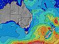 | ||||||||||||||
Onda Altezza (m) Direzione Periodo (s) | S 9 | S 10 | S 9 | S 8 | S 8 | S 8 | S 8 | S 8 | S 8 | S 8 | S 8 | S 8 | S 8 | S 7 | ESE 6 | ESE 6 | ESE 7 | ESE 7 | E 7 | ESE 7 | SE 7 | ESE 7 | ESE 7 | ESE 7 |
Grafico delle onde | ||||||||||||||||||||||||
1029 | 1212 | 901 | 601 | 475 | 504 | 459 | 518 | 507 | 323 | 240 | 167 | 133 | 107 | 107 | 104 | 111 | 114 | 113 | 147 | 211 | 128 | 186 | 210 | |
Vento (km/h) | ||||||||||||||||||||||||
Stato del vento onshore cross-onshore cross-shore cross-offshore offshore piatto | off | cross-off | cross-off | cross-off | cross-off | off | off | cross-off | cross | cross | cross | cross-on | cross-on | cross | cross | cross-off | cross-off | cross | cross | cross-off | cross-off | cross-off | cross | cross |
Alta Marea | 9:04PM1.94m | 9:52AM1.37m | 9:52PM1.87m | 10:39AM1.38m | 10:39PM1.76m | |||||||||||||||||||
Basso Marea | 2:35PM0.36m | 3:50AM0.09m | 3:28PM0.36m | 4:35AM0.12m | 4:20PM0.40m | 5:17AM0.18m | ||||||||||||||||||
— | — | — | — | — | 6:52 | — | — | — | — | — | — | — | 6:52 | — | — | — | — | — | — | — | 6:52 | — | — | |
— | 5:02 | — | — | — | — | — | — | — | 5:04 | — | — | — | — | — | — | — | 5:05 | — | — | — | — | — | 5:05 | |
mm | 1 | — | — | 1 | 1 | — | 1 | 4 | 5 | 2 | 1 | 1 | 1 | 1 | 1 | 1 | — | — | 1 | — | — | — | — | 1 |
Temp. °C | 15 | 15 | 15 | 16 | 16 | 15 | 12 | 14 | 16 | 17 | 17 | 16 | 16 | 16 | 16 | 16 | 17 | 17 | 16 | 17 | 17 | 16 | 16 | 16 |
Gelo °C | 8 | 8 | 9 | 10 | 9 | 9 | 6 | 9 | 13 | 14 | 14 | 14 | 14 | 14 | 14 | 14 | 15 | 14 | 13 | 14 | 13 | 12 | 12 | 12 |
Onda 1 Altezza (m) Direzione Periodo (s) | — | — | — | — | — | S 15 | S 15 | S 15 | S 8 | S 8 | S 8 | S 8 | S 8 | S 7 | S 7 | S 7 | S 6 | S 6 | E 7 | E 7 | E 7 | S 9 | S 10 | S 10 |
— | — | — | — | — | 5 | 5 | 5 | 507 | 323 | 240 | 167 | 133 | 107 | 80 | 73 | 53 | 28 | 113 | 97 | 100 | 58 | 46 | 47 | |
Onda 2 Altezza (m) Direzione Periodo (s) | — | — | — | — | — | — | — | — | ESE 6 | S 18 | E 8 | E 8 | E 8 | E 8 | SSE 18 | SSE 17 | S 16 | S 8 | S 6 | S 6 | S 8 | SSE 21 | SSE 21 | SSE 21 |
— | — | — | — | — | — | — | — | 39 | 25 | 5 | 12 | 12 | 21 | 31 | 30 | 19 | 22 | 25 | 17 | 57 | 44 | 44 | 43 | |
Onda 3 Altezza (m) Direzione Periodo (s) | — | — | — | — | — | — | — | — | S 18 | S 13 | SSE 18 | SSE 18 | SSE 18 | SSE 18 | S 18 | S 16 | S 16 | S 15 | S 8 | S 8 | S 20 | — | — | — |
— | — | — | — | — | — | — | — | 6 | 3 | 31 | 31 | 32 | 32 | 56 | 46 | 20 | 18 | 20 | 20 | 8 | — | — | — | |
onde vento Altezza (m) Direzione Periodo (s) | S 9 | S 10 | S 9 | S 8 | S 8 | S 8 | S 8 | S 8 | ESE 6 | ESE 6 | ESE 6 | ESE 6 | ESE 6 | ESE 6 | ESE 6 | ESE 6 | ESE 7 | ESE 7 | — | ESE 7 | SE 7 | ESE 7 | ESE 7 | ESE 7 |
1029 | 1212 | 901 | 601 | 475 | 504 | 459 | 518 | 80 | 73 | 73 | 73 | 71 | 73 | 107 | 104 | 111 | 114 | — | 147 | 211 | 128 | 186 | 210 | |
Il più vicino Offshore or Glassy | ||||||||||||||||||||||||
Distanza (km) | 135 | 87 | 34 | 34 | 34 | 34 | 34 | 135 | 10 | 1 | 1 | 34 | 34 | 1 | 1 | 0 | 0 | 80 | 10 | 10 | 10 | 33 | 130 | 87 |
Migliori previsioni per le condizioni d'onda in Newcastle | ||||||||||||||||||||||||
Migliori previsioni per le condizioni d'onda in Australia | ||||||||||||||||||||||||
Trova Onde Globale | ||||||||||||||||||||||||
- Map Icons:
 Break
Break Live Wave Height (m)
 Live Wind Speed (km/h)
 Surf Rating (10 Max)
 Ocean Swells (m)
- Wind Speed (km/h)
Widget Free Surf-Forecast.com per il tuo sito
La relazione di surf / widget meteo è disponibile qui sotto per incorporare su siti esterni a titolo gratuito e fornisce una sintesi delle nostre Leggy Point previsione surf. Basta prendere il frammento di codice html da noi fornito e copiarlo nel proprio sito. È possibile scegliere la lingua preferita e unità metriche / imperiali per il feed delle previsioni surf per soddisfare le esigenze degli utenti del vostro sito .... Clicca qui per ottenere il codice.
 Nearest