
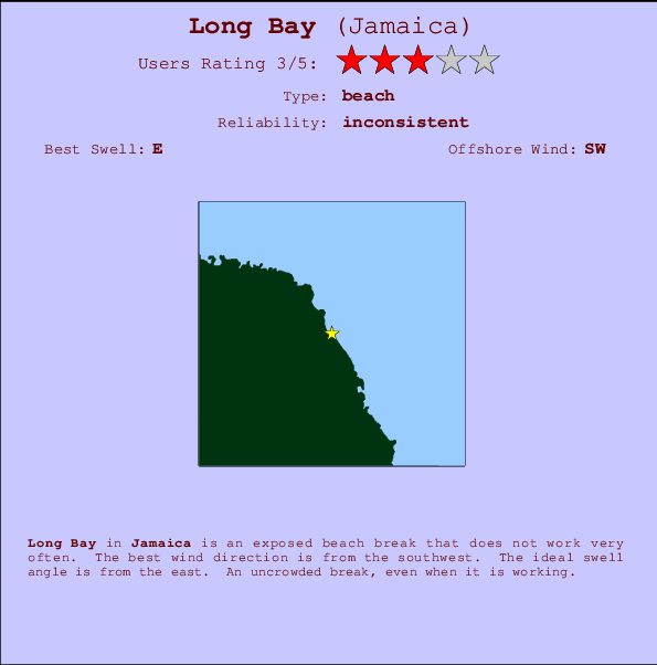
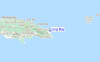
Long Bay Surf Guide
Long Bay in Jamaica is an exposed beach break that has inconsistent surf. The best wind direction is from the southwest. The optimum well angle is from the east. Crowds are never a problem here.
Long Bay Spot Info
| Type: | Rating: | Reliability: | Todays Sea Temp*: |
|---|---|---|---|
| inconsistent | 29.0°C*ocean temperature recorded from satellite |
Surfing Long Bay:
The best conditions reported for surf at Long Bay occur when a East swell combines with an offshore wind direction from the Southwest.
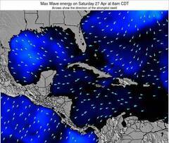
Previsioni Energia d'onda (Potenza): 12hrs

Long Bay Surf:
Wednesday, 15 July 2026, 16:54 Local time| Mercoledì 15 | Gio | |||
| 4PM | 7PM | 10PM | 1AM | |
| Wave (m) | ||||
| Periodo (s) | 9 | 9 | 9 | 9 |
| Vento (km/h) | ||||
| Stato del vento | cross- on |
cross- on |
cross- on |
cross- on |
- /breaks/Long-Bay-2/forecasts/latest
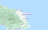
Long Bay Surf Guide
Long Bay in Jamaica is an exposed beach break that has inconsistent surf. The best wind direction is from the southwest. The optimum well angle is from the east. Crowds are never a problem here.
Long Bay Spot Info
Type: Rating: Reliability: Todays Sea Temp*:  Beach
Beach 3
3inconsistent 29.0°C*ocean temperature recorded from satelliteSurfing Long Bay:
The best conditions reported for surf at Long Bay occur when a East swell combines with an offshore wind direction from the Southwest.
Previsioni Energia d'onda (Potenza): 12hrs
Utilizzare la scheda di navigazione in alto per visualizzare Long Bay temperatura del mare, Long Bay fotografie, Long Bay dettagliate previsioni onde, il vento e le previsioni meteo, Long Bay webcam, vento corrente da Jamaica stazioni meteo e Long Bay previsioni marea. Il link Jamaica mappe maree apre l'immagine grande, che mostra Jamaica e dei mari circostanti. Queste mappe possono essere animate per mostrare le diverse componenti del moto ondoso, energia delle onde, periodo d'onda, altezza delle onde, insieme con le previsioni del vento e meteo, meteo corrente e osservazioni sullo stato del mare dal Jamaica onda-boe, le navi passanti e stazioni meteo costiere. Ciascuna delle pagine di previsioni per questo surf break rappresenta uno strumento di wavefinder globale e regionale per individuare le migliori condizioni di surf nella zona intorno Long Bay.
Long Bay Surf:
Wednesday, 15 July 2026, 16:54 Local timeMercoledì 15 Gio 4PM 7PM 10PM 1AM Wave (m) Periodo (s) 9 9 9 9 Vento (km/h) Stato del vento cross-
oncross-
oncross-
oncross-
on- /breaks/Long-Bay-2/forecasts/latest
- /breaks/Long-Bay-2/forecasts/latest/six_day
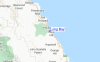
Long Bay Surf Guide
Long Bay in Jamaica is an exposed beach break that has inconsistent surf. The best wind direction is from the southwest. The optimum well angle is from the east. Crowds are never a problem here.
Long Bay Spot Info
Type: Rating: Reliability: Todays Sea Temp*: Beach3inconsistent 29.0°C*ocean temperature recorded from satelliteSurfing Long Bay:
The best conditions reported for surf at Long Bay occur when a East swell combines with an offshore wind direction from the Southwest.
Previsioni Energia d'onda (Potenza): 12hrs
Utilizzare la scheda di navigazione in alto per visualizzare Long Bay temperatura del mare, Long Bay fotografie, Long Bay dettagliate previsioni onde, il vento e le previsioni meteo, Long Bay webcam, vento corrente da Jamaica stazioni meteo e Long Bay previsioni marea. Il link Jamaica mappe maree apre l'immagine grande, che mostra Jamaica e dei mari circostanti. Queste mappe possono essere animate per mostrare le diverse componenti del moto ondoso, energia delle onde, periodo d'onda, altezza delle onde, insieme con le previsioni del vento e meteo, meteo corrente e osservazioni sullo stato del mare dal Jamaica onda-boe, le navi passanti e stazioni meteo costiere. Ciascuna delle pagine di previsioni per questo surf break rappresenta uno strumento di wavefinder globale e regionale per individuare le migliori condizioni di surf nella zona intorno Long Bay.
Long Bay Surf:
Wednesday, 15 July 2026, 16:54 Local timeMercoledì 15 Gio 4PM 7PM 10PM 1AM Wave (m) Periodo (s) 9 9 9 9 Vento (km/h) Stato del vento cross-
oncross-
oncross-
oncross-
on- /breaks/Long-Bay-2/forecasts/latest
Long Bay Surf Guide
Long Bay in Jamaica is an exposed beach break that has inconsistent surf. The best wind direction is from the southwest. The optimum well angle is from the east. Crowds are never a problem here.
Long Bay Spot Info
Type: Rating: Reliability: Todays Sea Temp*: Beach3inconsistent 29.0°C*ocean temperature recorded from satelliteSurfing Long Bay:
The best conditions reported for surf at Long Bay occur when a East swell combines with an offshore wind direction from the Southwest.
Previsioni Energia d'onda (Potenza): 12hrs
Utilizzare la scheda di navigazione in alto per visualizzare Long Bay temperatura del mare, Long Bay fotografie, Long Bay dettagliate previsioni onde, il vento e le previsioni meteo, Long Bay webcam, vento corrente da Jamaica stazioni meteo e Long Bay previsioni marea. Il link Jamaica mappe maree apre l'immagine grande, che mostra Jamaica e dei mari circostanti. Queste mappe possono essere animate per mostrare le diverse componenti del moto ondoso, energia delle onde, periodo d'onda, altezza delle onde, insieme con le previsioni del vento e meteo, meteo corrente e osservazioni sullo stato del mare dal Jamaica onda-boe, le navi passanti e stazioni meteo costiere. Ciascuna delle pagine di previsioni per questo surf break rappresenta uno strumento di wavefinder globale e regionale per individuare le migliori condizioni di surf nella zona intorno Long Bay.
Long Bay Surf:
Wednesday, 15 July 2026, 16:54 Local timeMercoledì 15 Gio 4PM 7PM 10PM 1AM Wave (m) Periodo (s) 9 9 9 9 Vento (km/h) Stato del vento cross-
oncross-
oncross-
oncross-
onTide Times:
Per Port Antonio, %{dist} %{km} da %{location}.
PROSSIMA È ALLE (ora locale) rimanente alta marea bassa marea Long Bay Tide Times and Tide Chart
Live Weather:
At SHIP7896, 47 km from Long Bay.
- Air temperature
-°COverall Long Bay Surf Consistency and Wind Distribution in Luglio
foto dall' album
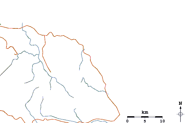
Contorni: Strade e fiumi: seleziona un surf break dal menu 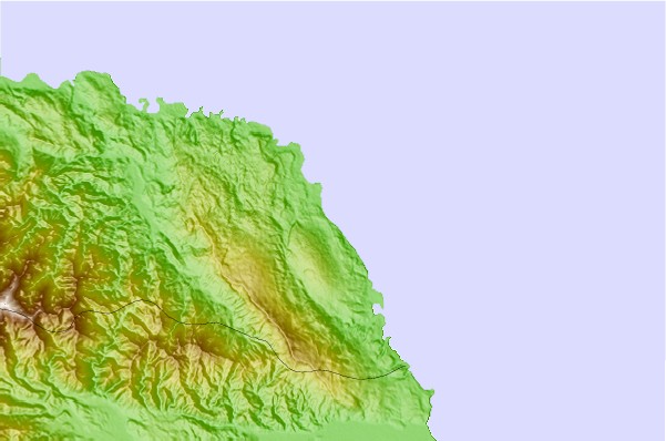
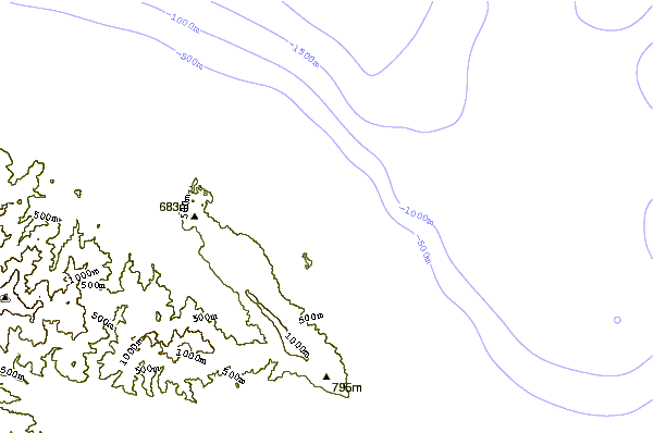
Utilizzare questa mappa sollievo per navigare Jamaica surf breaks e stazioni di marea che si trovano nella zona diLong Bay
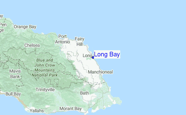
Altri surf breaks più vicini al Long Bay:
(clicca sul nome del luogo per maggiori informazioni)- Closest località surf3 mi
- Second closest località surf6 mi
- Third closest località surf11 mi
- Fourth closest località surf16 mi
- Fifth closest località surf24 mi
Onda boe più vicina a Long Bay:
- Closest Onda boa353 mi
- Second closest Onda boa531 mi
- Third closest Onda boa585 mi
- Fourth closest Onda boa594 mi
- Fifth closest Onda boa644 mi
Stazioni di marea più vicina alla Long Bay:
- Closest marea stazionePort Antonio6 mi
- Second closest marea stazionePort Morant15 mi
- Third closest marea stazioneMorant Bay17 mi
- Fourth closest marea stazioneYallahs23 mi
- Fifth closest marea stazioneNew Kingston32 mi
Airports
- The closest passenger airport to Long Bay is Ken Jones (Port Antonio) Airport (POT) in Jamaica, 26 km (16 miles) away (directly).
- The second nearest airport to Long Bay is Norman Manley International (Kingston) Airport (KIN), also in Jamaica, 54 km (34 miles) away.
- Third is Tinson Pen (Kingston) Airport (KTP) in Jamaica, 56 km (35 miles) away.
- Boscobel (Ocho Rios) Airport (OCJ) in Jamaica is 77 km (48 miles) away.
- Sangster International (Montego Bay) Airport (MBJ), also in Jamaica is the fifth nearest airport to Long Bay and is 175 km (109 miles) away.
- /breaks/Long-Bay-2/forecasts/latest


 Nearest