
Previsioni:

Previsione a breve termineper lo più asciutto. Warm (Max 29°C mercoledì mattina, Min 26°C mercoledì notte). Vento sarà generalmente leggero. | ||||||||||||||||||||||||
Mer 15 | Giovedì 16 | Venerdì 17 | 18 | |||||||||||||||||||||
10 AM | 1 PM | 4 PM | 7 PM | 10 PM | 1 AM | 4 AM | 7 AM | 10 AM | 1 PM | 4 PM | 7 PM | 10 PM | 1 AM | 4 AM | 7 AM | 10 AM | 1 PM | 4 PM | 7 PM | 10 PM | 1 AM | 4 AM | 7 AM | |
Mappa dell'altezza del moto ondoso |  | 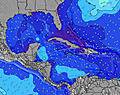 | 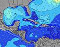 | 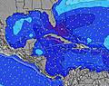 | 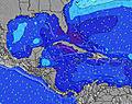 |  |  |  |  | |||||||||||||||
Onda Altezza (m) Direzione Periodo (s) | ESE 8 | ESE 8 | SE 9 | SE 9 | SE 9 | SE 9 | SE 9 | SE 9 | SE 8 | SE 8 | ESE 8 | ESE 8 | SE 9 | SE 9 | SE 8 | ESE 8 | ESE 9 | ESE 9 | ESE 9 | ESE 9 | ESE 9 | ESE 9 | ESE 9 | SE 9 |
Grafico delle onde | ||||||||||||||||||||||||
351 | 360 | 371 | 388 | 397 | 330 | 503 | 514 | 449 | 288 | 322 | 322 | 580 | 493 | 295 | 330 | 338 | 411 | 465 | 475 | 440 | 766 | 691 | 573 | |
Vento (km/h) | ||||||||||||||||||||||||
Stato del vento onshore cross-onshore cross-shore cross-offshore offshore piatto | cross-on | cross-on | cross-on | cross-on | cross-on | cross-on | cross-on | cross-on | cross-on | cross-on | cross-on | cross-on | cross-on | cross-on | cross-on | cross-on | cross-on | cross | cross-on | cross-on | cross | cross-on | cross-on | cross-on |
Alta Marea | 9:42AM0.22m | 10:30PM0.39m | 10:40AM0.23m | 11:12PM0.37m | 11:42AM0.25m | 11:51PM0.33m | ||||||||||||||||||
Basso Marea | 3:29PM0.02m | 5:17AM0.08m | 4:22PM0.06m | 5:59AM0.08m | 5:19PM0.11m | 6:41AM0.09m | ||||||||||||||||||
5:37 | — | — | — | — | — | 5:37 | — | — | — | — | — | — | — | 5:37 | — | — | — | — | — | — | — | 5:37 | — | |
— | — | 6:44 | — | — | — | — | — | — | — | 6:44 | — | — | — | — | — | — | — | 6:44 | — | — | — | — | 6:44 | |
mm | — | — | — | — | — | — | — | — | — | — | — | — | — | — | — | — | — | — | — | — | — | — | — | — |
Temp. °C | 28 | 29 | 29 | 27 | 26 | 27 | 26 | 27 | 28 | 29 | 28 | 27 | 27 | 27 | 27 | 27 | 28 | 28 | 28 | 27 | 27 | 27 | 26 | 27 |
Gelo °C | 29 | 32 | 32 | 31 | 29 | 30 | 28 | 29 | 30 | 30 | 29 | 30 | 30 | 29 | 29 | 28 | 29 | 28 | 29 | 29 | 29 | 29 | 28 | 28 |
Onda 1 Altezza (m) Direzione Periodo (s) | NE 7 | ESE 8 | SE 9 | SE 9 | SE 9 | SE 9 | SE 9 | ESE 9 | ESE 8 | NE 6 | NE 6 | ESE 8 | SE 8 | SE 8 | NE 6 | NE 6 | NE 7 | NE 6 | ESE 9 | ESE 9 | ESE 9 | ESE 9 | ESE 9 | ESE 9 |
75 | 360 | 371 | 388 | 397 | 330 | 323 | 286 | 241 | 56 | 43 | 322 | 288 | 288 | 29 | 47 | 73 | 70 | 465 | 475 | 440 | 430 | 362 | 362 | |
Onda 2 Altezza (m) Direzione Periodo (s) | — | NE 6 | NE 6 | NE 6 | NE 6 | NE 5 | NE 6 | NE 7 | NE 7 | — | — | NE 6 | NE 6 | NE 6 | — | — | — | — | NE 6 | NE 6 | NE 6 | NE 7 | NE 6 | NE 6 |
— | 47 | 30 | 21 | 19 | 18 | 36 | 73 | 73 | — | — | 32 | 24 | 21 | — | — | — | — | 46 | 42 | 30 | 22 | 21 | 20 | |
Onda 3 Altezza (m) Direzione Periodo (s) | — | — | — | — | — | — | — | — | — | — | — | — | — | — | — | — | — | — | — | — | — | — | — | — |
— | — | — | — | — | — | — | — | — | — | — | — | — | — | — | — | — | — | — | — | — | — | — | — | |
onde vento Altezza (m) Direzione Periodo (s) | ESE 8 | — | — | — | — | — | SE 9 | SE 9 | SE 8 | SE 8 | ESE 8 | — | SE 9 | SE 9 | SE 8 | ESE 8 | ESE 9 | ESE 9 | — | — | — | ESE 9 | ESE 9 | SE 9 |
351 | — | — | — | — | — | 503 | 514 | 449 | 288 | 322 | — | 580 | 493 | 295 | 330 | 338 | 411 | — | — | — | 766 | 691 | 573 | |
Il più vicino Offshore or Glassy | ||||||||||||||||||||||||
Distanza (km) | 843 | 810 | 820 | 399 | 115 | 399 | 399 | 399 | 808 | 808 | 938 | 1068 | 38 | 663 | 399 | 399 | 968 | 1068 | 1068 | 955 | 38 | 38 | 38 | 38 |
Migliori previsioni per le condizioni d'onda in Jamaica | ||||||||||||||||||||||||
Migliori previsioni per le condizioni d'onda in Jamaica | ||||||||||||||||||||||||
Trova Onde Globale | ||||||||||||||||||||||||
- Map Icons:
 Break
Break Live Wave Height (m)
 Live Wind Speed (km/h)
 Surf Rating (10 Max)
 Ocean Swells (m)
- Wind Speed (km/h)
Widget Free Surf-Forecast.com per il tuo sito
La relazione di surf / widget meteo è disponibile qui sotto per incorporare su siti esterni a titolo gratuito e fornisce una sintesi delle nostre Long Bay previsione surf. Basta prendere il frammento di codice html da noi fornito e copiarlo nel proprio sito. È possibile scegliere la lingua preferita e unità metriche / imperiali per il feed delle previsioni surf per soddisfare le esigenze degli utenti del vostro sito .... Clicca qui per ottenere il codice.
 Nearest