
Previsioni:

Previsione a breve terminePioggia abbondante (Totale 23mm), più pesante durante giovedì pomeriggio. Very mild (Max 18°C mercoledì notte, Min 12°C Sabato mattina). Venti in aumento (calma giovedì notte, raffiche di vento da O per sabato mattina). | ||||||||||||||||||||||||
Mer 15 | Giovedì 16 | Venerdì 17 | 18 | |||||||||||||||||||||
5 PM | 8 PM | 11 PM | 2 AM | 5 AM | 8 AM | 11 AM | 2 PM | 5 PM | 8 PM | 11 PM | 2 AM | 5 AM | 8 AM | 11 AM | 2 PM | 5 PM | 8 PM | 11 PM | 2 AM | 5 AM | 8 AM | 11 AM | 2 PM | |
Mappa dell'altezza del moto ondoso |  |  | 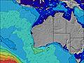 |  |  | 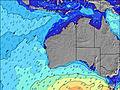 |  |  | 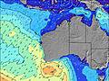 | |||||||||||||||
Onda Altezza (m) Direzione Periodo (s) | SSW 16 | SSW 16 | SW 16 | SW 16 | SW 16 | SW 15 | SW 15 | SW 14 | SW 14 | SW 14 | SW 13 | SW 13 | SW 13 | SW 13 | SW 13 | SW 12 | SW 12 | SW 12 | SW 14 | SW 14 | WSW 13 | WSW 11 | WSW 13 | SW 17 |
Grafico delle onde | ||||||||||||||||||||||||
3549 | 3287 | 3079 | 2844 | 2761 | 2697 | 2117 | 2968 | 2056 | 1610 | 1693 | 1162 | 969 | 1109 | 990 | 786 | 712 | 465 | 726 | 1018 | 3981 | 2667 | 5373 | 10859 | |
Vento (km/h) | ||||||||||||||||||||||||
Stato del vento onshore cross-onshore cross-shore cross-offshore offshore piatto | cross-off | cross-off | off | off | off | off | off | off | cross | on | on | cross-on | glassy | cross-off | cross-off | cross-off | off | off | off | off | cross-off | cross-off | cross-off | cross-off |
Alta Marea | 11:56AM0.81m | 12:18PM0.70m | 12:19PM0.59m | |||||||||||||||||||||
Basso Marea | 8:09PM0.01m | 8:41PM0.10m | 8:53PM0.20m | |||||||||||||||||||||
— | — | — | — | 7:15 | — | — | — | — | — | — | — | 7:15 | — | — | — | — | — | — | — | 7:13 | — | — | — | |
5:15 | — | — | — | — | — | — | — | 5:15 | — | — | — | — | — | — | — | 5:16 | — | — | — | — | — | — | 5:16 | |
mm | — | — | — | — | — | — | — | 3 | 7 | 4 | 1 | 1 | — | — | 1 | — | — | 1 | — | — | 2 | 1 | 1 | 1 |
Temp. °C | 19 | 18 | 18 | 18 | 18 | 17 | 17 | 16 | 15 | 15 | 14 | 14 | 14 | 14 | 14 | 18 | 17 | 15 | 14 | 15 | 14 | 12 | 13 | 14 |
Gelo °C | 14 | 12 | 12 | 12 | 12 | 11 | 11 | 12 | 15 | 13 | 13 | 14 | 15 | 12 | 12 | 14 | 15 | 12 | 10 | 10 | 8 | 4 | 4 | 6 |
Onda 1 Altezza (m) Direzione Periodo (s) | SSW 16 | SSW 16 | SW 16 | SW 16 | SW 16 | SW 15 | SW 15 | SW 14 | SW 14 | SW 14 | SW 13 | SW 13 | SW 13 | SW 13 | SW 13 | SW 12 | SW 12 | SW 12 | SW 14 | SW 14 | SW 20 | SW 14 | SW 17 | S 12 |
3549 | 3287 | 3079 | 2844 | 2761 | 2697 | 2117 | 2968 | 2056 | 1610 | 1693 | 1162 | 969 | 1109 | 990 | 786 | 712 | 465 | 726 | 1018 | 306 | 961 | 1710 | 46 | |
Onda 2 Altezza (m) Direzione Periodo (s) | ENE 5 | — | — | — | NE 5 | ENE 5 | SW 9 | ENE 6 | W 8 | WSW 8 | S 13 | WSW 8 | WSW 7 | S 11 | S 13 | S 13 | S 11 | W 8 | S 10 | SSW 10 | SW 20 | SW 19 | S 12 | — |
5 | — | — | — | 6 | 6 | 41 | 4 | 258 | 216 | 31 | 107 | 86 | 91 | 123 | 85 | 63 | 181 | 73 | 31 | 309 | 916 | 26 | — | |
Onda 3 Altezza (m) Direzione Periodo (s) | — | — | — | — | — | — | E 6 | SE 13 | NE 6 | S 13 | E 7 | S 13 | S 12 | E 6 | E 6 | E 6 | E 6 | S 10 | SW 22 | SW 21 | S 10 | S 10 | — | — |
— | — | — | — | — | — | 3 | 7 | 9 | 31 | 4 | 31 | 151 | 3 | 1 | 1 | 1 | 53 | 18 | 115 | 18 | 104 | — | — | |
onde vento Altezza (m) Direzione Periodo (s) | N 4 | N 4 | N 4 | NNW 4 | NNW 4 | N 4 | WNW 8 | NNW 4 | NNW 5 | — | — | — | — | — | — | NW 3 | — | WNW 8 | W 8 | W 9 | WSW 13 | WSW 11 | WSW 13 | SW 17 |
18 | 24 | 35 | 31 | 25 | 26 | 300 | 44 | 25 | — | — | — | — | — | — | 4 | — | 246 | 295 | 525 | 3981 | 2667 | 5373 | 10859 | |
Il più vicino Offshore or Glassy | ||||||||||||||||||||||||
Distanza (km) | 15 | 15 | 256 | 47 | 15 | 15 | 47 | 17 | 15 | 32 | 47 | 17 | 0 | 0 | 15 | 17 | 0 | 0 | 0 | 17 | 17 | 135 | 135 | 1074 |
Migliori previsioni per le condizioni d'onda in Far South of Western Australia | ||||||||||||||||||||||||
Migliori previsioni per le condizioni d'onda in Australia | ||||||||||||||||||||||||
Trova Onde Globale | ||||||||||||||||||||||||
- Map Icons:
 Break
Break Live Wave Height (m)
 Live Wind Speed (km/h)
 Surf Rating (10 Max)
 Ocean Swells (m)
- Wind Speed (km/h)
Widget Free Surf-Forecast.com per il tuo sito
La relazione di surf / widget meteo è disponibile qui sotto per incorporare su siti esterni a titolo gratuito e fornisce una sintesi delle nostre Lowlands Beach previsione surf. Basta prendere il frammento di codice html da noi fornito e copiarlo nel proprio sito. È possibile scegliere la lingua preferita e unità metriche / imperiali per il feed delle previsioni surf per soddisfare le esigenze degli utenti del vostro sito .... Clicca qui per ottenere il codice.
 Nearest