
Previsioni:

Previsione a breve terminePioggia abbondante (Totale 20mm), più pesante durante lunedì notte. Warm (Max 34°C Lunedì pomeriggio, Min 27°C Sabato mattina). Venti decrescenti (venti freschi da SSW Domenica mattina, venti deboli da SSW per lunedì notte). | ||||||||||||||||||||||||
Sabato 18 | Domenica 19 | Lunedì 20 | ||||||||||||||||||||||
2 AM | 5 AM | 8 AM | 11 AM | 2 PM | 5 PM | 8 PM | 11 PM | 2 AM | 5 AM | 8 AM | 11 AM | 2 PM | 5 PM | 8 PM | 11 PM | 2 AM | 5 AM | 8 AM | 11 AM | 2 PM | 5 PM | 8 PM | 11 PM | |
Mappa dell'altezza del moto ondoso | 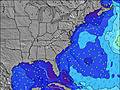 | 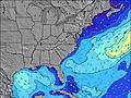 | 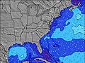 | 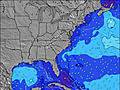 | 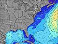 | 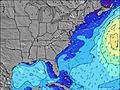 | 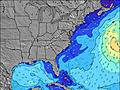 | 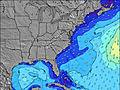 | 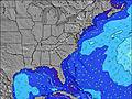 | |||||||||||||||
Onda Altezza (m) Direzione Periodo (s) | ESE 8 | ESE 8 | ESE 8 | S 4 | S 4 | SSW 4 | S 5 | S 6 | S 6 | E 13 | E 13 | ESE 8 | SE 8 | SE 8 | SE 8 | SE 8 | SE 8 | SE 8 | SE 8 | SE 8 | SE 8 | SSW 6 | SSW 6 | SSW 6 |
Grafico delle onde | ||||||||||||||||||||||||
13 | 6 | 6 | 8 | 11 | 25 | 51 | 103 | 0 | 3 | 3 | 6 | 2 | 2 | 2 | 2 | 2 | 2 | 2 | 2 | 2 | 98 | 98 | 126 | |
Vento (km/h) | ||||||||||||||||||||||||
Stato del vento onshore cross-onshore cross-shore cross-offshore offshore piatto | cross | cross-on | cross | cross | cross-on | cross-on | cross | cross | cross | cross | cross-off | cross | cross | cross | cross | cross-off | cross | cross | cross-off | cross-off | cross | cross | cross-on | cross-on |
Alta Marea | 11:28PM1.34m | 12:05PM1.21m | 00:15AM1.25m | 12:56PM1.20m | 1:02AM1.16m | 1:47PM1.18m | ||||||||||||||||||
Basso Marea | 5:57AM-0.04m | 6:14PM0.03m | 6:43AM-0.00m | 7:07PM0.11m | 7:29AM0.04m | 8:01PM0.18m | ||||||||||||||||||
— | 6:11 | — | — | — | — | — | — | — | 6:11 | — | — | — | — | — | — | — | 6:13 | — | — | — | — | — | — | |
— | — | — | — | — | — | 8:22 | — | — | — | — | — | — | — | 8:21 | — | — | — | — | — | — | — | 8:21 | — | |
mm | 1 | — | 1 | 1 | — | — | — | — | — | — | 1 | — | — | — | — | 3 | 3 | 2 | 1 | — | — | — | 2 | 5 |
Temp. °C | 28 | 28 | 27 | 29 | 30 | 30 | 28 | 28 | 28 | 28 | 29 | 32 | 33 | 31 | 29 | 28 | 28 | 27 | 27 | 31 | 34 | 32 | 28 | 28 |
Gelo °C | 32 | 32 | 30 | 31 | 29 | 30 | 29 | 29 | 29 | 29 | 30 | 32 | 32 | 30 | 29 | 29 | 29 | 29 | 29 | 33 | 34 | 31 | 32 | 32 |
Onda 1 Altezza (m) Direzione Periodo (s) | ESE 8 | ESE 8 | ESE 8 | ESE 8 | ESE 8 | ESE 8 | ESE 8 | E 13 | — | — | — | S 7 | SE 8 | SE 8 | SE 8 | SE 8 | SE 8 | SE 8 | S 6 | SSW 6 | SE 8 | SE 8 | ESE 8 | — |
13 | 6 | 6 | 6 | 6 | 6 | 6 | 3 | — | — | — | 128 | 2 | 2 | 2 | 2 | 2 | 2 | 86 | 66 | 2 | 2 | 6 | — | |
Onda 2 Altezza (m) Direzione Periodo (s) | — | — | E 13 | E 13 | E 13 | E 13 | E 13 | SE 13 | — | E 13 | E 13 | ESE 8 | — | — | — | — | — | — | SE 8 | SE 8 | — | — | — | — |
— | — | 4 | 4 | 3 | 3 | 3 | 7 | — | 3 | 3 | 6 | — | — | — | — | — | — | 2 | 2 | — | — | — | — | |
Onda 3 Altezza (m) Direzione Periodo (s) | — | — | E 7 | — | — | — | — | — | — | — | — | — | — | — | — | — | — | — | — | — | — | — | — | — |
— | — | 1 | — | — | — | — | — | — | — | — | — | — | — | — | — | — | — | — | — | — | — | — | — | |
onde vento Altezza (m) Direzione Periodo (s) | SSW 4 | SSW 4 | SSW 4 | S 4 | S 4 | SSW 4 | S 5 | S 6 | S 6 | S 7 | S 7 | SSW 7 | SSW 7 | SSW 7 | SSW 7 | SSW 7 | SSW 7 | SSW 7 | SSW 6 | SSW 6 | SSW 6 | SSW 6 | SSW 6 | SSW 6 |
4 | 5 | 5 | 8 | 11 | 25 | 51 | 103 | 146 | 171 | 152 | 195 | 152 | 240 | 220 | 192 | 163 | 141 | 170 | 136 | 62 | 98 | 98 | 126 | |
Il più vicino Offshore or Glassy | ||||||||||||||||||||||||
Distanza (km) | 1557 | 1557 | 1758 | 1687 | 1687 | 617 | 575 | 472 | 335 | 335 | 346 | 288 | 623 | 288 | 626 | 240 | 43 | 84 | 37 | 2 | 229 | 229 | 1557 | 5 |
Migliori previsioni per le condizioni d'onda in North Carolina | ||||||||||||||||||||||||
Migliori previsioni per le condizioni d'onda in United States | ||||||||||||||||||||||||
Trova Onde Globale | ||||||||||||||||||||||||
- Map Icons:
 Break
Break Live Wave Height (m)
 Live Wind Speed (km/h)
 Surf Rating (10 Max)
 Ocean Swells (m)
- Wind Speed (km/h)
Widget Free Surf-Forecast.com per il tuo sito
La relazione di surf / widget meteo è disponibile qui sotto per incorporare su siti esterni a titolo gratuito e fornisce una sintesi delle nostre Masonboro Inlet previsione surf. Basta prendere il frammento di codice html da noi fornito e copiarlo nel proprio sito. È possibile scegliere la lingua preferita e unità metriche / imperiali per il feed delle previsioni surf per soddisfare le esigenze degli utenti del vostro sito .... Clicca qui per ottenere il codice.
 Nearest