
Previsioni:

Previsione a breve termineper lo più asciutto. Warm (Max 24°C Sabato mattina, Min 20°C Domenica mattina). Principalmente venti freschi. | ||||||||||||||||||||||||
Sabato 1 | Domenica 2 | Lunedì 3 | ||||||||||||||||||||||
2 AM | 5 AM | 8 AM | 11 AM | 2 PM | 5 PM | 8 PM | 11 PM | 2 AM | 5 AM | 8 AM | 11 AM | 2 PM | 5 PM | 8 PM | 11 PM | 2 AM | 5 AM | 8 AM | 11 AM | 2 PM | 5 PM | 8 PM | 11 PM | |
Mappa dell'altezza del moto ondoso |  | 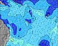 | 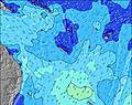 | 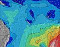 | 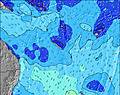 | 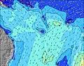 | 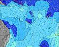 | 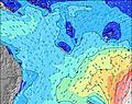 | 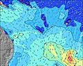 | |||||||||||||||
Onda Altezza (m) Direzione Periodo (s) | ENE 8 | ENE 9 | ENE 9 | ENE 9 | ENE 9 | ENE 9 | ENE 8 | ENE 8 | SSE 6 | SSE 6 | SSE 6 | SSE 7 | SSE 7 | SE 7 | SE 7 | SE 7 | SE 6 | SE 6 | ESE 6 | S 14 | S 14 | S 13 | S 13 | S 13 |
Grafico delle onde | ||||||||||||||||||||||||
0 | 0 | 0 | 0 | 0 | 0 | 0 | 0 | 0 | 0 | 0 | 0 | 0 | 0 | 0 | 0 | 0 | 0 | 0 | 0 | 0 | 0 | 0 | 0 | |
Vento (km/h) | ||||||||||||||||||||||||
Stato del vento onshore cross-onshore cross-shore cross-offshore offshore piatto | cross-off | cross-off | cross-off | cross-off | cross-off | off | off | cross-off | cross-off | cross-off | cross-off | cross-off | cross-off | cross-off | cross-off | cross-off | cross-off | cross-off | cross-off | cross-off | cross-off | cross-off | cross-off | cross-off |
Alta Marea | 6:17AM1.28m | 7:23PM1.21m | 6:55AM1.22m | 7:56PM1.23m | 7:38AM1.15m | 8:33PM1.23m | ||||||||||||||||||
Basso Marea | 00:28AM0.53m | 12:54PM0.18m | 1:09AM0.52m | 1:26PM0.24m | 1:53AM0.52m | 2:00PM0.32m | ||||||||||||||||||
— | 6:11 | — | — | — | — | — | — | — | 6:11 | — | — | — | — | — | — | — | 6:11 | — | — | — | — | — | — | |
— | — | — | — | — | 5:31 | — | — | — | — | — | — | — | 5:32 | — | — | — | — | — | — | — | 5:32 | — | — | |
mm | — | — | — | — | — | — | — | — | — | — | — | — | — | — | — | — | — | — | — | — | — | — | — | — |
Temp. °C | 23 | 23 | 23 | 24 | 24 | 23 | 23 | 23 | 22 | 22 | 22 | 22 | 22 | 22 | 21 | 21 | 20 | 21 | 21 | 21 | 21 | 22 | 22 | 22 |
Gelo °C | 24 | 23 | 23 | 24 | 22 | 20 | 20 | 20 | 19 | 18 | 18 | 17 | 17 | 18 | 16 | 15 | 14 | 15 | 15 | 15 | 16 | 17 | 17 | 17 |
Onda 1 Altezza (m) Direzione Periodo (s) | ENE 8 | ENE 9 | ENE 9 | ENE 9 | ENE 9 | ENE 9 | ENE 8 | ENE 8 | ENE 8 | ENE 8 | ENE 8 | ENE 8 | ENE 8 | ENE 9 | ENE 9 | ENE 8 | ENE 8 | ENE 8 | S 8 | S 8 | S 14 | S 13 | S 13 | S 13 |
221 | 232 | 232 | 222 | 144 | 141 | 113 | 127 | 80 | 80 | 80 | 64 | 64 | 49 | 42 | 39 | 38 | 53 | 60 | 58 | 191 | 165 | 153 | 155 | |
Onda 2 Altezza (m) Direzione Periodo (s) | NE 16 | NE 16 | NE 16 | NE 16 | NE 16 | NE 15 | NE 15 | ENE 15 | ENE 15 | ENE 15 | ENE 15 | ENE 14 | ENE 14 | ENE 14 | ENE 13 | ENE 13 | ENE 13 | S 12 | ENE 8 | S 14 | S 8 | S 8 | S 7 | S 7 |
69 | 66 | 66 | 65 | 64 | 59 | 56 | 85 | 84 | 84 | 84 | 81 | 76 | 71 | 70 | 70 | 69 | 72 | 37 | 148 | 41 | 41 | 40 | 25 | |
Onda 3 Altezza (m) Direzione Periodo (s) | SE 12 | SE 12 | SE 12 | SSE 12 | ESE 8 | SE 12 | SE 12 | SE 12 | SE 12 | S 15 | S 15 | S 15 | S 15 | S 16 | S 16 | S 15 | S 13 | NE 13 | S 11 | ENE 8 | ENE 8 | ENE 8 | NE 12 | NE 12 |
6 | 6 | 6 | 14 | 6 | 6 | 6 | 6 | 5 | 4 | 17 | 17 | 17 | 19 | 19 | 42 | 30 | 44 | 64 | 35 | 35 | 35 | 38 | 37 | |
onde vento Altezza (m) Direzione Periodo (s) | — | SSE 10 | S 7 | SSE 3 | S 3 | SSE 4 | SSE 4 | SSE 5 | SSE 6 | SSE 6 | SSE 6 | SSE 7 | SSE 7 | SE 7 | SE 7 | SE 7 | SE 6 | SE 6 | ESE 6 | ESE 6 | ESE 6 | ESE 6 | ESE 6 | E 6 |
— | 18 | 1 | 3 | 6 | 21 | 54 | 78 | 111 | 159 | 211 | 352 | 329 | 330 | 261 | 230 | 203 | 193 | 127 | 119 | 103 | 103 | 147 | 135 | |
Il più vicino Offshore or Glassy | ||||||||||||||||||||||||
Distanza (km) | 2 | 2 | 925 | 925 | 1022 | 932 | 931 | 931 | 931 | 941 | 994 | 1022 | 1143 | 1143 | 1848 | 1022 | 548 | 548 | 548 | 548 | 1856 | 1827 | 1827 | 548 |
Migliori previsioni per le condizioni d'onda in Efate | ||||||||||||||||||||||||
Migliori previsioni per le condizioni d'onda in Vanuatu | ||||||||||||||||||||||||
Trova Onde Globale | ||||||||||||||||||||||||
- Map Icons:
 Break
Break Live Wave Height (m)
 Live Wind Speed (km/h)
 Surf Rating (10 Max)
 Ocean Swells (m)
- Wind Speed (km/h)
Widget Free Surf-Forecast.com per il tuo sito
La relazione di surf / widget meteo è disponibile qui sotto per incorporare su siti esterni a titolo gratuito e fornisce una sintesi delle nostre Nagar previsione surf. Basta prendere il frammento di codice html da noi fornito e copiarlo nel proprio sito. È possibile scegliere la lingua preferita e unità metriche / imperiali per il feed delle previsioni surf per soddisfare le esigenze degli utenti del vostro sito .... Clicca qui per ottenere il codice.
 Nearest