
Previsioni:

Previsione a breve terminepioggia leggera (Totale 5mm), per lo più che cade mercoledì notte. Warm (Max 26°C mercoledì notte, Min 25°C mercoledì notte). Principalmente venti freschi. | ||||||||||||||||||||||||
Mer 15 | Giovedì 16 | Venerdì 17 | Sabato 18 | |||||||||||||||||||||
7 PM | 10 PM | 1 AM | 4 AM | 7 AM | 10 AM | 1 PM | 4 PM | 7 PM | 10 PM | 1 AM | 4 AM | 7 AM | 10 AM | 1 PM | 4 PM | 7 PM | 10 PM | 1 AM | 4 AM | 7 AM | 10 AM | 1 PM | 4 PM | |
Mappa dell'altezza del moto ondoso | 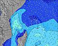 | 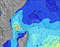 | 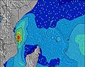 | 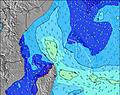 | 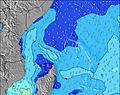 | 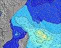 | 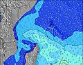 | 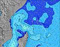 | 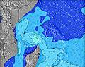 | |||||||||||||||
Onda Altezza (m) Direzione Periodo (s) | SE 9 | SE 9 | SE 9 | SE 9 | SE 9 | SE 9 | SE 9 | SE 8 | SE 8 | SE 9 | SE 8 | SE 9 | SE 8 | SE 8 | SE 8 | SE 8 | SE 9 | SE 9 | SE 9 | SE 9 | SE 9 | SE 9 | SE 9 | SE 9 |
Grafico delle onde | ||||||||||||||||||||||||
560 | 537 | 537 | 573 | 612 | 654 | 625 | 517 | 482 | 493 | 411 | 362 | 286 | 286 | 299 | 283 | 297 | 275 | 275 | 275 | 304 | 351 | 351 | 343 | |
Vento (km/h) | ||||||||||||||||||||||||
Stato del vento onshore cross-onshore cross-shore cross-offshore offshore piatto | cross | cross | cross | cross-off | cross-off | cross-off | cross-off | cross-off | cross-off | cross-off | cross-off | cross-off | cross-off | cross-off | cross-off | cross | cross | cross | cross | cross-off | cross-off | cross | cross | cross |
Alta Marea | 5:26PM1.60m | 6:03AM1.04m | 6:10PM1.55m | 6:48AM1.13m | 6:51PM1.45m | 7:33AM1.20m | ||||||||||||||||||
Basso Marea | 00:12AM-0.03m | 11:43AM0.12m | 00:49AM-0.02m | 12:35PM0.16m | 1:24AM0.00m | 1:26PM0.23m | ||||||||||||||||||
— | — | — | 6:26 | — | — | — | — | — | — | — | 6:26 | — | — | — | — | — | — | — | 6:26 | — | — | — | — | |
— | — | — | — | — | — | — | 6:20 | — | — | — | — | — | — | — | 6:20 | — | — | — | — | — | — | — | 6:20 | |
mm | 2 | 1 | 1 | 1 | 2 | — | — | — | — | — | — | — | — | — | — | — | — | — | — | — | — | — | — | — |
Temp. °C | 26 | 26 | 25 | 25 | 25 | 25 | 25 | 25 | 25 | 25 | 25 | 25 | 25 | 25 | 25 | 26 | 25 | 25 | 25 | 25 | 25 | 25 | 25 | 26 |
Gelo °C | 26 | 26 | 24 | 24 | 24 | 23 | 24 | 24 | 24 | 24 | 24 | 25 | 25 | 24 | 24 | 26 | 25 | 25 | 25 | 23 | 24 | 25 | 24 | 26 |
Onda 1 Altezza (m) Direzione Periodo (s) | SSW 13 | SSW 13 | SSW 12 | SSW 12 | SSW 14 | SSW 14 | SSW 13 | SSW 13 | SSW 13 | SSW 13 | SSW 12 | SE 9 | SE 8 | SE 8 | SSW 11 | SSW 11 | SSW 11 | SSW 10 | SE 9 | SSW 10 | SSW 10 | SW 6 | S 19 | S 19 |
56 | 58 | 28 | 28 | 70 | 61 | 59 | 59 | 58 | 54 | 30 | 362 | 286 | 286 | 41 | 40 | 37 | 35 | 275 | 34 | 33 | 1 | 29 | 28 | |
Onda 2 Altezza (m) Direzione Periodo (s) | SSW 16 | SSW 16 | SSW 15 | SSW 15 | NE 10 | NE 10 | S 14 | S 14 | NE 10 | NE 10 | NE 10 | SSW 12 | SSW 6 | SSW 12 | SW 6 | SSW 6 | S 6 | SW 6 | SSW 10 | SW 6 | SW 6 | S 20 | S 15 | S 14 |
50 | 25 | 42 | 42 | 4 | 4 | 15 | 15 | 4 | 4 | 4 | 29 | 25 | 27 | 2 | 6 | 1 | 2 | 34 | 1 | 1 | 8 | 17 | 16 | |
Onda 3 Altezza (m) Direzione Periodo (s) | NE 10 | NE 10 | S 16 | S 15 | S 15 | W 8 | NE 10 | NE 10 | S 13 | SW 7 | SSW 7 | NE 10 | SSW 12 | NE 10 | NE 10 | SW 6 | SW 7 | NE 10 | SW 6 | NE 10 | NE 10 | NE 10 | NE 10 | NE 10 |
4 | 4 | 19 | 4 | 4 | 1 | 4 | 4 | 3 | 2 | 17 | 4 | 28 | 4 | 4 | 2 | 2 | 4 | 2 | 4 | 4 | 4 | 4 | 4 | |
onde vento Altezza (m) Direzione Periodo (s) | SE 9 | SE 9 | SE 9 | SE 9 | SE 9 | SE 9 | SE 9 | SE 8 | SE 8 | SE 9 | SE 8 | SSW 6 | — | SSW 6 | SE 8 | SE 8 | SE 9 | SE 9 | SSE 9 | SE 9 | SE 9 | SE 9 | SE 9 | SE 9 |
560 | 537 | 537 | 573 | 612 | 654 | 625 | 517 | 482 | 493 | 411 | 25 | — | 14 | 299 | 283 | 297 | 275 | 144 | 275 | 304 | 351 | 351 | 343 | |
Il più vicino Offshore or Glassy | ||||||||||||||||||||||||
Distanza (km) | 1740 | 1740 | 1745 | 1745 | 1745 | 1745 | 1745 | 1745 | 1745 | 1745 | 19 | 19 | 19 | 1745 | 19 | 1782 | 1733 | 1733 | 19 | 1729 | 19 | 19 | 1729 | 1729 |
Migliori previsioni per le condizioni d'onda in Mahe | ||||||||||||||||||||||||
Migliori previsioni per le condizioni d'onda in Seychelles | ||||||||||||||||||||||||
Trova Onde Globale | ||||||||||||||||||||||||
- Map Icons:
 Break
Break Live Wave Height (m)
 Live Wind Speed (km/h)
 Surf Rating (10 Max)
 Ocean Swells (m)
- Wind Speed (km/h)
Widget Free Surf-Forecast.com per il tuo sito
La relazione di surf / widget meteo è disponibile qui sotto per incorporare su siti esterni a titolo gratuito e fornisce una sintesi delle nostre North East Point previsione surf. Basta prendere il frammento di codice html da noi fornito e copiarlo nel proprio sito. È possibile scegliere la lingua preferita e unità metriche / imperiali per il feed delle previsioni surf per soddisfare le esigenze degli utenti del vostro sito .... Clicca qui per ottenere il codice.
 Nearest