
Previsioni:

Previsione a breve terminePioggia abbondante (Totale 37mm), più pesante durante giovedì pomeriggio. Very mild (Max 19°C Sabato mattina, Min 14°C Venerdì notte). Principalmente venti freschi. | ||||||||||||||||||||
Gio 16 | Venerdì 17 | Sabato 18 | ||||||||||||||||||
1 PM | 4 PM | 7 PM | 10 PM | 1 AM | 4 AM | 7 AM | 10 AM | 1 PM | 4 PM | 7 PM | 10 PM | 1 AM | 4 AM | 7 AM | 10 AM | 1 PM | 4 PM | 7 PM | 10 PM | |
Mappa dell'altezza del moto ondoso |  | 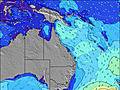 | 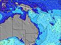 | 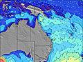 |  | 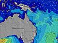 | 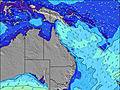 |  | ||||||||||||
Onda Altezza (m) Direzione Periodo (s) | SE 9 | SE 9 | SE 9 | SE 9 | SE 8 | SE 8 | SE 8 | SE 8 | SE 8 | SE 7 | SSE 7 | SSE 8 | SE 7 | ESE 8 | ESE 8 | ESE 8 | SE 8 | SE 9 | ESE 10 | ESE 10 |
Grafico delle onde | ||||||||||||||||||||
664 | 703 | 573 | 470 | 371 | 299 | 211 | 163 | 181 | 156 | 183 | 213 | 285 | 224 | 236 | 242 | 505 | 911 | 1019 | 1394 | |
Vento (km/h) | ||||||||||||||||||||
Stato del vento onshore cross-onshore cross-shore cross-offshore offshore piatto | cross-off | cross-off | cross | cross | cross | cross | cross | cross | cross | cross | cross-off | cross-off | cross-off | cross-off | cross-off | cross-off | cross-off | cross-off | cross-off | cross-off |
Alta Marea | 9:39PM1.90m | 10:02AM1.19m | 10:21PM1.78m | 10:51AM1.21m | ||||||||||||||||
Basso Marea | 2:58PM-0.03m | 4:18AM0.02m | 3:47PM0.05m | 4:58AM0.05m | 4:35PM0.18m | |||||||||||||||
— | — | — | — | — | 6:35 | — | — | — | — | — | — | — | 6:35 | — | — | — | — | — | — | |
— | 5:07 | — | — | — | — | — | — | — | 5:07 | — | — | — | — | — | — | — | 5:07 | — | — | |
mm | 2 | 2 | 11 | 3 | 2 | 3 | 2 | 2 | 2 | 2 | 1 | 1 | 1 | — | — | — | — | — | — | — |
Temp. °C | 17 | 16 | 17 | 17 | 17 | 17 | 16 | 18 | 18 | 17 | 16 | 16 | 15 | 14 | 14 | 15 | 19 | 18 | 17 | 16 |
Gelo °C | 10 | 10 | 12 | 12 | 12 | 13 | 12 | 14 | 14 | 12 | 11 | 11 | 11 | 10 | 9 | 10 | 13 | 12 | 11 | 10 |
Onda 1 Altezza (m) Direzione Periodo (s) | NE 9 | NE 9 | NE 8 | ENE 8 | ENE 8 | NE 8 | E 6 | E 6 | E 6 | E 6 | E 6 | E 6 | S 16 | ESE 8 | ESE 8 | ESE 8 | E 20 | E 20 | ESE 10 | ESE 10 |
3 | 3 | 3 | 6 | 6 | 10 | 36 | 46 | 47 | 49 | 51 | 51 | 5 | 224 | 236 | 242 | 8 | 8 | 1019 | 1394 | |
Onda 2 Altezza (m) Direzione Periodo (s) | — | — | E 7 | — | — | — | NE 8 | NE 8 | NE 7 | — | — | — | — | — | — | — | — | — | E 20 | — |
— | — | 1 | — | — | — | 9 | 9 | 8 | — | — | — | — | — | — | — | — | — | 8 | — | |
Onda 3 Altezza (m) Direzione Periodo (s) | — | — | — | — | — | — | — | — | — | S 19 | — | — | — | — | — | — | — | — | — | — |
— | — | — | — | — | — | — | — | — | 7 | — | — | — | — | — | — | — | — | — | — | |
onde vento Altezza (m) Direzione Periodo (s) | SE 9 | SE 9 | SE 9 | SE 9 | SE 8 | SE 8 | SE 8 | SE 8 | SE 8 | SE 7 | SSE 7 | SSE 8 | SE 7 | S 4 | S 4 | S 4 | SE 8 | SE 9 | S 5 | S 5 |
664 | 703 | 573 | 470 | 371 | 299 | 211 | 163 | 181 | 156 | 183 | 213 | 285 | 18 | 13 | 18 | 505 | 911 | 59 | 56 | |
Il più vicino Offshore or Glassy | ||||||||||||||||||||
Distanza (km) | 528 | 557 | 442 | 442 | 442 | 9 | 9 | 196 | 9 | 558 | 147 | 147 | 2 | 2 | 2 | 2 | 647 | 329 | 654 | 654 |
Migliori previsioni per le condizioni d'onda in Gold Coast | ||||||||||||||||||||
Migliori previsioni per le condizioni d'onda in Australia | ||||||||||||||||||||
Trova Onde Globale | ||||||||||||||||||||
- Map Icons:
 Break
Break Live Wave Height (m)
 Live Wind Speed (km/h)
 Surf Rating (10 Max)
 Ocean Swells (m)
- Wind Speed (km/h)
Widget Free Surf-Forecast.com per il tuo sito
La relazione di surf / widget meteo è disponibile qui sotto per incorporare su siti esterni a titolo gratuito e fornisce una sintesi delle nostre Palm beach previsione surf. Basta prendere il frammento di codice html da noi fornito e copiarlo nel proprio sito. È possibile scegliere la lingua preferita e unità metriche / imperiali per il feed delle previsioni surf per soddisfare le esigenze degli utenti del vostro sito .... Clicca qui per ottenere il codice.
 Nearest