
Previsioni:

Aggiornamento in hr min s Forecast update imminent
Previsione a breve termineper lo più asciutto. Warm (Max 24°C Domenica mattina, Min 21°C Domenica mattina). Vento sarà generalmente leggero. | ||||||||||||||||||||||||
Domenica 5 | Lunedì 6 | Martedì 7 | ||||||||||||||||||||||
2 AM | 5 AM | 8 AM | 11 AM | 2 PM | 5 PM | 8 PM | 11 PM | 2 AM | 5 AM | 8 AM | 11 AM | 2 PM | 5 PM | 8 PM | 11 PM | 2 AM | 5 AM | 8 AM | 11 AM | 2 PM | 5 PM | 8 PM | 11 PM | |
Mappa dell'altezza del moto ondoso |  | 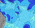 | 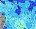 | 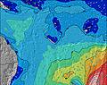 | 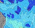 | 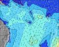 | 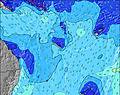 | 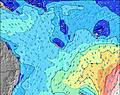 | 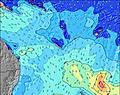 | |||||||||||||||
Onda Altezza (m) Direzione Periodo (s) | SE 11 | SE 11 | SE 11 | SE 11 | SE 4 | SE 4 | SE 4 | SE 13 | SE 13 | SE 13 | SE 12 | SE 12 | SE 12 | SE 12 | SE 12 | SE 12 | SE 11 | SE 11 | S 15 | S 14 | S 14 | S 12 | S 18 | S 18 |
Grafico delle onde | ||||||||||||||||||||||||
58 | 60 | 58 | 56 | 30 | 42 | 35 | 83 | 82 | 79 | 73 | 72 | 71 | 69 | 49 | 47 | 31 | 31 | 41 | 65 | 140 | 151 | 158 | 222 | |
Vento (km/h) | ||||||||||||||||||||||||
Stato del vento onshore cross-onshore cross-shore cross-offshore offshore piatto | cross | cross | cross | cross | cross | cross | cross | cross | cross | cross | cross | cross-on | cross-on | cross-on | cross-on | cross-on | cross-on | cross-on | cross-on | cross-on | cross-on | cross-on | cross-on | cross-on |
Alta Marea | 8:24AM1.03m | 9:57PM1.10m | 9:15AM0.97m | 10:35PM1.12m | 10:18AM0.91m | |||||||||||||||||||
Basso Marea | 3:00AM0.58m | 3:09PM0.19m | 3:53AM0.55m | 3:47PM0.26m | 4:52AM0.50m | 4:31PM0.33m | ||||||||||||||||||
— | 6:18 | — | — | — | — | — | — | — | 6:18 | — | — | — | — | — | — | — | 6:18 | — | — | — | — | — | — | |
— | — | — | — | — | 5:23 | — | — | — | — | — | — | — | 5:23 | — | — | — | — | — | — | — | 5:23 | — | — | |
mm | — | — | — | — | — | — | — | — | — | — | — | — | — | — | — | — | — | — | — | — | — | — | — | — |
Temp. °C | 23 | 22 | 23 | 23 | 24 | 23 | 23 | 23 | 22 | 21 | 22 | 22 | 22 | 22 | 22 | 22 | 22 | 22 | 22 | 23 | 22 | 22 | 22 | 22 |
Gelo °C | 21 | 20 | 20 | 21 | 21 | 19 | 20 | 21 | 20 | 19 | 20 | 20 | 20 | 20 | 21 | 21 | 21 | 21 | 20 | 21 | 19 | 19 | 19 | 19 |
Onda 1 Altezza (m) Direzione Periodo (s) | SE 11 | SE 11 | SE 11 | SE 11 | ENE 8 | S 10 | NE 9 | SE 13 | SE 13 | SE 13 | SE 12 | SE 12 | SE 12 | SE 12 | SE 12 | SE 12 | SE 11 | SE 11 | SE 11 | S 14 | S 14 | S 12 | S 12 | S 18 |
58 | 60 | 58 | 56 | 7 | 2 | 3 | 83 | 82 | 79 | 73 | 72 | 71 | 69 | 49 | 47 | 31 | 31 | 30 | 65 | 140 | 151 | 108 | 222 | |
Onda 2 Altezza (m) Direzione Periodo (s) | NE 8 | NE 8 | ENE 8 | NE 8 | S 10 | S 14 | S 14 | ENE 6 | ENE 6 | NE 9 | ENE 6 | NE 8 | ENE 8 | ENE 8 | ENE 8 | NE 6 | ENE 8 | ENE 8 | S 15 | SE 11 | SE 11 | SE 11 | S 18 | S 12 |
11 | 11 | 7 | 11 | 2 | 4 | 4 | 4 | 4 | 12 | 4 | 11 | 7 | 7 | 7 | 1 | 7 | 7 | 41 | 30 | 30 | 30 | 158 | 101 | |
Onda 3 Altezza (m) Direzione Periodo (s) | SSE 9 | S 9 | S 9 | S 7 | S 14 | — | S 9 | NE 9 | NE 9 | — | NE 9 | S 13 | S 13 | S 14 | S 15 | S 13 | S 13 | S 16 | ENE 8 | S 20 | S 20 | S 20 | SE 11 | SE 11 |
8 | 2 | 2 | 1 | 4 | — | 2 | 3 | 3 | — | 3 | 3 | 3 | 4 | 4 | 3 | 12 | 5 | 7 | 30 | 30 | 68 | 30 | 18 | |
onde vento Altezza (m) Direzione Periodo (s) | SE 4 | SE 4 | SE 4 | SE 4 | SE 4 | SE 4 | SE 4 | SE 5 | SSE 5 | SSE 5 | SSE 4 | SSE 4 | SSE 3 | SSE 4 | S 4 | SSE 4 | S 4 | S 4 | S 4 | S 5 | S 5 | S 5 | S 5 | S 5 |
21 | 10 | 18 | 14 | 30 | 42 | 35 | 31 | 23 | 19 | 8 | 12 | 7 | 10 | 9 | 6 | 9 | 10 | 11 | 34 | 40 | 40 | 62 | 67 | |
Il più vicino Offshore or Glassy | ||||||||||||||||||||||||
Distanza (km) | 517 | 517 | 517 | 1755 | 555 | 944 | 944 | 517 | 526 | 944 | 937 | 937 | 1032 | 944 | 937 | 29 | 29 | 937 | 937 | 937 | 1029 | 1024 | 944 | 944 |
Migliori previsioni per le condizioni d'onda in Efate | ||||||||||||||||||||||||
Migliori previsioni per le condizioni d'onda in Vanuatu | ||||||||||||||||||||||||
Trova Onde Globale | ||||||||||||||||||||||||
- Map Icons:
 Break
Break Live Wave Height (m)
 Live Wind Speed (km/h)
 Surf Rating (10 Max)
 Ocean Swells (m)
- Wind Speed (km/h)
Widget Free Surf-Forecast.com per il tuo sito
La relazione di surf / widget meteo è disponibile qui sotto per incorporare su siti esterni a titolo gratuito e fornisce una sintesi delle nostre Pango Point previsione surf. Basta prendere il frammento di codice html da noi fornito e copiarlo nel proprio sito. È possibile scegliere la lingua preferita e unità metriche / imperiali per il feed delle previsioni surf per soddisfare le esigenze degli utenti del vostro sito .... Clicca qui per ottenere il codice.
 Nearest