
Previsioni:

Previsione a breve termineper lo più asciutto. Very mild (Max 14°C mercoledì pomeriggio, Min 10°C giovedì mattina). Vento sarà generalmente leggero. | ||||||||||||||||||||||||
Mer 15 | Giovedì 16 | Venerdì 17 | 18 | |||||||||||||||||||||
12 PM | 3 PM | 6 PM | 9 PM | 12 AM | 3 AM | 6 AM | 9 AM | 12 PM | 3 PM | 6 PM | 9 PM | 12 AM | 3 AM | 6 AM | 9 AM | 12 PM | 3 PM | 6 PM | 9 PM | 12 AM | 3 AM | 6 AM | 9 AM | |
Mappa dell'altezza del moto ondoso |  | 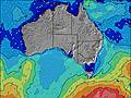 | 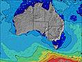 | 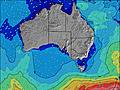 | 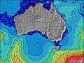 | 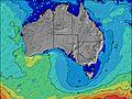 | 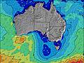 | 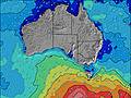 | 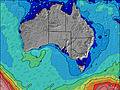 | 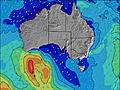 | ||||||||||||||
Onda Altezza (m) Direzione Periodo (s) | S 14 | S 14 | S 14 | S 15 | S 15 | S 15 | S 15 | S 15 | S 17 | S 16 | S 15 | S 15 | S 15 | S 16 | S 16 | S 16 | S 16 | S 16 | SSW 15 | SSW 15 | SSW 14 | SSW 14 | SSW 14 | SSW 14 |
Grafico delle onde | ||||||||||||||||||||||||
1663 | 1504 | 1373 | 1392 | 1547 | 1735 | 1735 | 1712 | 2765 | 2178 | 1830 | 1589 | 1509 | 1589 | 1459 | 1496 | 1314 | 1117 | 904 | 639 | 631 | 529 | 431 | 331 | |
Vento (km/h) | ||||||||||||||||||||||||
Stato del vento onshore cross-onshore cross-shore cross-offshore offshore piatto | cross-off | glassy | glassy | glassy | cross-off | cross-off | cross-off | off | off | off | off | off | off | off | cross-off | off | cross-off | cross-off | off | cross-off | off | cross-off | cross-off | off |
Alta Marea | 4:42PM1.49m | 6:11AM0.84m | 5:17PM1.48m | 6:17AM0.93m | 5:49PM1.43m | 6:31AM1.03m | ||||||||||||||||||
Basso Marea | 9:32AM0.70m | 00:07AM0.35m | 10:22AM0.64m | 00:20AM0.40m | 11:06AM0.60m | 00:31AM0.44m | ||||||||||||||||||
— | — | — | — | — | — | 7:26 | — | — | — | — | — | — | — | 7:26 | — | — | — | — | — | — | — | 7:24 | — | |
— | 5:22 | — | — | — | — | — | — | — | 5:22 | — | — | — | — | — | — | — | 5:23 | — | — | — | — | — | 5:24 | |
mm | — | — | — | — | — | — | — | — | — | — | — | — | — | — | — | — | — | — | — | — | — | — | — | — |
Temp. °C | 13 | 14 | 14 | 14 | 13 | 11 | 11 | 10 | 11 | 12 | 12 | 12 | 11 | 11 | 11 | 11 | 12 | 12 | 12 | 12 | 12 | 12 | 12 | 12 |
Gelo °C | 12 | 13 | 13 | 13 | 11 | 9 | 9 | 8 | 8 | 9 | 9 | 9 | 8 | 8 | 8 | 8 | 8 | 9 | 9 | 9 | 8 | 8 | 9 | 8 |
Onda 1 Altezza (m) Direzione Periodo (s) | S 14 | S 14 | S 14 | S 15 | S 15 | S 15 | S 15 | S 15 | S 17 | S 16 | S 15 | S 15 | S 15 | S 16 | S 16 | S 16 | S 16 | S 16 | SSW 15 | SSW 15 | SSW 14 | SSW 14 | SSW 14 | SSW 14 |
1663 | 1504 | 1373 | 1392 | 1547 | 1735 | 1735 | 1712 | 2765 | 2178 | 1830 | 1589 | 1509 | 1589 | 1459 | 1496 | 1314 | 1117 | 904 | 639 | 631 | 529 | 431 | 331 | |
Onda 2 Altezza (m) Direzione Periodo (s) | — | — | — | — | — | — | — | S 19 | S 18 | — | — | — | — | — | — | — | — | — | — | — | — | — | — | — |
— | — | — | — | — | — | — | 340 | 321 | — | — | — | — | — | — | — | — | — | — | — | — | — | — | — | |
Onda 3 Altezza (m) Direzione Periodo (s) | — | — | — | — | — | — | — | — | — | — | — | — | — | — | — | — | — | — | — | — | — | — | — | — |
— | — | — | — | — | — | — | — | — | — | — | — | — | — | — | — | — | — | — | — | — | — | — | — | |
onde vento Altezza (m) Direzione Periodo (s) | — | — | — | — | — | — | — | — | — | — | — | — | — | — | — | — | — | — | — | — | — | — | — | N 3 |
— | — | — | — | — | — | — | — | — | — | — | — | — | — | — | — | — | — | — | — | — | — | — | 1 | |
Il più vicino Offshore or Glassy | ||||||||||||||||||||||||
Distanza (km) | 77 | 59 | 57 | 59 | 59 | 59 | 71 | 71 | 59 | 71 | 71 | 59 | 54 | 54 | 54 | 54 | 54 | 54 | 54 | 54 | 54 | 54 | 54 | 54 |
Migliori previsioni per le condizioni d'onda in Kangaroo Island | ||||||||||||||||||||||||
Migliori previsioni per le condizioni d'onda in Australia | ||||||||||||||||||||||||
Trova Onde Globale | ||||||||||||||||||||||||
- Map Icons:
 Break
Break Live Wave Height (m)
 Live Wind Speed (km/h)
 Surf Rating (10 Max)
 Ocean Swells (m)
- Wind Speed (km/h)
Widget Free Surf-Forecast.com per il tuo sito
La relazione di surf / widget meteo è disponibile qui sotto per incorporare su siti esterni a titolo gratuito e fornisce una sintesi delle nostre Pennington Bay previsione surf. Basta prendere il frammento di codice html da noi fornito e copiarlo nel proprio sito. È possibile scegliere la lingua preferita e unità metriche / imperiali per il feed delle previsioni surf per soddisfare le esigenze degli utenti del vostro sito .... Clicca qui per ottenere il codice.
 Nearest