
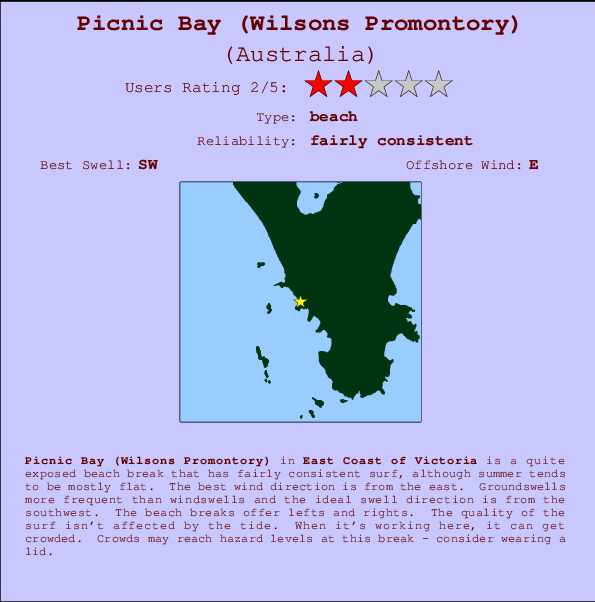
Picnic Bay (Wilsons Promontory) Surf Guide
Picnic Bay in Wilson Promentary is a fairly exposed beach break that has reasonably consistent surf, although summer tends to be mostly flat. The best wind direction is from the east. Clean groundswells prevail and the optimum swell angle is from the southwest. The beach breaks offer lefts and rights. Surfable at all stages of the tide. It's sometimes crowded here. Crowds may reach hazard levels at this break - consider wearing a lid.
Picnic Bay (Wilsons Promontory) Spot Info
| Type: | Rating: | Reliability: | Todays Sea Temp*: |
|---|---|---|---|
| fairly consistent | 14.0°C*ocean temperature recorded from satellite |
Surfing Picnic Bay (Wilsons Promontory):
The best conditions reported for surf at Picnic Bay (Wilsons Promontory) occur when a Southwest swell combines with an offshore wind direction from the East.

Previsioni Energia d'onda (Potenza): 12hrs


Picnic Bay (Wilsons Promontory) Surf:
Thursday, 16 July 2026, 12:40 Local time| Giovedì 16 | ||||
| 7AM | 10AM | 1PM | 4PM | |
| Wave (m) | ||||
| Periodo (s) | 15 | 15 | 15 | 15 |
| Vento (km/h) | ||||
| Stato del vento | cross- on |
on | on | cross- on |
- /breaks/Picnic-Bay/forecasts/latest
Picnic Bay (Wilsons Promontory) Surf Guide
Picnic Bay in Wilson Promentary is a fairly exposed beach break that has reasonably consistent surf, although summer tends to be mostly flat. The best wind direction is from the east. Clean groundswells prevail and the optimum swell angle is from the southwest. The beach breaks offer lefts and rights. Surfable at all stages of the tide. It's sometimes crowded here. Crowds may reach hazard levels at this break - consider wearing a lid.
Picnic Bay (Wilsons Promontory) Spot Info
Type: Rating: Reliability: Todays Sea Temp*:  Beach
Beach 2
2fairly consistent 14.0°C*ocean temperature recorded from satelliteSurfing Picnic Bay (Wilsons Promontory):
The best conditions reported for surf at Picnic Bay (Wilsons Promontory) occur when a Southwest swell combines with an offshore wind direction from the East.
Previsioni Energia d'onda (Potenza): 12hrs
Utilizzare la scheda di navigazione in alto per visualizzare Picnic Bay (Wilsons Promontory) temperatura del mare, Picnic Bay (Wilsons Promontory) fotografie, Picnic Bay (Wilsons Promontory) dettagliate previsioni onde, il vento e le previsioni meteo, Picnic Bay (Wilsons Promontory) webcam, vento corrente da VIC - East Coast stazioni meteo e Picnic Bay (Wilsons Promontory) previsioni marea. Il link Australia mappe maree apre l'immagine grande, che mostra Australia e dei mari circostanti. Queste mappe possono essere animate per mostrare le diverse componenti del moto ondoso, energia delle onde, periodo d'onda, altezza delle onde, insieme con le previsioni del vento e meteo, meteo corrente e osservazioni sullo stato del mare dal Australia onda-boe, le navi passanti e stazioni meteo costiere. Ciascuna delle pagine di previsioni per questo surf break rappresenta uno strumento di wavefinder globale e regionale per individuare le migliori condizioni di surf nella zona intorno Picnic Bay (Wilsons Promontory).
Picnic Bay (Wilsons Promontory) Surf:
Thursday, 16 July 2026, 12:40 Local timeGiovedì 16 7AM 10AM 1PM 4PM Wave (m) Periodo (s) 15 15 15 15 Vento (km/h) Stato del vento cross-
onon on cross-
on- /breaks/Picnic-Bay/forecasts/latest
- /breaks/Picnic-Bay/forecasts/latest/six_day
Picnic Bay (Wilsons Promontory) Surf Guide
Picnic Bay in Wilson Promentary is a fairly exposed beach break that has reasonably consistent surf, although summer tends to be mostly flat. The best wind direction is from the east. Clean groundswells prevail and the optimum swell angle is from the southwest. The beach breaks offer lefts and rights. Surfable at all stages of the tide. It's sometimes crowded here. Crowds may reach hazard levels at this break - consider wearing a lid.
Picnic Bay (Wilsons Promontory) Spot Info
Type: Rating: Reliability: Todays Sea Temp*: Beach2fairly consistent 14.0°C*ocean temperature recorded from satelliteSurfing Picnic Bay (Wilsons Promontory):
The best conditions reported for surf at Picnic Bay (Wilsons Promontory) occur when a Southwest swell combines with an offshore wind direction from the East.
Previsioni Energia d'onda (Potenza): 12hrs
Utilizzare la scheda di navigazione in alto per visualizzare Picnic Bay (Wilsons Promontory) temperatura del mare, Picnic Bay (Wilsons Promontory) fotografie, Picnic Bay (Wilsons Promontory) dettagliate previsioni onde, il vento e le previsioni meteo, Picnic Bay (Wilsons Promontory) webcam, vento corrente da VIC - East Coast stazioni meteo e Picnic Bay (Wilsons Promontory) previsioni marea. Il link Australia mappe maree apre l'immagine grande, che mostra Australia e dei mari circostanti. Queste mappe possono essere animate per mostrare le diverse componenti del moto ondoso, energia delle onde, periodo d'onda, altezza delle onde, insieme con le previsioni del vento e meteo, meteo corrente e osservazioni sullo stato del mare dal Australia onda-boe, le navi passanti e stazioni meteo costiere. Ciascuna delle pagine di previsioni per questo surf break rappresenta uno strumento di wavefinder globale e regionale per individuare le migliori condizioni di surf nella zona intorno Picnic Bay (Wilsons Promontory).
Picnic Bay (Wilsons Promontory) Surf:
Thursday, 16 July 2026, 12:40 Local timeGiovedì 16 7AM 10AM 1PM 4PM Wave (m) Periodo (s) 15 15 15 15 Vento (km/h) Stato del vento cross-
onon on cross-
on- /breaks/Picnic-Bay/forecasts/latest
Picnic Bay (Wilsons Promontory) Surf Guide
Picnic Bay in Wilson Promentary is a fairly exposed beach break that has reasonably consistent surf, although summer tends to be mostly flat. The best wind direction is from the east. Clean groundswells prevail and the optimum swell angle is from the southwest. The beach breaks offer lefts and rights. Surfable at all stages of the tide. It's sometimes crowded here. Crowds may reach hazard levels at this break - consider wearing a lid.
Picnic Bay (Wilsons Promontory) Spot Info
Type: Rating: Reliability: Todays Sea Temp*: Beach2fairly consistent 14.0°C*ocean temperature recorded from satelliteSurfing Picnic Bay (Wilsons Promontory):
The best conditions reported for surf at Picnic Bay (Wilsons Promontory) occur when a Southwest swell combines with an offshore wind direction from the East.
Previsioni Energia d'onda (Potenza): 12hrs
Utilizzare la scheda di navigazione in alto per visualizzare Picnic Bay (Wilsons Promontory) temperatura del mare, Picnic Bay (Wilsons Promontory) fotografie, Picnic Bay (Wilsons Promontory) dettagliate previsioni onde, il vento e le previsioni meteo, Picnic Bay (Wilsons Promontory) webcam, vento corrente da VIC - East Coast stazioni meteo e Picnic Bay (Wilsons Promontory) previsioni marea. Il link Australia mappe maree apre l'immagine grande, che mostra Australia e dei mari circostanti. Queste mappe possono essere animate per mostrare le diverse componenti del moto ondoso, energia delle onde, periodo d'onda, altezza delle onde, insieme con le previsioni del vento e meteo, meteo corrente e osservazioni sullo stato del mare dal Australia onda-boe, le navi passanti e stazioni meteo costiere. Ciascuna delle pagine di previsioni per questo surf break rappresenta uno strumento di wavefinder globale e regionale per individuare le migliori condizioni di surf nella zona intorno Picnic Bay (Wilsons Promontory).
Picnic Bay (Wilsons Promontory) Surf:
Thursday, 16 July 2026, 12:40 Local timeGiovedì 16 7AM 10AM 1PM 4PM Wave (m) Periodo (s) 15 15 15 15 Vento (km/h) Stato del vento cross-
onon on cross-
onTide Times:
Per Buckleys Reef (Wilsons Promontory), %{dist} %{km} da %{location}.
PROSSIMA È ALLE (ora locale) rimanente alta marea bassa marea Picnic Bay (Wilsons Promontory) Tide Times and Tide Chart
Live Weather:
At Wilsons Promontory Lighthouse, 17 km from Picnic Bay (Wilsons Promontory).
wind obs. (13 kph from 190 degs) was rejected
(km/h)
no reportAir temperature
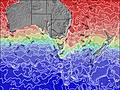
11.2°COverall Picnic Bay (Wilsons Promontory) Surf Consistency and Wind Distribution in Luglio


Surf stats for Picnic Bay (Wilsons Promontory): see the swell variation by month.

Wind stats for Picnic Bay (Wilsons Promontory): see the variation in direction and stength by month.
foto dall' album
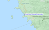
Contorni: Strade e fiumi: seleziona un surf break dal menu 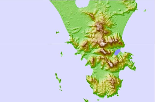
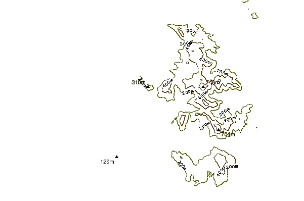
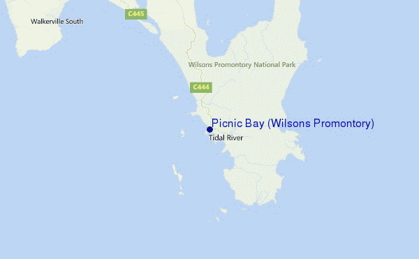
Utilizzare questa mappa sollievo per navigare VIC - East Coast surf breaks e stazioni di marea che si trovano nella zona diPicnic Bay (Wilsons Promontory)
Altri surf breaks più vicini al Picnic Bay (Wilsons Promontory):
(clicca sul nome del luogo per maggiori informazioni)- Closest località surf1 mi
- Second closest località surf2 mi
- Third closest località surf2 mi
- Fourth closest località surf3 mi
- Fifth closest località surf4 mi
Onda boe più vicina a Picnic Bay (Wilsons Promontory):
- Closest Onda boa224 mi
- Second closest Onda boa244 mi
- Third closest Onda boa319 mi
- Fourth closest Onda boa409 mi
- Fifth closest Onda boa461 mi
Stazioni di marea più vicina alla Picnic Bay (Wilsons Promontory):
- Closest marea stazioneGreat Glennie Island6 mi
- Second closest marea stazioneRabbit Island14 mi
- Third closest marea stazioneWaratah Bay19 mi
- Fourth closest marea stazionePort Welshpool24 mi
- Fifth closest marea stazionePhillip Island68 mi
Airports
- The closest passenger airport to Picnic Bay (Wilsons Promontory) is Melbourne Moorabbin Airport (MBW) in Australia, 155 km (96 miles) away (directly).
- The second nearest airport to Picnic Bay (Wilsons Promontory) is Melbourne Essendon Airport (MEB), also in Australia, 188 km (117 miles) away.
- Third is Avalon Airport (AVV) in Australia, 192 km (119 miles) away.
- Melbourne International Airport (MEL) in Australia is 196 km (122 miles) away.
- Launceston Airport (LST), also in Australia is the fifth nearest airport to Picnic Bay (Wilsons Promontory) and is 292 km (181 miles) away.
- /breaks/Picnic-Bay/forecasts/latest
 Nearest