
Pulau Pinang Surf Guide
Pulau Pinang in Banyak Islands is an exposed reef break that has quite reliable surf. May-Oct (Dry Season) is the best time of year for waves. Works best in offshore winds from the southwest. Groundswells more frequent than windswells and the best swell direction is from the south. A reef breaks right. Surfable at all stages of the tide. It very rarely gets crowded here. Watch out for rocks.
Pulau Pinang Spot Info
| Type: | Rating: | Reliability: | Todays Sea Temp*: |
|---|---|---|---|
| fairly consistent | 30.0°C*ocean temperature recorded from satellite |
Surfing Pulau Pinang:
The best conditions reported for surf at Pulau Pinang occur when a South swell combines with an offshore wind direction from the Southwest.

Previsioni Energia d'onda (Potenza): 12hrs


Pulau Pinang Surf:
Saturday, 18 July 2026, 15:41 Local time| Sabato 18 | Dom | |||
| 4PM | 7PM | 10PM | 1AM | |
| Wave (m) | ||||
| Periodo (s) | 14 | 14 | 14 | 14 |
| Vento (km/h) | ||||
| Stato del vento | cross- off |
cross- off |
cross- on |
on |
- /breaks/Pulau-Pinang/forecasts/latest
Pulau Pinang Surf Guide
Pulau Pinang in Banyak Islands is an exposed reef break that has quite reliable surf. May-Oct (Dry Season) is the best time of year for waves. Works best in offshore winds from the southwest. Groundswells more frequent than windswells and the best swell direction is from the south. A reef breaks right. Surfable at all stages of the tide. It very rarely gets crowded here. Watch out for rocks.
Pulau Pinang Spot Info
Type: Rating: Reliability: Todays Sea Temp*:  Reef
Reef 5
5fairly consistent 30.0°C*ocean temperature recorded from satelliteSurfing Pulau Pinang:
The best conditions reported for surf at Pulau Pinang occur when a South swell combines with an offshore wind direction from the Southwest.
Previsioni Energia d'onda (Potenza): 12hrs
Utilizzare la scheda di navigazione in alto per visualizzare Pulau Pinang temperatura del mare, Pulau Pinang fotografie, Pulau Pinang dettagliate previsioni onde, il vento e le previsioni meteo, Pulau Pinang webcam, vento corrente da Banyak Islands stazioni meteo e Pulau Pinang previsioni marea. Il link Indonesia mappe maree apre l'immagine grande, che mostra Indonesia e dei mari circostanti. Queste mappe possono essere animate per mostrare le diverse componenti del moto ondoso, energia delle onde, periodo d'onda, altezza delle onde, insieme con le previsioni del vento e meteo, meteo corrente e osservazioni sullo stato del mare dal Indonesia onda-boe, le navi passanti e stazioni meteo costiere. Ciascuna delle pagine di previsioni per questo surf break rappresenta uno strumento di wavefinder globale e regionale per individuare le migliori condizioni di surf nella zona intorno Pulau Pinang.
Pulau Pinang Surf:
Saturday, 18 July 2026, 15:41 Local timeSabato 18 Dom 4PM 7PM 10PM 1AM Wave (m) Periodo (s) 14 14 14 14 Vento (km/h) Stato del vento cross-
offcross-
offcross-
onon - /breaks/Pulau-Pinang/forecasts/latest
- /breaks/Pulau-Pinang/forecasts/latest/six_day
Pulau Pinang Surf Guide
Pulau Pinang in Banyak Islands is an exposed reef break that has quite reliable surf. May-Oct (Dry Season) is the best time of year for waves. Works best in offshore winds from the southwest. Groundswells more frequent than windswells and the best swell direction is from the south. A reef breaks right. Surfable at all stages of the tide. It very rarely gets crowded here. Watch out for rocks.
Pulau Pinang Spot Info
Type: Rating: Reliability: Todays Sea Temp*: Reef5fairly consistent 30.0°C*ocean temperature recorded from satelliteSurfing Pulau Pinang:
The best conditions reported for surf at Pulau Pinang occur when a South swell combines with an offshore wind direction from the Southwest.
Previsioni Energia d'onda (Potenza): 12hrs
Utilizzare la scheda di navigazione in alto per visualizzare Pulau Pinang temperatura del mare, Pulau Pinang fotografie, Pulau Pinang dettagliate previsioni onde, il vento e le previsioni meteo, Pulau Pinang webcam, vento corrente da Banyak Islands stazioni meteo e Pulau Pinang previsioni marea. Il link Indonesia mappe maree apre l'immagine grande, che mostra Indonesia e dei mari circostanti. Queste mappe possono essere animate per mostrare le diverse componenti del moto ondoso, energia delle onde, periodo d'onda, altezza delle onde, insieme con le previsioni del vento e meteo, meteo corrente e osservazioni sullo stato del mare dal Indonesia onda-boe, le navi passanti e stazioni meteo costiere. Ciascuna delle pagine di previsioni per questo surf break rappresenta uno strumento di wavefinder globale e regionale per individuare le migliori condizioni di surf nella zona intorno Pulau Pinang.
Pulau Pinang Surf:
Saturday, 18 July 2026, 15:41 Local timeSabato 18 Dom 4PM 7PM 10PM 1AM Wave (m) Periodo (s) 14 14 14 14 Vento (km/h) Stato del vento cross-
offcross-
offcross-
onon - /breaks/Pulau-Pinang/forecasts/latest
Pulau Pinang Surf Guide
Pulau Pinang in Banyak Islands is an exposed reef break that has quite reliable surf. May-Oct (Dry Season) is the best time of year for waves. Works best in offshore winds from the southwest. Groundswells more frequent than windswells and the best swell direction is from the south. A reef breaks right. Surfable at all stages of the tide. It very rarely gets crowded here. Watch out for rocks.
Pulau Pinang Spot Info
Type: Rating: Reliability: Todays Sea Temp*: Reef5fairly consistent 30.0°C*ocean temperature recorded from satelliteSurfing Pulau Pinang:
The best conditions reported for surf at Pulau Pinang occur when a South swell combines with an offshore wind direction from the Southwest.
Previsioni Energia d'onda (Potenza): 12hrs
Utilizzare la scheda di navigazione in alto per visualizzare Pulau Pinang temperatura del mare, Pulau Pinang fotografie, Pulau Pinang dettagliate previsioni onde, il vento e le previsioni meteo, Pulau Pinang webcam, vento corrente da Banyak Islands stazioni meteo e Pulau Pinang previsioni marea. Il link Indonesia mappe maree apre l'immagine grande, che mostra Indonesia e dei mari circostanti. Queste mappe possono essere animate per mostrare le diverse componenti del moto ondoso, energia delle onde, periodo d'onda, altezza delle onde, insieme con le previsioni del vento e meteo, meteo corrente e osservazioni sullo stato del mare dal Indonesia onda-boe, le navi passanti e stazioni meteo costiere. Ciascuna delle pagine di previsioni per questo surf break rappresenta uno strumento di wavefinder globale e regionale per individuare le migliori condizioni di surf nella zona intorno Pulau Pinang.
Pulau Pinang Surf:
Saturday, 18 July 2026, 15:41 Local timeSabato 18 Dom 4PM 7PM 10PM 1AM Wave (m) Periodo (s) 14 14 14 14 Vento (km/h) Stato del vento cross-
offcross-
offcross-
onon Tide Times:
Per Bay of Plenty, %{dist} %{km} da %{location}.
PROSSIMA È ALLE (ora locale) rimanente alta marea bassa marea Pulau Pinang Tide Times and Tide Chart
Live Weather:
At Medan/Polonia Airport, 221 km from Pulau Pinang.
light winds from the WNW
(km/h)
Dry and partly cloudyAir temperature
26°COverall Pulau Pinang Surf Consistency and Wind Distribution in Luglio


Wind stats for Pulau Pinang: see the variation in direction and stength by month.
foto dall' album
Contorni: Strade e fiumi: seleziona un surf break dal menu 


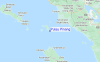
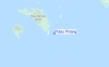
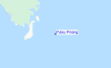
Utilizzare questa mappa sollievo per navigare Banyak Islands surf breaks e stazioni di marea che si trovano nella zona diPulau Pinang
Altri surf breaks più vicini al Pulau Pinang:
(clicca sul nome del luogo per maggiori informazioni)- Closest località surf4 mi
- Second closest località surf7 mi
- Third closest località surf21 mi
- Fourth closest località surf77 mi
- Fifth closest località surf78 mi
Onda boe più vicina a Pulau Pinang:
- Closest Onda boa2359 mi
- Second closest Onda boa2437 mi
- Third closest Onda boa2616 mi
- Fourth closest Onda boa2631 mi
- Fifth closest Onda boa2797 mi
Stazioni di marea più vicina alla Pulau Pinang:
- Closest marea stazioneSinabang76 mi
- Second closest marea stazioneSibolga98 mi
- Third closest marea stazionePangkalan Brandan150 mi
- Fourth closest marea stazioneBelawan154 mi
- Fifth closest marea stazioneTanjungtiram155 mi
Airports
- The nearest passenger airport to Pulau Pinang is Binaka (Gunung Sitoli) Airport (GNS) in Indonesia, which is 103 km (64 miles) away (directly).
- The second closest airport to Pulau Pinang is Polonia (Medan) Airport (MES), also in Indonesia, 221 km (137 miles) away.

- /breaks/Pulau-Pinang/forecasts/latest


 Nearest