
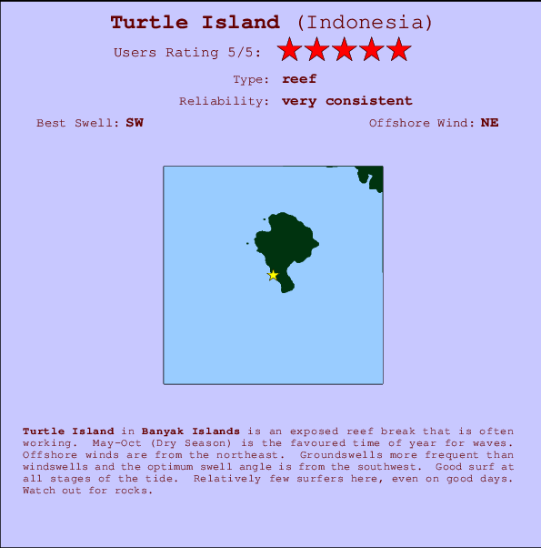
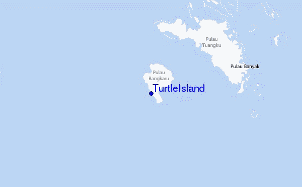
Turtle Island Surf Guide
TurtleIsland in Banyak Islands is an exposed reef break that has very consistent waves. May-Oct (Dry Season) is the optimum time of year for waves. Offshore winds blow from the northeast. Clean groundswells prevail and the ideal swell direction is from the southwest. A reef breaks left. Good surf at all stages of the tide. Rarely crowded here. Watch out for rocks.
Turtle Island Spot Info
| Type: | Rating: | Reliability: | Todays Sea Temp*: |
|---|---|---|---|
| very consistent | 30.1°C*ocean temperature recorded from satellite |
Surfing Turtle Island:
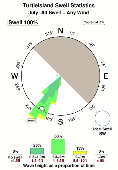
The best conditions reported for surf at Turtle Island occur when a Southwest swell combines with an offshore wind direction from the Northeast.

Previsioni Energia d'onda (Potenza): 12hrs


Turtle Island Surf:
Saturday, 18 July 2026, 17:14 Local time| Sabato 18 | Dom | |||
| 4PM | 7PM | 10PM | 1AM | |
| Wave (m) | ||||
| Periodo (s) | 14 | 14 | 14 | 14 |
| Vento (km/h) | ||||
| Stato del vento | cross- on |
cross | off | cross- off |
- /breaks/Turtle-Island/forecasts/latest
Turtle Island Surf Guide
TurtleIsland in Banyak Islands is an exposed reef break that has very consistent waves. May-Oct (Dry Season) is the optimum time of year for waves. Offshore winds blow from the northeast. Clean groundswells prevail and the ideal swell direction is from the southwest. A reef breaks left. Good surf at all stages of the tide. Rarely crowded here. Watch out for rocks.
Turtle Island Spot Info
Type: Rating: Reliability: Todays Sea Temp*:  Reef
Reef 5
5very consistent 30.1°C*ocean temperature recorded from satelliteSurfing Turtle Island:
The best conditions reported for surf at Turtle Island occur when a Southwest swell combines with an offshore wind direction from the Northeast.
Previsioni Energia d'onda (Potenza): 12hrs
Utilizzare la scheda di navigazione in alto per visualizzare Turtle Island temperatura del mare, Turtle Island fotografie, Turtle Island dettagliate previsioni onde, il vento e le previsioni meteo, Turtle Island webcam, vento corrente da Banyak Islands stazioni meteo e Turtle Island previsioni marea. Il link Indonesia mappe maree apre l'immagine grande, che mostra Indonesia e dei mari circostanti. Queste mappe possono essere animate per mostrare le diverse componenti del moto ondoso, energia delle onde, periodo d'onda, altezza delle onde, insieme con le previsioni del vento e meteo, meteo corrente e osservazioni sullo stato del mare dal Indonesia onda-boe, le navi passanti e stazioni meteo costiere. Ciascuna delle pagine di previsioni per questo surf break rappresenta uno strumento di wavefinder globale e regionale per individuare le migliori condizioni di surf nella zona intorno Turtle Island.
Turtle Island Surf:
Saturday, 18 July 2026, 17:14 Local timeSabato 18 Dom 4PM 7PM 10PM 1AM Wave (m) Periodo (s) 14 14 14 14 Vento (km/h) Stato del vento cross-
oncross off cross-
off- /breaks/Turtle-Island/forecasts/latest
- /breaks/Turtle-Island/forecasts/latest/six_day
Turtle Island Surf Guide
TurtleIsland in Banyak Islands is an exposed reef break that has very consistent waves. May-Oct (Dry Season) is the optimum time of year for waves. Offshore winds blow from the northeast. Clean groundswells prevail and the ideal swell direction is from the southwest. A reef breaks left. Good surf at all stages of the tide. Rarely crowded here. Watch out for rocks.
Turtle Island Spot Info
Type: Rating: Reliability: Todays Sea Temp*: Reef5very consistent 30.1°C*ocean temperature recorded from satelliteSurfing Turtle Island:
The best conditions reported for surf at Turtle Island occur when a Southwest swell combines with an offshore wind direction from the Northeast.
Previsioni Energia d'onda (Potenza): 12hrs
Utilizzare la scheda di navigazione in alto per visualizzare Turtle Island temperatura del mare, Turtle Island fotografie, Turtle Island dettagliate previsioni onde, il vento e le previsioni meteo, Turtle Island webcam, vento corrente da Banyak Islands stazioni meteo e Turtle Island previsioni marea. Il link Indonesia mappe maree apre l'immagine grande, che mostra Indonesia e dei mari circostanti. Queste mappe possono essere animate per mostrare le diverse componenti del moto ondoso, energia delle onde, periodo d'onda, altezza delle onde, insieme con le previsioni del vento e meteo, meteo corrente e osservazioni sullo stato del mare dal Indonesia onda-boe, le navi passanti e stazioni meteo costiere. Ciascuna delle pagine di previsioni per questo surf break rappresenta uno strumento di wavefinder globale e regionale per individuare le migliori condizioni di surf nella zona intorno Turtle Island.
Turtle Island Surf:
Saturday, 18 July 2026, 17:14 Local timeSabato 18 Dom 4PM 7PM 10PM 1AM Wave (m) Periodo (s) 14 14 14 14 Vento (km/h) Stato del vento cross-
oncross off cross-
off- /breaks/Turtle-Island/forecasts/latest
Turtle Island Surf Guide
TurtleIsland in Banyak Islands is an exposed reef break that has very consistent waves. May-Oct (Dry Season) is the optimum time of year for waves. Offshore winds blow from the northeast. Clean groundswells prevail and the ideal swell direction is from the southwest. A reef breaks left. Good surf at all stages of the tide. Rarely crowded here. Watch out for rocks.
Turtle Island Spot Info
Type: Rating: Reliability: Todays Sea Temp*: Reef5very consistent 30.1°C*ocean temperature recorded from satelliteSurfing Turtle Island:
The best conditions reported for surf at Turtle Island occur when a Southwest swell combines with an offshore wind direction from the Northeast.
Previsioni Energia d'onda (Potenza): 12hrs
Utilizzare la scheda di navigazione in alto per visualizzare Turtle Island temperatura del mare, Turtle Island fotografie, Turtle Island dettagliate previsioni onde, il vento e le previsioni meteo, Turtle Island webcam, vento corrente da Banyak Islands stazioni meteo e Turtle Island previsioni marea. Il link Indonesia mappe maree apre l'immagine grande, che mostra Indonesia e dei mari circostanti. Queste mappe possono essere animate per mostrare le diverse componenti del moto ondoso, energia delle onde, periodo d'onda, altezza delle onde, insieme con le previsioni del vento e meteo, meteo corrente e osservazioni sullo stato del mare dal Indonesia onda-boe, le navi passanti e stazioni meteo costiere. Ciascuna delle pagine di previsioni per questo surf break rappresenta uno strumento di wavefinder globale e regionale per individuare le migliori condizioni di surf nella zona intorno Turtle Island.
Turtle Island Surf:
Saturday, 18 July 2026, 17:14 Local timeSabato 18 Dom 4PM 7PM 10PM 1AM Wave (m) Periodo (s) 14 14 14 14 Vento (km/h) Stato del vento cross-
oncross off cross-
offTide Times:
A Turtle Island (0 km).
PROSSIMA È ALLE (ora locale) rimanente alta marea bassa marea Turtle Island Tide Times and Tide Chart
Live Weather:
At Medan/Polonia Airport, 244 km from Turtle Island.
light winds from the W
(km/h)
Dry and partly cloudyAir temperature
27°COverall Turtle Island Surf Consistency and Wind Distribution in Luglio


Wind stats for Turtle Island: see the variation in direction and stength by month.
foto dall' album
Contorni: Strade e fiumi: seleziona un surf break dal menu 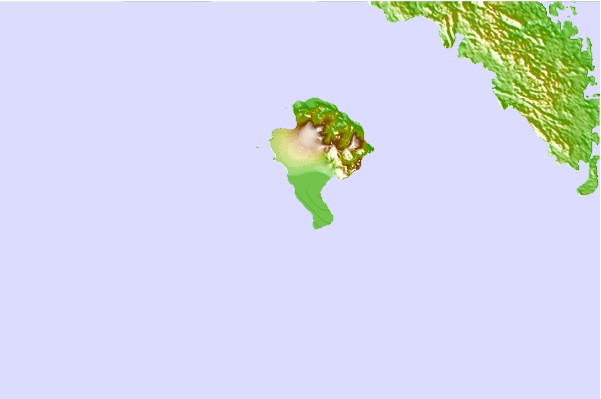
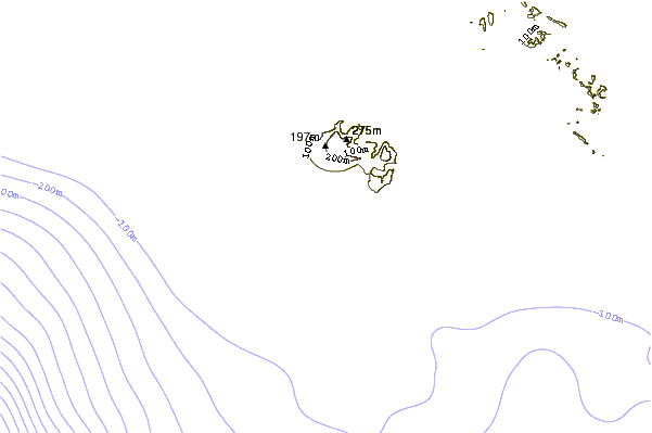

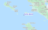
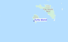
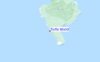
Utilizzare questa mappa sollievo per navigare Banyak Islands surf breaks e stazioni di marea che si trovano nella zona diTurtle Island
Altri surf breaks più vicini al Turtle Island:
(clicca sul nome del luogo per maggiori informazioni)- Closest località surf17 mi
- Second closest località surf19 mi
- Third closest località surf21 mi
- Fourth closest località surf58 mi
- Fifth closest località surf58 mi
Onda boe più vicina a Turtle Island:
- Closest Onda boa2374 mi
- Second closest Onda boa2452 mi
- Third closest Onda boa2631 mi
- Fourth closest Onda boa2647 mi
- Fifth closest Onda boa2812 mi
Stazioni di marea più vicina alla Turtle Island:
- Closest marea stazioneSinabang58 mi
- Second closest marea stazioneSibolga118 mi
- Third closest marea stazioneMeulaboh160 mi
- Fourth closest marea stazionePangkalan Brandan160 mi
- Fifth closest marea stazioneTanjungtiram165 mi
Airports
- The nearest passenger airport to TurtleIsland is Binaka (Gunung Sitoli) Airport (GNS) in Indonesia, which is 118 km (73 miles) away (directly).
- The second closest airport to TurtleIsland is Polonia (Medan) Airport (MES), also in Indonesia, 244 km (152 miles) away.
- /breaks/Turtle-Island/forecasts/latest
 Nearest