
Previsioni:

Previsione a breve termineper lo più asciutto. Warm (Max 24°C Venerdì pomeriggio, Min 21°C Venerdì notte). Venti decrescenti (venti freschi da S Venerdì pomeriggio, venti deboli da S per lunedì mattina). | |||||||||||||||||||
Ven 31 | Sabato 1 | Domenica 2 | |||||||||||||||||
4 PM | 7 PM | 10 PM | 1 AM | 4 AM | 7 AM | 10 AM | 1 PM | 4 PM | 7 PM | 10 PM | 1 AM | 4 AM | 7 AM | 10 AM | 1 PM | 4 PM | 7 PM | 10 PM | |
Mappa dell'altezza del moto ondoso |  | 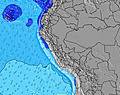 | 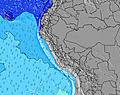 | 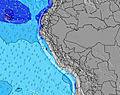 | 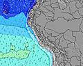 |  |  | ||||||||||||
Onda Altezza (m) Direzione Periodo (s) | SW 12 | SW 12 | SW 12 | SW 12 | SW 11 | SW 11 | SW 11 | SW 12 | SW 12 | SW 11 | SW 11 | SW 11 | SW 11 | SW 11 | SW 11 | SW 10 | WSW 13 | WSW 13 | WSW 13 |
Grafico delle onde | |||||||||||||||||||
114 | 112 | 110 | 65 | 123 | 60 | 103 | 137 | 86 | 86 | 147 | 114 | 90 | 80 | 75 | 71 | 69 | 69 | 68 | |
Vento (km/h) | |||||||||||||||||||
Stato del vento onshore cross-onshore cross-shore cross-offshore offshore piatto | cross-off | cross-off | cross-off | cross-off | cross-off | cross-off | cross-off | cross-off | cross-off | cross-off | cross-off | cross-off | cross-off | cross-off | cross-off | cross | cross-off | cross-off | cross-off |
Alta Marea | 5:12PM1.37m | 5:51AM1.58m | 5:49PM1.37m | 6:21AM1.58m | 6:27PM1.36m | ||||||||||||||
Basso Marea | 11:25PM0.19m | 12:03PM0.40m | 11:57PM0.24m | 12:36PM0.38m | |||||||||||||||
— | — | — | — | 6:33 | — | — | — | — | — | — | — | 6:33 | — | — | — | — | — | — | |
6:25 | — | — | — | — | — | — | — | 6:25 | — | — | — | — | — | — | — | 6:25 | — | — | |
mm | — | — | — | — | — | — | — | — | — | — | — | — | — | — | — | — | — | — | — |
Temp. °C | 24 | 23 | 23 | 22 | 22 | 21 | 23 | 24 | 23 | 22 | 22 | 22 | 21 | 21 | 23 | 24 | 23 | 22 | 22 |
Gelo °C | 21 | 21 | 22 | 22 | 22 | 21 | 22 | 22 | 20 | 19 | 20 | 21 | 21 | 21 | 24 | 23 | 20 | 19 | 20 |
Onda 1 Altezza (m) Direzione Periodo (s) | SW 12 | SW 12 | SW 12 | SW 12 | SW 11 | SW 11 | SW 11 | SW 16 | SW 12 | SW 11 | SW 11 | SW 11 | SW 11 | SW 11 | SW 11 | WSW 14 | WSW 13 | WSW 13 | WSW 13 |
114 | 112 | 110 | 65 | 123 | 60 | 103 | 63 | 86 | 80 | 147 | 114 | 90 | 71 | 71 | 71 | 69 | 69 | 68 | |
Onda 2 Altezza (m) Direzione Periodo (s) | WSW 18 | WSW 17 | SW 6 | SSW 8 | WSW 16 | SSW 7 | WSW 16 | NW 11 | SW 15 | WSW 15 | WSW 15 | WSW 15 | WSW 14 | WSW 14 | WSW 14 | WNW 11 | SW 10 | SW 10 | SW 10 |
30 | 29 | 9 | 32 | 25 | 19 | 50 | 5 | 58 | 86 | 85 | 84 | 82 | 80 | 75 | 12 | 34 | 34 | 24 | |
Onda 3 Altezza (m) Direzione Periodo (s) | W 11 | S 11 | WSW 17 | WSW 16 | NW 12 | WSW 16 | NW 11 | SW 19 | WNW 11 | WNW 11 | WNW 11 | WNW 11 | WNW 11 | WNW 11 | WNW 11 | W 12 | WNW 11 | WNW 11 | WNW 11 |
3 | 2 | 27 | 26 | 6 | 50 | 5 | 15 | 12 | 12 | 12 | 13 | 12 | 12 | 12 | 11 | 12 | 12 | 11 | |
onde vento Altezza (m) Direzione Periodo (s) | SSW 4 | SSW 4 | S 3 | — | — | — | — | SW 12 | SSW 4 | SSW 4 | — | — | — | — | — | SW 10 | SSW 4 | SSW 4 | SSW 3 |
10 | 14 | 4 | — | — | — | — | 137 | 11 | 7 | — | — | — | — | — | 68 | 8 | 7 | 7 | |
Il più vicino Offshore or Glassy | |||||||||||||||||||
Distanza (km) | 896 | 896 | 837 | 201 | 151 | 150 | 88 | 837 | 768 | 768 | 234 | 187 | 187 | 179 | 0 | 837 | 837 | 238 | 234 |
Migliori previsioni per le condizioni d'onda in Piura | |||||||||||||||||||
Migliori previsioni per le condizioni d'onda in Peru | |||||||||||||||||||
Trova Onde Globale | |||||||||||||||||||
- Map Icons:
 Break
Break Live Wave Height (m)
 Live Wind Speed (km/h)
 Surf Rating (10 Max)
 Ocean Swells (m)
- Wind Speed (km/h)
Widget Free Surf-Forecast.com per il tuo sito
La relazione di surf / widget meteo è disponibile qui sotto per incorporare su siti esterni a titolo gratuito e fornisce una sintesi delle nostre Bayobar - Punta Aguja previsione surf. Basta prendere il frammento di codice html da noi fornito e copiarlo nel proprio sito. È possibile scegliere la lingua preferita e unità metriche / imperiali per il feed delle previsioni surf per soddisfare le esigenze degli utenti del vostro sito .... Clicca qui per ottenere il codice.
 Nearest