
Previsioni:

Previsione a breve terminepioggia leggera (Totale 5mm), per lo più che cade Lunedì notte. Very mild (Max 19°C Lunedì pomeriggio, Min 15°C Lunedì mattina). Venti decrescenti (raffiche di vento da ONO Lunedì notte, calma per mercoledì notte). | ||||||||||||||||||||||||
Lunedì 3 | Martedì 4 | Mercoledì 5 | ||||||||||||||||||||||
2 AM | 5 AM | 8 AM | 11 AM | 2 PM | 5 PM | 8 PM | 11 PM | 2 AM | 5 AM | 8 AM | 11 AM | 2 PM | 5 PM | 8 PM | 11 PM | 2 AM | 5 AM | 8 AM | 11 AM | 2 PM | 5 PM | 8 PM | 11 PM | |
Mappa dell'altezza del moto ondoso |  | 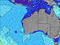 | 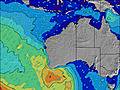 |  | 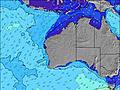 | 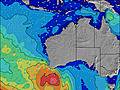 |  | 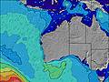 | 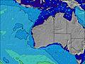 | |||||||||||||||
Onda Altezza (m) Direzione Periodo (s) | WSW 13 | WSW 14 | WSW 14 | WSW 14 | WSW 14 | WSW 15 | WSW 16 | WSW 16 | WSW 15 | WSW 15 | WSW 19 | WSW 19 | WSW 18 | WSW 17 | WSW 17 | WSW 16 | WSW 16 | WSW 16 | WSW 16 | WSW 16 | WSW 16 | WSW 16 | WSW 16 | WSW 16 |
Grafico delle onde | ||||||||||||||||||||||||
850 | 733 | 754 | 692 | 577 | 530 | 291 | 612 | 566 | 530 | 904 | 2218 | 3102 | 2993 | 3053 | 2686 | 2271 | 1875 | 2133 | 2931 | 3745 | 4001 | 4267 | 4267 | |
Vento (km/h) | ||||||||||||||||||||||||
Stato del vento onshore cross-onshore cross-shore cross-offshore offshore piatto | off | off | cross-off | cross-off | cross-off | cross-off | cross | cross | cross-on | on | on | cross-on | on | cross-on | on | cross-on | cross-on | cross-on | cross-on | cross | cross | cross | glassy | off |
Alta Marea | 00:43AM0.55m | 11:36AM0.62m | 1:00AM0.62m | 11:55AM0.54m | 1:36AM0.72m | |||||||||||||||||||
Basso Marea | 5:17AM0.47m | 6:00PM0.41m | 6:48AM0.49m | 5:32PM0.44m | 4:31PM0.45m | |||||||||||||||||||
— | 7:05 | — | — | — | — | — | — | — | 7:05 | — | — | — | — | — | — | — | 7:03 | — | — | — | — | — | — | |
— | — | — | — | — | 5:42 | — | — | — | — | — | — | — | 5:43 | — | — | — | — | — | — | — | 5:44 | — | — | |
mm | — | — | — | — | — | — | — | 1 | 2 | 2 | — | — | — | — | — | — | — | — | — | — | — | — | — | — |
Temp. °C | 14 | 14 | 15 | 16 | 17 | 19 | 19 | 18 | 17 | 17 | 17 | 17 | 16 | 17 | 16 | 15 | 16 | 16 | 16 | 16 | 16 | 17 | 17 | 17 |
Gelo °C | 8 | 8 | 9 | 11 | 13 | 14 | 12 | 13 | 12 | 12 | 13 | 12 | 11 | 12 | 11 | 12 | 12 | 13 | 13 | 13 | 13 | 15 | 16 | 15 |
Onda 1 Altezza (m) Direzione Periodo (s) | WSW 13 | WSW 14 | WSW 14 | WSW 14 | WSW 14 | WSW 15 | WSW 12 | WSW 16 | WSW 15 | W 7 | WSW 14 | WSW 19 | WSW 18 | WSW 17 | WSW 17 | WSW 16 | WSW 16 | WSW 16 | WSW 16 | WSW 16 | WSW 16 | WSW 16 | WSW 16 | WSW 16 |
850 | 733 | 754 | 692 | 577 | 530 | 230 | 612 | 566 | 127 | 494 | 2218 | 3102 | 2993 | 3053 | 2686 | 2271 | 1875 | 2133 | 2931 | 3745 | 4001 | 4267 | 4267 | |
Onda 2 Altezza (m) Direzione Periodo (s) | — | — | — | — | — | — | WSW 16 | WSW 22 | WSW 6 | WSW 15 | WSW 19 | W 6 | — | — | WNW 6 | WNW 6 | WNW 6 | — | — | — | — | — | — | — |
— | — | — | — | — | — | 291 | 47 | 42 | 530 | 904 | 81 | — | — | 22 | 14 | 13 | — | — | — | — | — | — | — | |
Onda 3 Altezza (m) Direzione Periodo (s) | — | — | — | — | — | — | — | — | WSW 21 | WSW 20 | WSW 7 | — | — | — | — | — | — | — | — | — | — | — | — | — |
— | — | — | — | — | — | — | — | 178 | 364 | 96 | — | — | — | — | — | — | — | — | — | — | — | — | — | |
onde vento Altezza (m) Direzione Periodo (s) | ENE 3 | NE 3 | NNE 4 | N 4 | NNW 4 | NNW 3 | NW 4 | W 5 | NW 4 | — | — | — | — | — | — | — | — | — | — | — | — | — | — | — |
4 | 5 | 10 | 6 | 4 | 4 | 22 | 34 | 20 | — | — | — | — | — | — | — | — | — | — | — | — | — | — | — | |
Il più vicino Offshore or Glassy | ||||||||||||||||||||||||
Distanza (km) | 35 | 35 | 30 | 6 | 258 | 258 | 258 | 317 | 346 | 209 | 143 | 371 | 371 | 361 | 310 | 300 | 300 | 143 | 29 | 6 | 6 | 360 | 0 | 0 |
Migliori previsioni per le condizioni d'onda in Rottnest Island | ||||||||||||||||||||||||
Migliori previsioni per le condizioni d'onda in Australia | ||||||||||||||||||||||||
Trova Onde Globale | ||||||||||||||||||||||||
- Map Icons:
 Break
Break Live Wave Height (m)
 Live Wind Speed (km/h)
 Surf Rating (10 Max)
 Ocean Swells (m)
- Wind Speed (km/h)
Widget Free Surf-Forecast.com per il tuo sito
La relazione di surf / widget meteo è disponibile qui sotto per incorporare su siti esterni a titolo gratuito e fornisce una sintesi delle nostre Radar Reef previsione surf. Basta prendere il frammento di codice html da noi fornito e copiarlo nel proprio sito. È possibile scegliere la lingua preferita e unità metriche / imperiali per il feed delle previsioni surf per soddisfare le esigenze degli utenti del vostro sito .... Clicca qui per ottenere il codice.
 Nearest