
Previsioni:

Previsione a breve termineper lo più asciutto. Warm (Max 20°C Domenica mattina, Min 17°C Venerdì notte). Vento sarà generalmente leggero. | ||||||||||||||||||||||||
Sabato 18 | Domenica 19 | Lunedì 20 | ||||||||||||||||||||||
1 AM | 4 AM | 7 AM | 10 AM | 1 PM | 4 PM | 7 PM | 10 PM | 1 AM | 4 AM | 7 AM | 10 AM | 1 PM | 4 PM | 7 PM | 10 PM | 1 AM | 4 AM | 7 AM | 10 AM | 1 PM | 4 PM | 7 PM | 10 PM | |
Mappa dell'altezza del moto ondoso | 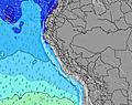 | 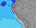 | 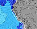 | 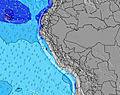 | 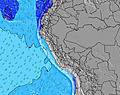 | 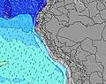 | 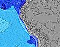 | 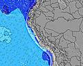 | 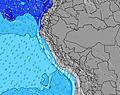 | |||||||||||||||
Onda Altezza (m) Direzione Periodo (s) | SSW 12 | SW 12 | SSW 12 | SW 12 | SW 11 | SW 11 | SW 11 | SW 12 | SW 12 | SW 12 | SW 11 | SW 11 | SW 13 | SW 12 | SW 12 | SW 12 | SW 11 | SW 11 | SW 11 | SW 11 | WSW 13 | SW 13 | SW 13 | SW 12 |
Grafico delle onde | ||||||||||||||||||||||||
397 | 341 | 390 | 400 | 373 | 403 | 373 | 393 | 433 | 469 | 398 | 303 | 732 | 724 | 593 | 583 | 501 | 483 | 483 | 326 | 215 | 591 | 238 | 347 | |
Vento (km/h) | ||||||||||||||||||||||||
Stato del vento onshore cross-onshore cross-shore cross-offshore offshore piatto | cross-on | cross-on | cross | cross-on | cross-on | cross-on | cross-on | cross-on | cross-on | cross | cross | cross-on | cross-on | cross-on | cross-on | cross-on | cross | glassy | cross-on | cross-on | cross-on | cross-on | cross | cross |
Alta Marea | 8:34AM1.03m | 8:54PM0.67m | 9:15AM0.94m | 10:02PM0.67m | 9:54AM0.84m | |||||||||||||||||||
Basso Marea | 1:40AM0.14m | 3:14PM0.24m | 2:31AM0.25m | 4:00PM0.24m | 3:29AM0.36m | 4:47PM0.24m | ||||||||||||||||||
— | 6:30 | — | — | — | — | — | — | — | 6:30 | — | — | — | — | — | — | — | 6:30 | — | — | — | — | — | — | |
— | — | — | — | — | 6:01 | — | — | — | — | — | — | — | 6:02 | — | — | — | — | — | — | — | 6:02 | — | — | |
mm | — | — | — | — | — | — | — | — | — | — | — | — | — | — | — | — | — | — | — | — | — | — | — | — |
Temp. °C | 18 | 17 | 17 | 19 | 19 | 19 | 18 | 18 | 17 | 17 | 17 | 19 | 20 | 19 | 18 | 18 | 18 | 18 | 17 | 19 | 20 | 20 | 18 | 18 |
Gelo °C | 17 | 16 | 16 | 19 | 17 | 17 | 16 | 17 | 16 | 16 | 17 | 19 | 20 | 19 | 17 | 16 | 16 | 19 | 16 | 19 | 20 | 18 | 16 | 16 |
Onda 1 Altezza (m) Direzione Periodo (s) | SSW 12 | SW 12 | SSW 12 | SW 12 | SW 11 | SW 11 | SW 11 | SW 12 | SW 12 | SW 12 | SW 11 | SW 11 | SW 13 | SW 12 | SW 12 | SW 12 | SW 11 | SW 11 | SW 11 | SW 11 | SW 10 | SW 13 | SW 10 | SW 12 |
397 | 341 | 390 | 400 | 373 | 403 | 373 | 393 | 433 | 469 | 398 | 303 | 732 | 724 | 593 | 583 | 501 | 483 | 483 | 326 | 208 | 591 | 163 | 347 | |
Onda 2 Altezza (m) Direzione Periodo (s) | NW 11 | SW 17 | S 5 | S 5 | SSW 16 | SW 16 | SW 15 | SW 15 | S 4 | SSW 15 | SSW 14 | SW 13 | WSW 16 | WSW 16 | NW 10 | NW 10 | WSW 15 | WSW 15 | W 22 | WSW 13 | WSW 13 | SSW 13 | SW 13 | SW 10 |
4 | 74 | 16 | 11 | 25 | 90 | 107 | 104 | 9 | 21 | 133 | 295 | 26 | 26 | 4 | 4 | 21 | 21 | 9 | 151 | 215 | 35 | 238 | 142 | |
Onda 3 Altezza (m) Direzione Periodo (s) | — | NW 11 | SW 16 | SW 16 | WSW 15 | SW 15 | WSW 14 | WSW 13 | SW 15 | NW 10 | NW 10 | NW 10 | NW 10 | NW 10 | W 22 | W 22 | NW 10 | W 22 | NW 10 | W 21 | SSW 13 | W 21 | SSW 14 | W 20 |
— | 4 | 69 | 67 | 21 | 8 | 37 | 35 | 104 | 4 | 4 | 4 | 4 | 4 | 9 | 9 | 4 | 9 | 4 | 9 | 34 | 9 | 18 | 33 | |
onde vento Altezza (m) Direzione Periodo (s) | S 5 | S 5 | — | — | S 5 | S 5 | S 5 | S 4 | — | S 4 | S 4 | S 4 | S 4 | S 4 | S 4 | S 4 | S 4 | S 4 | S 4 | S 4 | S 4 | — | S 4 | S 4 |
15 | 16 | — | — | 11 | 11 | 16 | 10 | — | 6 | 6 | 5 | 5 | 5 | 5 | 5 | 6 | 7 | 5 | 5 | 5 | — | 6 | 7 | |
Il più vicino Offshore or Glassy | ||||||||||||||||||||||||
Distanza (km) | 52 | 52 | 52 | 96 | 96 | 101 | 52 | 96 | 52 | 52 | 52 | 96 | 96 | 96 | 52 | 52 | 52 | 0 | 52 | 52 | 96 | 52 | 52 | 52 |
Migliori previsioni per le condizioni d'onda in Ancash | ||||||||||||||||||||||||
Migliori previsioni per le condizioni d'onda in Peru | ||||||||||||||||||||||||
Trova Onde Globale | ||||||||||||||||||||||||
- Map Icons:
 Break
Break Live Wave Height (m)
 Live Wind Speed (km/h)
 Surf Rating (10 Max)
 Ocean Swells (m)
- Wind Speed (km/h)
Widget Free Surf-Forecast.com per il tuo sito
La relazione di surf / widget meteo è disponibile qui sotto per incorporare su siti esterni a titolo gratuito e fornisce una sintesi delle nostre Salinas previsione surf. Basta prendere il frammento di codice html da noi fornito e copiarlo nel proprio sito. È possibile scegliere la lingua preferita e unità metriche / imperiali per il feed delle previsioni surf per soddisfare le esigenze degli utenti del vostro sito .... Clicca qui per ottenere il codice.
 Nearest