
Previsioni:

Previsione a breve termineper lo più asciutto. Very mild (Max 17°C mercoledì notte, Min 16°C mercoledì notte). Vento sarà generalmente leggero. | ||||||||||||||||||||||||
Giovedì 16 | Venerdì 17 | Sabato 18 | ||||||||||||||||||||||
1 AM | 4 AM | 7 AM | 10 AM | 1 PM | 4 PM | 7 PM | 10 PM | 1 AM | 4 AM | 7 AM | 10 AM | 1 PM | 4 PM | 7 PM | 10 PM | 1 AM | 4 AM | 7 AM | 10 AM | 1 PM | 4 PM | 7 PM | 10 PM | |
Mappa dell'altezza del moto ondoso | 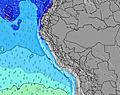 | 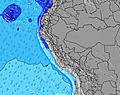 | 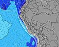 | 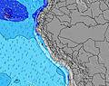 | 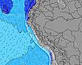 | 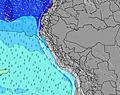 | 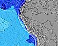 | 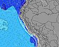 | 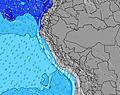 | |||||||||||||||
Onda Altezza (m) Direzione Periodo (s) | SW 13 | SSW 13 | S 3 | S 4 | S 4 | SSW 13 | SSW 13 | SSW 12 | SSW 12 | SSW 12 | SSW 13 | SSW 12 | SSW 12 | SSW 12 | SSW 18 | S 12 | S 5 | S 5 | S 5 | S 5 | S 5 | S 5 | S 5 | S 5 |
Grafico delle onde | ||||||||||||||||||||||||
0 | 0 | 6 | 6 | 6 | 862 | 848 | 797 | 739 | 668 | 679 | 534 | 451 | 443 | 31 | 76 | 27 | 22 | 27 | 28 | 21 | 27 | 21 | 15 | |
Vento (km/h) | ||||||||||||||||||||||||
Stato del vento onshore cross-onshore cross-shore cross-offshore offshore piatto | on | on | on | on | cross-on | cross-on | on | on | on | on | on | on | cross-on | on | on | on | on | on | on | on | cross-on | on | on | on |
Alta Marea | 8:00AM1.06m | 8:03PM0.53m | 8:45AM1.02m | 9:04PM0.55m | 9:29AM0.94m | |||||||||||||||||||
Basso Marea | 00:47AM-0.01m | 2:50PM0.16m | 1:40AM0.05m | 3:36PM0.15m | 2:34AM0.14m | 4:21PM0.15m | ||||||||||||||||||
— | 6:30 | — | — | — | — | — | — | — | 6:30 | — | — | — | — | — | — | — | 6:30 | — | — | — | — | — | — | |
— | — | — | — | — | 5:52 | — | — | — | — | — | — | — | 5:52 | — | — | — | — | — | — | — | 5:53 | — | — | |
mm | — | — | — | — | — | — | — | — | — | — | — | — | — | — | — | — | — | — | — | — | — | — | — | — |
Temp. °C | 16 | 16 | 16 | 17 | 17 | 17 | 16 | 16 | 16 | 16 | 16 | 16 | 17 | 17 | 16 | 16 | 16 | 16 | 16 | 17 | 17 | 17 | 16 | 16 |
Gelo °C | 15 | 14 | 14 | 16 | 15 | 14 | 14 | 14 | 13 | 13 | 14 | 14 | 14 | 14 | 13 | 13 | 13 | 15 | 13 | 15 | 14 | 14 | 14 | 14 |
Onda 1 Altezza (m) Direzione Periodo (s) | SW 13 | SSW 13 | SSW 13 | SSW 13 | SSW 13 | SSW 13 | SSW 13 | SSW 12 | SSW 12 | SSW 12 | SSW 13 | SSW 12 | SSW 12 | SSW 12 | SSW 12 | SW 12 | SSW 12 | SSW 12 | SSW 11 | SSW 11 | SW 11 | SW 11 | SW 11 | SW 11 |
867 | 946 | 1045 | 932 | 932 | 862 | 848 | 797 | 739 | 668 | 679 | 534 | 451 | 443 | 390 | 358 | 390 | 449 | 418 | 418 | 463 | 471 | 506 | 347 | |
Onda 2 Altezza (m) Direzione Periodo (s) | WNW 12 | WNW 12 | NW 12 | NW 12 | NW 12 | SW 16 | S 6 | NW 11 | NW 11 | SW 20 | NW 11 | NW 11 | SW 18 | SSW 18 | SSW 18 | S 12 | SW 16 | SW 16 | SW 16 | SSW 16 | SSW 15 | SW 15 | SW 15 | SW 14 |
14 | 14 | 6 | 6 | 6 | 66 | 3 | 5 | 5 | 15 | 5 | 5 | 51 | 32 | 31 | 76 | 95 | 94 | 91 | 162 | 150 | 109 | 106 | 293 | |
Onda 3 Altezza (m) Direzione Periodo (s) | — | — | — | — | NW 12 | NW 12 | NW 12 | NW 12 | NW 11 | NW 11 | SW 20 | NW 11 | NW 11 | NW 11 | NW 11 | NW 11 | NW 11 | WSW 16 | WSW 15 | WSW 15 | NW 11 | NW 11 | NW 10 | WSW 13 |
— | — | — | — | 6 | 6 | 5 | 5 | 5 | 5 | 16 | 5 | 5 | 5 | 5 | 5 | 5 | 24 | 21 | 21 | 4 | 4 | 4 | 70 | |
onde vento Altezza (m) Direzione Periodo (s) | — | — | S 3 | S 4 | S 4 | S 4 | S 4 | S 4 | S 3 | S 4 | S 4 | S 4 | S 4 | S 4 | S 4 | S 4 | S 5 | S 5 | S 5 | S 5 | S 5 | S 5 | S 5 | S 5 |
— | — | 6 | 6 | 6 | 10 | 7 | 4 | 6 | 10 | 15 | 12 | 12 | 17 | 17 | 24 | 27 | 22 | 27 | 28 | 21 | 27 | 21 | 15 | |
Il più vicino Offshore or Glassy | ||||||||||||||||||||||||
Distanza (km) | 55 | 139 | 10 | 139 | 139 | 139 | 139 | 10 | 55 | 55 | 55 | 139 | 139 | 139 | 55 | 55 | 55 | 10 | 55 | 55 | 139 | 139 | 10 | 55 |
Migliori previsioni per le condizioni d'onda in Ica | ||||||||||||||||||||||||
Migliori previsioni per le condizioni d'onda in Peru | ||||||||||||||||||||||||
Trova Onde Globale | ||||||||||||||||||||||||
- Map Icons:
 Break
Break Live Wave Height (m)
 Live Wind Speed (km/h)
 Surf Rating (10 Max)
 Ocean Swells (m)
- Wind Speed (km/h)
Widget Free Surf-Forecast.com per il tuo sito
La relazione di surf / widget meteo è disponibile qui sotto per incorporare su siti esterni a titolo gratuito e fornisce una sintesi delle nostre San Gallan previsione surf. Basta prendere il frammento di codice html da noi fornito e copiarlo nel proprio sito. È possibile scegliere la lingua preferita e unità metriche / imperiali per il feed delle previsioni surf per soddisfare le esigenze degli utenti del vostro sito .... Clicca qui per ottenere il codice.
 Nearest