
Previsioni:

Previsione a breve termineQualche pioggerella, più pesante durante mercoledì mattina. Very mild (Max 15°C giovedì pomeriggio, Min 12°C mercoledì notte). Vento sarà generalmente leggero. | |||||||||||||||||||||
Mar 21 | Mercoledì 22 | Giovedì 23 | |||||||||||||||||||
11 AM | 2 PM | 5 PM | 8 PM | 11 PM | 2 AM | 5 AM | 8 AM | 11 AM | 2 PM | 5 PM | 8 PM | 11 PM | 2 AM | 5 AM | 8 AM | 11 AM | 2 PM | 5 PM | 8 PM | 11 PM | |
Mappa dell'altezza del moto ondoso |  |  | 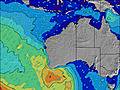 | 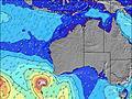 |  |  | 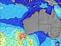 |  | |||||||||||||
Onda Altezza (m) Direzione Periodo (s) | SW 14 | SW 13 | SW 13 | SW 13 | SW 13 | SSW 14 | SSW 14 | SSW 14 | SSW 13 | SSW 15 | SSW 15 | SSW 15 | SSW 15 | SSW 15 | SSW 15 | SSW 15 | SSW 14 | SSW 14 | SSW 14 | SSW 11 | SSW 13 |
Grafico delle onde | |||||||||||||||||||||
1891 | 1708 | 1565 | 1387 | 1240 | 3083 | 4067 | 4925 | 3898 | 3626 | 2477 | 4882 | 4618 | 4326 | 4076 | 3465 | 3155 | 2831 | 2279 | 889 | 1192 | |
Vento (km/h) | |||||||||||||||||||||
Stato del vento onshore cross-onshore cross-shore cross-offshore offshore piatto | on | cross-on | on | on | on | on | on | on | cross-on | cross-on | cross-on | cross-off | glassy | glassy | cross-off | cross-off | off | off | cross-off | off | off |
Alta Marea | 10:16AM0.81m | 3:40AM0.87m | 6:47AM0.93m | ||||||||||||||||||
Basso Marea | 6:17PM0.50m | 6:18PM0.44m | 6:21PM0.40m | ||||||||||||||||||
— | — | — | — | — | — | 7:11 | — | — | — | — | — | — | — | 7:09 | — | — | — | — | — | — | |
— | — | 5:17 | — | — | — | — | — | — | — | 5:19 | — | — | — | — | — | — | — | 5:19 | — | — | |
mm | — | — | — | — | — | — | — | — | 1 | — | — | — | — | — | — | — | — | — | — | — | — |
Temp. °C | 13 | 13 | 13 | 14 | 14 | 13 | 14 | 14 | 13 | 14 | 14 | 13 | 13 | 13 | 12 | 12 | 13 | 15 | 15 | 14 | 14 |
Gelo °C | 8 | 8 | 8 | 9 | 10 | 9 | 10 | 11 | 9 | 11 | 11 | 11 | 12 | 12 | 10 | 10 | 11 | 13 | 13 | 11 | 11 |
Onda 1 Altezza (m) Direzione Periodo (s) | SW 14 | SW 13 | SW 13 | SW 13 | SW 13 | SSW 14 | SSW 14 | SSW 14 | SSW 13 | SSW 15 | SSW 13 | SSW 15 | SSW 15 | SSW 15 | SSW 15 | SSW 15 | SSW 14 | SSW 14 | SSW 14 | SSW 11 | SSW 13 |
1891 | 1708 | 1565 | 1387 | 1185 | 3083 | 4067 | 4925 | 3898 | 3626 | 2477 | 4882 | 4618 | 4326 | 4076 | 3465 | 3155 | 2831 | 2279 | 889 | 1192 | |
Onda 2 Altezza (m) Direzione Periodo (s) | S 12 | S 13 | S 12 | SSW 12 | SSW 14 | SE 16 | SE 16 | SE 15 | SSW 16 | SSW 14 | SSW 15 | SE 14 | SE 14 | SE 14 | — | — | — | — | S 18 | SSW 13 | SSW 13 |
522 | 564 | 404 | 618 | 1240 | 10 | 9 | 9 | 1098 | 1889 | 2207 | 8 | 8 | 8 | — | — | — | — | 56 | 680 | 479 | |
Onda 3 Altezza (m) Direzione Periodo (s) | SSE 17 | SSE 16 | SSE 16 | SSE 16 | SE 16 | — | — | — | SE 15 | SE 15 | — | — | — | — | — | — | — | — | — | S 13 | WSW 18 |
27 | 26 | 25 | 25 | 10 | — | — | — | 9 | 9 | — | — | — | — | — | — | — | — | — | 125 | 31 | |
onde vento Altezza (m) Direzione Periodo (s) | — | — | — | — | — | — | — | — | — | — | — | — | — | — | — | — | — | — | — | — | — |
— | — | — | — | — | — | — | — | — | — | — | — | — | — | — | — | — | — | — | — | — | |
Il più vicino Offshore or Glassy | |||||||||||||||||||||
Distanza (km) | 281 | 108 | 108 | 108 | 108 | 108 | 108 | 108 | 265 | 265 | 265 | 0 | 0 | 0 | 0 | 0 | 0 | 0 | 0 | 0 | 0 |
Migliori previsioni per le condizioni d'onda in Far South of Western Australia | |||||||||||||||||||||
Migliori previsioni per le condizioni d'onda in Australia | |||||||||||||||||||||
Trova Onde Globale | |||||||||||||||||||||
- Map Icons:
 Break
Break Live Wave Height (m)
 Live Wind Speed (km/h)
 Surf Rating (10 Max)
 Ocean Swells (m)
- Wind Speed (km/h)
Widget Free Surf-Forecast.com per il tuo sito
La relazione di surf / widget meteo è disponibile qui sotto per incorporare su siti esterni a titolo gratuito e fornisce una sintesi delle nostre Sand Patch Beach previsione surf. Basta prendere il frammento di codice html da noi fornito e copiarlo nel proprio sito. È possibile scegliere la lingua preferita e unità metriche / imperiali per il feed delle previsioni surf per soddisfare le esigenze degli utenti del vostro sito .... Clicca qui per ottenere il codice.
 Nearest