
Previsioni:

Previsione a breve terminePioggia abbondante (Totale 25mm), più pesante durante venerdì notte. Warm (Max 22°C Venerdì mattina, Min 16°C Domenica mattina). Venti decrescenti (venti freschi da NNW Venerdì pomeriggio, venti deboli da ENE per domenica notte). | ||||||||||||||||||||||||
Venerdì 17 | Sabato 18 | Domenica 19 | ||||||||||||||||||||||
2 AM | 5 AM | 8 AM | 11 AM | 2 PM | 5 PM | 8 PM | 11 PM | 2 AM | 5 AM | 8 AM | 11 AM | 2 PM | 5 PM | 8 PM | 11 PM | 2 AM | 5 AM | 8 AM | 11 AM | 2 PM | 5 PM | 8 PM | 11 PM | |
Mappa dell'altezza del moto ondoso |  | 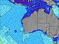 | 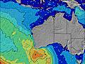 |  | 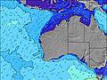 | 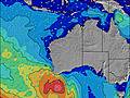 |  | 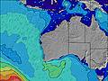 | 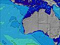 | |||||||||||||||
Onda Altezza (m) Direzione Periodo (s) | SW 14 | SW 14 | WSW 14 | WSW 13 | SW 13 | SW 13 | SW 13 | SW 13 | SW 13 | SW 13 | SW 14 | SW 14 | SW 14 | SW 14 | SW 14 | SW 16 | SW 16 | SW 16 | SW 15 | SW 15 | SW 15 | SW 14 | SW 14 | SW 14 |
Grafico delle onde | ||||||||||||||||||||||||
1321 | 1267 | 1291 | 1303 | 933 | 905 | 891 | 966 | 951 | 951 | 1533 | 1836 | 1914 | 2687 | 3569 | 4777 | 4915 | 4629 | 4111 | 3624 | 3101 | 2671 | 2318 | 1996 | |
Vento (km/h) | ||||||||||||||||||||||||
Stato del vento onshore cross-onshore cross-shore cross-offshore offshore piatto | cross | cross | cross | cross | cross | cross-on | cross-on | cross-on | on | cross-on | cross-on | cross | cross-off | cross-off | cross | cross-off | cross-off | cross-off | cross-off | cross-off | cross-off | cross-off | cross-off | off |
Alta Marea | 1:23AM0.44m | 11:23AM0.80m | 1:35AM0.51m | 12:10PM0.69m | 1:57AM0.59m | 12:55PM0.58m | ||||||||||||||||||
Basso Marea | 4:19AM0.40m | 6:50PM0.12m | 5:40AM0.39m | 7:00PM0.18m | 6:58AM0.39m | 7:04PM0.23m | ||||||||||||||||||
— | 7:13 | — | — | — | — | — | — | — | 7:13 | — | — | — | — | — | — | — | 7:11 | — | — | — | — | — | — | |
— | — | — | — | — | 5:52 | — | — | — | — | — | — | — | 5:53 | — | — | — | — | — | — | — | 5:53 | — | — | |
mm | — | — | — | — | — | 1 | 1 | 2 | 4 | 5 | 1 | — | — | — | — | — | — | 1 | 1 | 3 | 3 | — | 1 | 1 |
Temp. °C | 22 | 22 | 22 | 22 | 22 | 22 | 22 | 20 | 20 | 19 | 19 | 20 | 20 | 20 | 20 | 20 | 19 | 17 | 17 | 16 | 17 | 17 | 17 | 18 |
Gelo °C | 21 | 21 | 21 | 20 | 19 | 19 | 19 | 17 | 19 | 16 | 16 | 17 | 18 | 19 | 18 | 17 | 16 | 13 | 13 | 13 | 14 | 15 | 15 | 17 |
Onda 1 Altezza (m) Direzione Periodo (s) | SW 14 | SW 14 | WSW 14 | WSW 13 | SW 13 | SW 13 | SW 13 | SW 13 | SW 13 | SW 13 | SW 14 | SW 14 | SW 14 | SW 14 | SW 14 | SW 16 | SW 16 | SW 16 | SW 15 | SW 15 | SW 15 | SW 14 | SW 14 | SW 14 |
1321 | 1267 | 1291 | 1303 | 933 | 905 | 891 | 966 | 951 | 951 | 1533 | 1836 | 1914 | 2687 | 3569 | 4777 | 4915 | 4629 | 4111 | 3624 | 3101 | 2671 | 2318 | 1996 | |
Onda 2 Altezza (m) Direzione Periodo (s) | WNW 11 | WNW 11 | WNW 11 | NW 11 | W 6 | NW 11 | NW 11 | NW 11 | WNW 5 | WNW 5 | WSW 22 | NW 10 | SW 19 | WSW 19 | — | — | — | — | — | — | — | — | — | — |
13 | 13 | 12 | 5 | 17 | 5 | 5 | 5 | 27 | 14 | 45 | 4 | 446 | 72 | — | — | — | — | — | — | — | — | — | — | |
Onda 3 Altezza (m) Direzione Periodo (s) | — | — | — | — | NW 11 | — | — | — | NW 11 | NW 10 | WSW 22 | — | — | — | — | — | — | — | — | — | — | — | — | — |
— | — | — | — | 5 | — | — | — | 4 | 4 | 45 | — | — | — | — | — | — | — | — | — | — | — | — | — | |
onde vento Altezza (m) Direzione Periodo (s) | — | NW 3 | — | N 3 | NNW 4 | NW 5 | WNW 6 | WNW 5 | W 13 | — | SW 5 | — | — | — | — | — | — | — | — | SE 3 | SE 3 | SE 3 | SE 3 | SE 3 |
— | 2 | — | 8 | 28 | 53 | 58 | 53 | 160 | — | 6 | — | — | — | — | — | — | — | — | 2 | 2 | 1 | 2 | 2 | |
Il più vicino Offshore or Glassy | ||||||||||||||||||||||||
Distanza (km) | 832 | 243 | 329 | 569 | 931 | 931 | 1005 | 1053 | 1053 | 1066 | 243 | 1950 | 0 | 0 | 303 | 202 | 202 | 202 | 202 | 202 | 325 | 202 | 202 | 0 |
Migliori previsioni per le condizioni d'onda in North West WA | ||||||||||||||||||||||||
Migliori previsioni per le condizioni d'onda in Australia | ||||||||||||||||||||||||
Trova Onde Globale | ||||||||||||||||||||||||
- Map Icons:
 Break
Break Live Wave Height (m)
 Live Wind Speed (km/h)
 Surf Rating (10 Max)
 Ocean Swells (m)
- Wind Speed (km/h)
Widget Free Surf-Forecast.com per il tuo sito
La relazione di surf / widget meteo è disponibile qui sotto per incorporare su siti esterni a titolo gratuito e fornisce una sintesi delle nostre Steep Point previsione surf. Basta prendere il frammento di codice html da noi fornito e copiarlo nel proprio sito. È possibile scegliere la lingua preferita e unità metriche / imperiali per il feed delle previsioni surf per soddisfare le esigenze degli utenti del vostro sito .... Clicca qui per ottenere il codice.
 Nearest