
Previsioni:

Previsione a breve termineper lo più asciutto. Warm (Max 25°C mercoledì notte, Min 23°C Lunedì pomeriggio). Principalmente raffiche di vento. | |||||||||||||||||||||
Lun 20 | Martedì 21 | Mercoledì 22 | |||||||||||||||||||
11 AM | 2 PM | 5 PM | 8 PM | 11 PM | 2 AM | 5 AM | 8 AM | 11 AM | 2 PM | 5 PM | 8 PM | 11 PM | 2 AM | 5 AM | 8 AM | 11 AM | 2 PM | 5 PM | 8 PM | 11 PM | |
Mappa dell'altezza del moto ondoso |  |  |  |  |  |  |  | 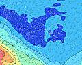 | |||||||||||||
Onda Altezza (m) Direzione Periodo (s) | SSW 22 | SSW 21 | SSW 21 | SSW 20 | SSW 19 | SSW 19 | SSW 19 | SSW 18 | SSW 18 | SSW 18 | SSW 17 | SSW 17 | SSW 17 | SSW 16 | SSW 16 | SSW 16 | SSW 19 | SSW 18 | SSW 18 | SSW 17 | SSW 17 |
Grafico delle onde | |||||||||||||||||||||
4178 | 4635 | 5433 | 4730 | 4634 | 6513 | 5953 | 4904 | 4403 | 4354 | 4144 | 3876 | 3354 | 2748 | 2290 | 2511 | 5043 | 4777 | 4618 | 4461 | 4178 | |
Vento (km/h) | |||||||||||||||||||||
Stato del vento onshore cross-onshore cross-shore cross-offshore offshore piatto | cross-off | cross-off | cross-off | cross-off | cross-off | cross-off | cross-off | cross-off | cross-off | cross-off | cross-off | cross-off | cross-off | cross-off | cross-off | cross-off | cross-off | cross-off | cross-off | cross-off | cross-off |
Alta Marea | 4:14PM0.22m | 3:33AM0.21m | 5:26PM0.18m | 2:48AM0.19m | 1:38PM0.14m | ||||||||||||||||
Basso Marea | 9:53AM0.10m | 10:04PM0.14m | 10:31AM0.12m | 10:20PM0.17m | 12:36PM0.14m | 4:08PM0.14m | |||||||||||||||
— | — | — | — | — | — | 6:28 | — | — | — | — | — | — | — | 6:28 | — | — | — | — | — | — | |
— | — | 5:40 | — | — | — | — | — | — | — | 5:40 | — | — | — | — | — | — | — | 5:40 | — | — | |
mm | — | — | — | — | — | — | — | — | — | — | — | — | — | — | — | — | — | — | — | — | — |
Temp. °C | 23 | 23 | 23 | 23 | 23 | 23 | 23 | 23 | 24 | 24 | 24 | 24 | 24 | 24 | 24 | 24 | 24 | 24 | 24 | 25 | 25 |
Gelo °C | 19 | 19 | 18 | 18 | 19 | 19 | 19 | 19 | 21 | 21 | 21 | 20 | 20 | 20 | 20 | 20 | 20 | 21 | 20 | 21 | 21 |
Onda 1 Altezza (m) Direzione Periodo (s) | SSW 22 | SSW 21 | SSW 21 | SSW 20 | SSW 19 | SSW 19 | SSW 19 | SSW 18 | SSW 18 | SSW 18 | SSW 17 | SSW 17 | SSW 17 | SSW 16 | SSW 16 | SSW 16 | SSW 19 | SSW 18 | SSW 18 | SSW 17 | SSW 17 |
4178 | 4635 | 5433 | 4730 | 4634 | 6513 | 5953 | 4904 | 4403 | 4354 | 4144 | 3876 | 3354 | 2748 | 2290 | 2511 | 5043 | 4777 | 4618 | 4461 | 4178 | |
Onda 2 Altezza (m) Direzione Periodo (s) | SSW 11 | SSW 11 | SSW 11 | SSW 14 | SW 14 | SW 11 | S 10 | SE 12 | SSE 10 | — | — | SSE 10 | SSW 22 | SSE 10 | SSW 20 | SSW 20 | SSE 10 | SSE 10 | SSE 10 | SSE 10 | SSE 10 |
1121 | 973 | 883 | 1728 | 902 | 233 | 296 | 22 | 324 | — | — | 260 | 265 | 214 | 1312 | 1461 | 190 | 133 | 104 | 104 | 55 | |
Onda 3 Altezza (m) Direzione Periodo (s) | SW 16 | SW 16 | SE 13 | SE 13 | SW 14 | — | — | — | — | — | — | — | SSW 22 | SSW 22 | — | — | — | — | — | — | — |
376 | 371 | 27 | 26 | 407 | — | — | — | — | — | — | — | 265 | 408 | — | — | — | — | — | — | — | |
onde vento Altezza (m) Direzione Periodo (s) | — | — | — | S 11 | SSE 10 | SSE 10 | SSE 10 | SSE 10 | SSE 10 | SSE 10 | SSE 10 | SSE 10 | SSE 10 | E 4 | SE 10 | SE 10 | E 4 | SE 6 | SE 6 | SE 6 | SE 6 |
— | — | — | 798 | 388 | 410 | 402 | 402 | 353 | 298 | 314 | 333 | 333 | 21 | 362 | 328 | 27 | 135 | 157 | 157 | 172 | |
Il più vicino Offshore or Glassy | |||||||||||||||||||||
Distanza (km) | 3449 | 2580 | 2580 | 2580 | 2272 | 1146 | 1146 | 2272 | 2272 | 2272 | 2272 | 2272 | 2272 | 2272 | 2272 | 2272 | 2272 | 2272 | 2272 | 2272 | 2301 |
Migliori previsioni per le condizioni d'onda in Tahiti | |||||||||||||||||||||
Migliori previsioni per le condizioni d'onda in French Polynesia | |||||||||||||||||||||
Trova Onde Globale | |||||||||||||||||||||
- Map Icons:
 Break
Break Live Wave Height (m)
 Live Wind Speed (km/h)
 Surf Rating (10 Max)
 Ocean Swells (m)
- Wind Speed (km/h)
Widget Free Surf-Forecast.com per il tuo sito
La relazione di surf / widget meteo è disponibile qui sotto per incorporare su siti esterni a titolo gratuito e fornisce una sintesi delle nostre Taapuna previsione surf. Basta prendere il frammento di codice html da noi fornito e copiarlo nel proprio sito. È possibile scegliere la lingua preferita e unità metriche / imperiali per il feed delle previsioni surf per soddisfare le esigenze degli utenti del vostro sito .... Clicca qui per ottenere il codice.
 Nearest