
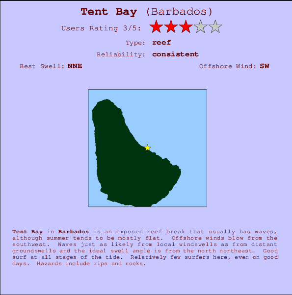
Tent Bay Surf Guide
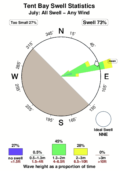
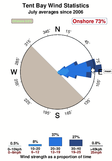
Tent Bay on the East Coast is an exposed reef break that usually has waves, although summer tends to be mostly flat. The best wind direction is from the southwest. Tends to receive a mix of groundswells and windswells and the ideal swell angle is from the north northeast. A left hand reef. Good surf at all stages of the tide. Rarely crowded here. Take care of rips and rocks.
Tent Bay Spot Info
| Type: | Rating: | Reliability: | Todays Sea Temp*: |
|---|---|---|---|
| consistent | 28.0°C*ocean temperature recorded from satellite |
Surfing Tent Bay:
The best conditions reported for surf at Tent Bay occur when a North-northeast swell combines with an offshore wind direction from the Southwest.

Previsioni Energia d'onda (Potenza): 12hrs


Tent Bay Surf:
Tuesday, 21 July 2026, 00:01 Local time| Lun | Martedì 21 | |||
| 11PM | 2AM | 5AM | 8AM | |
| Wave (m) | ||||
| Periodo (s) | 7 | 7 | 7 | 7 |
| Vento (km/h) | ||||
| Stato del vento | cross- on |
cross- on |
cross- on |
cross- on |
- /breaks/Tent-Bay/forecasts/latest
Tent Bay Surf Guide
Tent Bay on the East Coast is an exposed reef break that usually has waves, although summer tends to be mostly flat. The best wind direction is from the southwest. Tends to receive a mix of groundswells and windswells and the ideal swell angle is from the north northeast. A left hand reef. Good surf at all stages of the tide. Rarely crowded here. Take care of rips and rocks.
Tent Bay Spot Info
Type: Rating: Reliability: Todays Sea Temp*:  Reef
Reef 3
3consistent 28.0°C*ocean temperature recorded from satelliteSurfing Tent Bay:
The best conditions reported for surf at Tent Bay occur when a North-northeast swell combines with an offshore wind direction from the Southwest.
Previsioni Energia d'onda (Potenza): 12hrs
Utilizzare la scheda di navigazione in alto per visualizzare Tent Bay temperatura del mare, Tent Bay fotografie, Tent Bay dettagliate previsioni onde, il vento e le previsioni meteo, Tent Bay webcam, vento corrente da Barbados stazioni meteo e Tent Bay previsioni marea. Il link Barbados mappe maree apre l'immagine grande, che mostra Barbados e dei mari circostanti. Queste mappe possono essere animate per mostrare le diverse componenti del moto ondoso, energia delle onde, periodo d'onda, altezza delle onde, insieme con le previsioni del vento e meteo, meteo corrente e osservazioni sullo stato del mare dal Barbados onda-boe, le navi passanti e stazioni meteo costiere. Ciascuna delle pagine di previsioni per questo surf break rappresenta uno strumento di wavefinder globale e regionale per individuare le migliori condizioni di surf nella zona intorno Tent Bay.
Tent Bay Surf:
Tuesday, 21 July 2026, 00:01 Local timeLun Martedì 21 11PM 2AM 5AM 8AM Wave (m) Periodo (s) 7 7 7 7 Vento (km/h) Stato del vento cross-
oncross-
oncross-
oncross-
on- /breaks/Tent-Bay/forecasts/latest
- /breaks/Tent-Bay/forecasts/latest/six_day
Tent Bay Surf Guide
Tent Bay on the East Coast is an exposed reef break that usually has waves, although summer tends to be mostly flat. The best wind direction is from the southwest. Tends to receive a mix of groundswells and windswells and the ideal swell angle is from the north northeast. A left hand reef. Good surf at all stages of the tide. Rarely crowded here. Take care of rips and rocks.
Tent Bay Spot Info
Type: Rating: Reliability: Todays Sea Temp*: Reef3consistent 28.0°C*ocean temperature recorded from satelliteSurfing Tent Bay:
The best conditions reported for surf at Tent Bay occur when a North-northeast swell combines with an offshore wind direction from the Southwest.
Previsioni Energia d'onda (Potenza): 12hrs
Utilizzare la scheda di navigazione in alto per visualizzare Tent Bay temperatura del mare, Tent Bay fotografie, Tent Bay dettagliate previsioni onde, il vento e le previsioni meteo, Tent Bay webcam, vento corrente da Barbados stazioni meteo e Tent Bay previsioni marea. Il link Barbados mappe maree apre l'immagine grande, che mostra Barbados e dei mari circostanti. Queste mappe possono essere animate per mostrare le diverse componenti del moto ondoso, energia delle onde, periodo d'onda, altezza delle onde, insieme con le previsioni del vento e meteo, meteo corrente e osservazioni sullo stato del mare dal Barbados onda-boe, le navi passanti e stazioni meteo costiere. Ciascuna delle pagine di previsioni per questo surf break rappresenta uno strumento di wavefinder globale e regionale per individuare le migliori condizioni di surf nella zona intorno Tent Bay.
Tent Bay Surf:
Tuesday, 21 July 2026, 00:01 Local timeLun Martedì 21 11PM 2AM 5AM 8AM Wave (m) Periodo (s) 7 7 7 7 Vento (km/h) Stato del vento cross-
oncross-
oncross-
oncross-
on- /breaks/Tent-Bay/forecasts/latest
Tent Bay Surf Guide
Tent Bay on the East Coast is an exposed reef break that usually has waves, although summer tends to be mostly flat. The best wind direction is from the southwest. Tends to receive a mix of groundswells and windswells and the ideal swell angle is from the north northeast. A left hand reef. Good surf at all stages of the tide. Rarely crowded here. Take care of rips and rocks.
Tent Bay Spot Info
Type: Rating: Reliability: Todays Sea Temp*: Reef3consistent 28.0°C*ocean temperature recorded from satelliteSurfing Tent Bay:
The best conditions reported for surf at Tent Bay occur when a North-northeast swell combines with an offshore wind direction from the Southwest.
Previsioni Energia d'onda (Potenza): 12hrs
Utilizzare la scheda di navigazione in alto per visualizzare Tent Bay temperatura del mare, Tent Bay fotografie, Tent Bay dettagliate previsioni onde, il vento e le previsioni meteo, Tent Bay webcam, vento corrente da Barbados stazioni meteo e Tent Bay previsioni marea. Il link Barbados mappe maree apre l'immagine grande, che mostra Barbados e dei mari circostanti. Queste mappe possono essere animate per mostrare le diverse componenti del moto ondoso, energia delle onde, periodo d'onda, altezza delle onde, insieme con le previsioni del vento e meteo, meteo corrente e osservazioni sullo stato del mare dal Barbados onda-boe, le navi passanti e stazioni meteo costiere. Ciascuna delle pagine di previsioni per questo surf break rappresenta uno strumento di wavefinder globale e regionale per individuare le migliori condizioni di surf nella zona intorno Tent Bay.
Tent Bay Surf:
Tuesday, 21 July 2026, 00:01 Local timeLun Martedì 21 11PM 2AM 5AM 8AM Wave (m) Periodo (s) 7 7 7 7 Vento (km/h) Stato del vento cross-
oncross-
oncross-
oncross-
onTide Times:
Per Barclays, %{dist} %{km} da %{location}.
PROSSIMA È ALLE (ora locale) rimanente alta marea bassa marea Tent Bay Tide Times and Tide Chart
Live Weather:
At Grantley Adams International Airport, 16 km from Tent Bay.
light winds from the E
(km/h)
no reportAir temperature
27°COverall Tent Bay Surf Consistency and Wind Distribution in Luglio
foto dall' album
Contorni: Strade e fiumi: seleziona un surf break dal menu 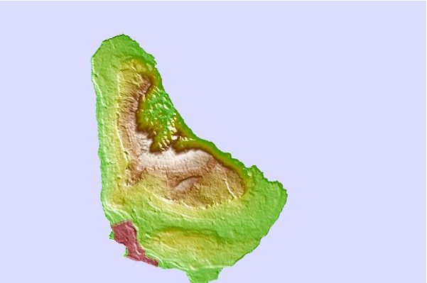
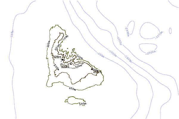
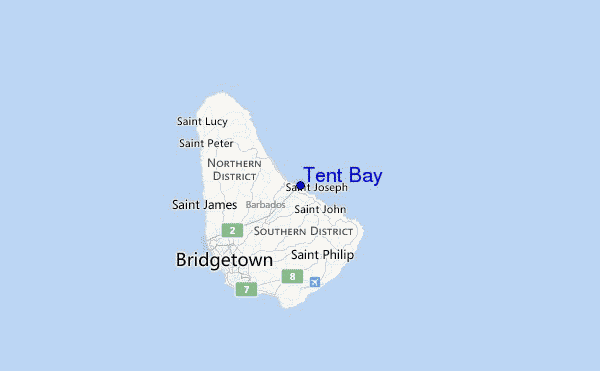
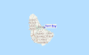
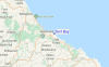
Utilizzare questa mappa sollievo per navigare Barbados surf breaks e stazioni di marea che si trovano nella zona diTent Bay
Altri surf breaks più vicini al Tent Bay:
(clicca sul nome del luogo per maggiori informazioni)- Closest località surf0 mi
- Second closest località surf1 mi
- Third closest località surf1 mi
- Fourth closest località surf1 mi
- Fifth closest località surf1 mi
Onda boe più vicina a Tent Bay:
- Closest Onda boa242 mi
- Second closest Onda boa351 mi
- Third closest Onda boa445 mi
- Fourth closest Onda boa493 mi
- Fifth closest Onda boa528 mi
Stazioni di marea più vicina alla Tent Bay:
- Closest marea stazioneBridgetown, Barbados11 mi
- Second closest marea stazioneVieux Fort Bay104 mi
- Third closest marea stazioneLe Robert110 mi
- Fourth closest marea stazioneBisee112 mi
- Fifth closest marea stazioneKingstown, Saint Vincent115 mi
Airports
- The closest passenger airport to Tent Bay is Grantley Adams International (Bridgetown) Airport (BGI) in Barbados, 15 km (9 miles) away (directly).
- The second nearest airport to Tent Bay is Hewanorra International (Hewandorra) Airport (UVF) in St. Lucia Island, 167 km (104 miles) away.
- Third is George F L Charles (Castries) Airport (SLU) in St. Lucia Island, 184 km (114 miles) away.
- Mustique Airport (MQS) in St.vincent/grenadines is 185 km (115 miles) away.
- E T Joshua (Kingstown) Airport (SVD), also in St.vincent/grenadines is the fifth nearest airport to Tent Bay and is 185 km (115 miles) away.
- /breaks/Tent-Bay/forecasts/latest


 Nearest