
Previsioni:

Previsione a breve terminePioggia abbondante (Totale 36mm), più pesante durante mercoledì notte. Very mild (Max 18°C Venerdì mattina, Min 14°C mercoledì notte). Principalmente venti freschi. | ||||||||||||||||||||||||
Mer 15 | Giovedì 16 | Venerdì 17 | 18 | |||||||||||||||||||||
1 PM | 4 PM | 7 PM | 10 PM | 1 AM | 4 AM | 7 AM | 10 AM | 1 PM | 4 PM | 7 PM | 10 PM | 1 AM | 4 AM | 7 AM | 10 AM | 1 PM | 4 PM | 7 PM | 10 PM | 1 AM | 4 AM | 7 AM | 10 AM | |
Mappa dell'altezza del moto ondoso |  | 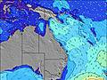 | 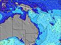 | 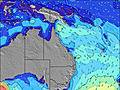 |  | 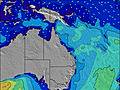 |  |  |  |  | ||||||||||||||
Onda Altezza (m) Direzione Periodo (s) | ESE 10 | SE 5 | SE 6 | SSE 7 | SSE 7 | SSE 8 | SSE 8 | SSE 8 | SSE 8 | SSE 7 | SSE 8 | SE 7 | SE 7 | SE 7 | SE 6 | SE 6 | SE 6 | SE 6 | SE 7 | SE 7 | SE 7 | SE 8 | SE 8 | SE 9 |
Grafico delle onde | ||||||||||||||||||||||||
9 | 73 | 303 | 342 | 440 | 429 | 477 | 464 | 452 | 528 | 491 | 440 | 434 | 415 | 265 | 278 | 296 | 311 | 363 | 374 | 432 | 465 | 413 | 612 | |
Vento (km/h) | ||||||||||||||||||||||||
Stato del vento onshore cross-onshore cross-shore cross-offshore offshore piatto | cross | cross-on | cross | cross | cross | cross | cross | cross | cross | cross | cross-off | cross | cross-on | cross-on | cross-on | cross-on | cross-on | cross-on | cross | cross | cross | cross | cross-off | cross |
Alta Marea | 9:07PM2.12m | 9:17AM1.41m | 9:52PM2.04m | 10:06AM1.41m | 10:35PM1.91m | |||||||||||||||||||
Basso Marea | 2:22PM0.13m | 3:42AM0.33m | 3:10PM0.17m | 4:26AM0.33m | 3:59PM0.25m | 5:09AM0.35m | ||||||||||||||||||
— | — | — | — | — | 6:35 | — | — | — | — | — | — | — | 6:33 | — | — | — | — | — | — | — | 6:33 | — | — | |
— | 5:10 | — | — | — | — | — | — | — | 5:12 | — | — | — | — | — | — | — | 5:12 | — | — | — | — | — | 5:13 | |
mm | — | — | 3 | 5 | 2 | 1 | — | — | 1 | 2 | 1 | 1 | 3 | 3 | 3 | 3 | 2 | 2 | 1 | 1 | 1 | — | — | — |
Temp. °C | 17 | 17 | 15 | 14 | 14 | 14 | 14 | 16 | 17 | 17 | 15 | 15 | 17 | 17 | 17 | 17 | 18 | 18 | 17 | 16 | 15 | 14 | 14 | 17 |
Gelo °C | 12 | 12 | 10 | 9 | 8 | 9 | 8 | 10 | 10 | 10 | 9 | 11 | 12 | 13 | 14 | 13 | 14 | 13 | 13 | 11 | 10 | 9 | 9 | 11 |
Onda 1 Altezza (m) Direzione Periodo (s) | ESE 10 | NE 9 | NE 8 | NE 8 | NE 8 | NE 10 | NE 9 | NE 9 | ENE 8 | NE 8 | NE 8 | NE 8 | NE 8 | NE 8 | NE 7 | NE 7 | NE 7 | NE 7 | NE 7 | — | — | SE 8 | SE 8 | SE 9 |
9 | 3 | 3 | 3 | 3 | 4 | 3 | 3 | 7 | 11 | 11 | 17 | 16 | 16 | 14 | 14 | 12 | 12 | 12 | — | — | 262 | 413 | 612 | |
Onda 2 Altezza (m) Direzione Periodo (s) | NE 9 | N 6 | — | — | — | — | — | — | — | — | — | E 6 | E 6 | E 6 | — | E 6 | — | — | — | — | — | — | — | E 21 |
3 | 1 | — | — | — | — | — | — | — | — | — | 1 | 1 | 1 | — | 1 | — | — | — | — | — | — | — | 9 | |
Onda 3 Altezza (m) Direzione Periodo (s) | — | — | — | — | — | — | — | — | — | — | — | — | — | — | — | — | — | — | — | — | — | — | — | — |
— | — | — | — | — | — | — | — | — | — | — | — | — | — | — | — | — | — | — | — | — | — | — | — | |
onde vento Altezza (m) Direzione Periodo (s) | S 3 | SE 5 | SE 6 | SSE 7 | SSE 7 | SSE 8 | SSE 8 | SSE 8 | SSE 8 | SSE 7 | SSE 8 | SE 7 | SE 7 | SE 7 | SE 6 | SE 6 | SE 6 | SE 6 | SE 7 | SE 7 | SE 7 | SE 8 | SSW 4 | SSW 4 |
8 | 73 | 303 | 342 | 440 | 429 | 477 | 464 | 452 | 528 | 491 | 440 | 434 | 415 | 265 | 278 | 296 | 311 | 363 | 374 | 432 | 465 | 22 | 28 | |
Il più vicino Offshore or Glassy | ||||||||||||||||||||||||
Distanza (km) | 491 | 216 | 170 | 170 | 170 | 170 | 444 | 444 | 600 | 600 | 600 | 557 | 29 | 29 | 29 | 29 | 600 | 797 | 600 | 312 | 170 | 170 | 846 | 803 |
Migliori previsioni per le condizioni d'onda in Sunshine Coast | ||||||||||||||||||||||||
Migliori previsioni per le condizioni d'onda in Australia | ||||||||||||||||||||||||
Trova Onde Globale | ||||||||||||||||||||||||
- Map Icons:
 Break
Break Live Wave Height (m)
 Live Wind Speed (km/h)
 Surf Rating (10 Max)
 Ocean Swells (m)
- Wind Speed (km/h)
Widget Free Surf-Forecast.com per il tuo sito
La relazione di surf / widget meteo è disponibile qui sotto per incorporare su siti esterni a titolo gratuito e fornisce una sintesi delle nostre Twinnies previsione surf. Basta prendere il frammento di codice html da noi fornito e copiarlo nel proprio sito. È possibile scegliere la lingua preferita e unità metriche / imperiali per il feed delle previsioni surf per soddisfare le esigenze degli utenti del vostro sito .... Clicca qui per ottenere il codice.
 Nearest