
Previsioni:

Previsione a breve termineper lo più asciutto. Very mild (Max 16°C Sabato pomeriggio, Min 10°C Sabato mattina). Venti decrescenti (venti freschi da N Sabato mattina, venti deboli da SE per lunedì notte). | ||||||||||||||||||||||||
Sabato 1 | Domenica 2 | Lunedì 3 | ||||||||||||||||||||||
12 AM | 3 AM | 6 AM | 9 AM | 12 PM | 3 PM | 6 PM | 9 PM | 12 AM | 3 AM | 6 AM | 9 AM | 12 PM | 3 PM | 6 PM | 9 PM | 12 AM | 3 AM | 6 AM | 9 AM | 12 PM | 3 PM | 6 PM | 9 PM | |
Mappa dell'altezza del moto ondoso |  | 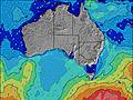 | 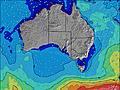 | 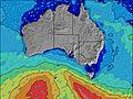 | 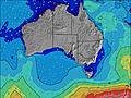 | 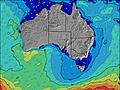 | 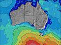 | 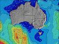 | 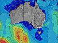 | |||||||||||||||
Onda Altezza (m) Direzione Periodo (s) | SW 18 | SW 18 | SW 18 | SW 18 | SW 17 | SW 17 | SW 16 | SW 16 | SW 16 | SW 16 | SW 16 | SW 16 | WSW 15 | SW 15 | SW 15 | WSW 16 | SW 16 | SW 15 | SW 15 | SW 14 | SW 14 | SW 14 | SW 13 | SW 13 |
Grafico delle onde | ||||||||||||||||||||||||
614 | 607 | 510 | 679 | 1098 | 886 | 988 | 854 | 746 | 651 | 719 | 783 | 1042 | 1062 | 496 | 2354 | 2185 | 1531 | 1220 | 1092 | 1077 | 938 | 637 | 495 | |
Vento (km/h) | ||||||||||||||||||||||||
Stato del vento onshore cross-onshore cross-shore cross-offshore offshore piatto | cross-off | cross-off | cross-off | cross-off | cross-off | cross | cross-off | cross-off | cross-off | cross-off | cross | cross-on | on | on | on | on | cross-on | cross-on | cross-on | cross-on | cross-on | cross-on | cross-on | cross-off |
Alta Marea | 1:45AM0.82m | 2:11PM1.20m | 2:11AM0.87m | 2:34PM1.13m | 2:39AM0.90m | 2:57PM1.03m | ||||||||||||||||||
Basso Marea | 7:36AM-0.01m | 8:32PM0.11m | 8:07AM0.01m | 8:50PM0.11m | 8:39AM0.07m | 9:08PM0.14m | ||||||||||||||||||
— | — | 7:22 | — | — | — | — | — | — | — | 7:22 | — | — | — | — | — | — | — | 7:20 | — | — | — | — | — | |
— | — | — | — | — | 5:52 | — | — | — | — | — | — | — | 5:52 | — | — | — | — | — | — | — | 5:52 | — | — | |
mm | — | — | — | — | — | — | — | — | — | — | — | — | — | — | — | — | — | — | — | — | — | — | — | — |
Temp. °C | 14 | 13 | 11 | 10 | 14 | 16 | 15 | 15 | 14 | 12 | 11 | 13 | 14 | 14 | 14 | 14 | 14 | 14 | 14 | 13 | 14 | 13 | 13 | 13 |
Gelo °C | 9 | 7 | 5 | 3 | 6 | 9 | 10 | 8 | 6 | 4 | 3 | 8 | 8 | 8 | 9 | 9 | 9 | 9 | 10 | 9 | 10 | 9 | 10 | 10 |
Onda 1 Altezza (m) Direzione Periodo (s) | SW 18 | SW 18 | SW 18 | SW 18 | SW 17 | SW 17 | SW 16 | SW 16 | SW 16 | SW 16 | SW 16 | SW 16 | S 16 | S 15 | SW 15 | SW 15 | SW 16 | SW 15 | SW 15 | SW 14 | SW 14 | SW 14 | SW 13 | SW 13 |
614 | 607 | 510 | 679 | 1098 | 886 | 988 | 854 | 746 | 651 | 719 | 783 | 119 | 224 | 496 | 1456 | 1742 | 1531 | 1220 | 1092 | 1077 | 938 | 637 | 495 | |
Onda 2 Altezza (m) Direzione Periodo (s) | S 18 | S 18 | S 18 | S 17 | SSW 17 | S 18 | WNW 6 | S 16 | S 17 | S 16 | SSE 17 | NNW 4 | — | — | SW 18 | S 18 | SSW 15 | SSW 16 | S 15 | S 15 | S 14 | S 14 | S 13 | S 13 |
227 | 225 | 97 | 90 | 505 | 155 | 11 | 132 | 135 | 132 | 92 | 6 | — | — | 252 | 6 | 316 | 329 | 302 | 272 | 257 | 239 | 78 | 114 | |
Onda 3 Altezza (m) Direzione Periodo (s) | WSW 18 | — | — | — | — | — | — | W 6 | — | — | — | — | — | — | — | — | — | — | — | — | — | SSW 18 | SW 18 | SW 17 |
124 | — | — | — | — | — | — | 3 | — | — | — | — | — | — | — | — | — | — | — | — | — | 32 | 81 | 148 | |
onde vento Altezza (m) Direzione Periodo (s) | — | NNE 3 | N 3 | N 3 | NNW 4 | NW 4 | NNW 3 | N 3 | NNW 4 | NNW 4 | NNW 4 | WNW 5 | WSW 15 | SW 15 | WSW 6 | WSW 16 | SW 16 | — | — | — | — | — | — | — |
— | 2 | 7 | 11 | 16 | 11 | 4 | 8 | 17 | 28 | 31 | 23 | 1042 | 1062 | 65 | 2354 | 2185 | — | — | — | — | — | — | — | |
Il più vicino Offshore or Glassy | ||||||||||||||||||||||||
Distanza (km) | 28 | 28 | 204 | 207 | 369 | 300 | 0 | 28 | 369 | 439 | 446 | 946 | 1024 | 449 | 843 | 777 | 843 | 1038 | 1025 | 203 | 203 | 1016 | 46 | 0 |
Migliori previsioni per le condizioni d'onda in Eyre Peninsula | ||||||||||||||||||||||||
Migliori previsioni per le condizioni d'onda in Australia | ||||||||||||||||||||||||
Trova Onde Globale | ||||||||||||||||||||||||
- Map Icons:
 Break
Break Live Wave Height (m)
 Live Wind Speed (km/h)
 Surf Rating (10 Max)
 Ocean Swells (m)
- Wind Speed (km/h)
Widget Free Surf-Forecast.com per il tuo sito
La relazione di surf / widget meteo è disponibile qui sotto per incorporare su siti esterni a titolo gratuito e fornisce una sintesi delle nostre Venus Bay previsione surf. Basta prendere il frammento di codice html da noi fornito e copiarlo nel proprio sito. È possibile scegliere la lingua preferita e unità metriche / imperiali per il feed delle previsioni surf per soddisfare le esigenze degli utenti del vostro sito .... Clicca qui per ottenere il codice.
 Nearest