
Previsioni:

Previsione a breve terminePioggia moderata (Totale 12mm), più pesante giovedì notte. Very mild (Max 15°C giovedì mattina, Min 11°C mercoledì notte). Principalmente venti freschi. | ||||||||||||||||||||||||
Mer 15 | Giovedì 16 | Venerdì 17 | Sabato 18 | |||||||||||||||||||||
7 PM | 10 PM | 1 AM | 4 AM | 7 AM | 10 AM | 1 PM | 4 PM | 7 PM | 10 PM | 1 AM | 4 AM | 7 AM | 10 AM | 1 PM | 4 PM | 7 PM | 10 PM | 1 AM | 4 AM | 7 AM | 10 AM | 1 PM | 4 PM | |
Mappa dell'altezza del moto ondoso |  |  |  |  |  |  |  |  | 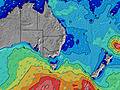 | |||||||||||||||
Onda Altezza (m) Direzione Periodo (s) | S 8 | S 8 | S 7 | S 7 | S 8 | S 8 | S 8 | S 7 | S 7 | SSE 7 | SSE 7 | SSE 7 | SSE 6 | S 6 | SSE 6 | E 7 | E 6 | E 7 | E 7 | E 7 | S 10 | S 10 | E 7 | E 8 |
Grafico delle onde | ||||||||||||||||||||||||
418 | 350 | 343 | 419 | 466 | 558 | 553 | 623 | 522 | 336 | 219 | 189 | 142 | 83 | 93 | 67 | 51 | 82 | 87 | 88 | 158 | 154 | 106 | 121 | |
Vento (km/h) | ||||||||||||||||||||||||
Stato del vento onshore cross-onshore cross-shore cross-offshore offshore piatto | cross-on | cross | cross | cross-off | cross-on | cross-on | cross-on | cross-on | cross-on | cross-on | cross-on | cross-on | cross-on | cross | cross-on | cross-on | cross-on | cross | cross | cross-on | cross-on | cross-on | cross-on | cross-on |
Alta Marea | 9:06PM1.78m | 9:56AM1.18m | 9:55PM1.71m | 10:45AM1.20m | 10:42PM1.60m | 11:33AM1.22m | ||||||||||||||||||
Basso Marea | 3:56AM-0.06m | 3:29PM0.24m | 4:41AM-0.02m | 4:22PM0.27m | 5:24AM0.04m | |||||||||||||||||||
— | — | — | 6:58 | — | — | — | — | — | — | — | 6:58 | — | — | — | — | — | — | — | 6:58 | — | — | — | — | |
— | — | — | — | — | — | — | 5:04 | — | — | — | — | — | — | — | 5:05 | — | — | — | — | — | — | — | 5:05 | |
mm | — | — | — | — | — | — | — | — | — | 1 | 2 | 3 | 2 | 1 | — | 1 | 1 | 1 | — | — | — | — | — | — |
Temp. °C | 14 | 13 | 12 | 12 | 11 | 14 | 15 | 15 | 15 | 15 | 14 | 13 | 13 | 12 | 13 | 14 | 15 | 14 | 13 | 12 | 12 | 14 | 15 | 15 |
Gelo °C | 11 | 10 | 9 | 9 | 7 | 9 | 9 | 9 | 10 | 11 | 11 | 10 | 10 | 9 | 9 | 11 | 12 | 12 | 11 | 9 | 9 | 11 | 12 | 13 |
Onda 1 Altezza (m) Direzione Periodo (s) | S 16 | S 15 | E 11 | S 15 | S 15 | S 18 | S 18 | S 18 | S 18 | S 18 | S 19 | S 18 | E 8 | E 5 | ENE 8 | E 7 | E 6 | E 7 | E 7 | E 7 | E 7 | E 7 | E 7 | E 8 |
5 | 5 | 2 | 4 | 4 | 6 | 26 | 26 | 26 | 27 | 27 | 27 | 10 | 20 | 19 | 67 | 51 | 82 | 87 | 88 | 86 | 106 | 106 | 121 | |
Onda 2 Altezza (m) Direzione Periodo (s) | — | E 11 | E 11 | — | — | — | S 14 | — | S 13 | S 12 | E 8 | E 8 | S 19 | E 8 | S 9 | S 8 | S 5 | S 5 | S 10 | S 10 | S 21 | S 21 | S 10 | S 10 |
— | 2 | 2 | — | — | — | 4 | — | 12 | 11 | 5 | 5 | 27 | 10 | 13 | 21 | 27 | 18 | 52 | 72 | 35 | 34 | 46 | 44 | |
Onda 3 Altezza (m) Direzione Periodo (s) | — | — | — | — | — | — | — | — | — | E 11 | SSW 12 | SSW 18 | SSW 17 | S 15 | S 11 | S 11 | S 8 | S 10 | S 21 | S 21 | S 18 | S 18 | S 20 | S 19 |
— | — | — | — | — | — | — | — | — | 2 | 27 | 64 | 59 | 18 | 21 | 21 | 21 | 54 | 9 | 35 | 6 | 6 | 31 | 29 | |
onde vento Altezza (m) Direzione Periodo (s) | S 8 | S 8 | S 7 | S 7 | S 8 | S 8 | S 8 | S 7 | S 7 | SSE 7 | SSE 7 | SSE 7 | SSE 6 | S 6 | SSE 6 | S 6 | — | — | S 5 | S 4 | S 10 | S 10 | S 4 | S 4 |
418 | 350 | 343 | 419 | 466 | 558 | 553 | 623 | 522 | 336 | 219 | 189 | 142 | 83 | 93 | 50 | — | — | 7 | 6 | 158 | 154 | 16 | 8 | |
Il più vicino Offshore or Glassy | ||||||||||||||||||||||||
Distanza (km) | 8 | 8 | 3 | 0 | 49 | 96 | 96 | 156 | 96 | 57 | 48 | 58 | 43 | 58 | 62 | 37 | 3 | 3 | 3 | 15 | 8 | 20 | 39 | 15 |
Migliori previsioni per le condizioni d'onda in Illawarra | ||||||||||||||||||||||||
Migliori previsioni per le condizioni d'onda in Australia | ||||||||||||||||||||||||
Trova Onde Globale | ||||||||||||||||||||||||
- Map Icons:
 Break
Break Live Wave Height (m)
 Live Wind Speed (km/h)
 Surf Rating (10 Max)
 Ocean Swells (m)
- Wind Speed (km/h)
Widget Free Surf-Forecast.com per il tuo sito
La relazione di surf / widget meteo è disponibile qui sotto per incorporare su siti esterni a titolo gratuito e fornisce una sintesi delle nostre Wombarra previsione surf. Basta prendere il frammento di codice html da noi fornito e copiarlo nel proprio sito. È possibile scegliere la lingua preferita e unità metriche / imperiali per il feed delle previsioni surf per soddisfare le esigenze degli utenti del vostro sito .... Clicca qui per ottenere il codice.
 Nearest