

Botany Bay Surf Guide
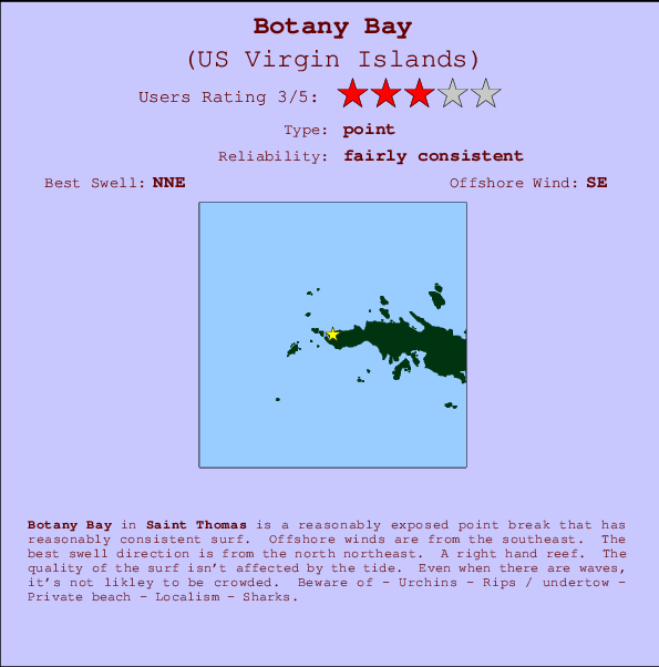
Botany Bay in Saint Thomas is a fairly exposed point break that has reasonably consistent surf. The best wind direction is from the southeast. The ideal swell direction from the north northeast. A right hand reef break. The quality of the surf isn't affected by the tide. Even when there are waves, it's not likley to be crowded. Hazards include - Urchins - Rips / undertow - Private beach - Localism - Sharks.
Botany Bay Spot Info
| Type: | Rating: | Reliability: | Todays Sea Temp*: |
|---|---|---|---|
| fairly consistent | 28.5°C*ocean temperature recorded from satellite |
Surfing Botany Bay:
The best conditions reported for surf at Botany Bay occur when a North-northeast swell combines with an offshore wind direction from the Southeast.

Previsioni Energia d'onda (Potenza): 12hrs


Botany Bay Surf:
Monday, 20 July 2026, 15:06 Local time| Lunedì 20 | ||||
| 11AM | 2PM | 5PM | 8PM | |
| Wave (m) | ||||
| Periodo (s) | 8 | 6 | 6 | 8 |
| Vento (km/h) | ||||
| Stato del vento | cross- off |
cross- off |
cross- off |
cross- off |
- /breaks/Botany-Bay/forecasts/latest
Botany Bay Surf Guide
Botany Bay in Saint Thomas is a fairly exposed point break that has reasonably consistent surf. The best wind direction is from the southeast. The ideal swell direction from the north northeast. A right hand reef break. The quality of the surf isn't affected by the tide. Even when there are waves, it's not likley to be crowded. Hazards include - Urchins - Rips / undertow - Private beach - Localism - Sharks.
Botany Bay Spot Info
Type: Rating: Reliability: Todays Sea Temp*:  Point
Point 3
3fairly consistent 28.5°C*ocean temperature recorded from satelliteSurfing Botany Bay:
The best conditions reported for surf at Botany Bay occur when a North-northeast swell combines with an offshore wind direction from the Southeast.
Previsioni Energia d'onda (Potenza): 12hrs
Utilizzare la scheda di navigazione in alto per visualizzare Botany Bay temperatura del mare, Botany Bay fotografie, Botany Bay dettagliate previsioni onde, il vento e le previsioni meteo, Botany Bay webcam, vento corrente da Saint Thomas stazioni meteo e Botany Bay previsioni marea. Il link US Virgin Islands mappe maree apre l'immagine grande, che mostra US Virgin Islands e dei mari circostanti. Queste mappe possono essere animate per mostrare le diverse componenti del moto ondoso, energia delle onde, periodo d'onda, altezza delle onde, insieme con le previsioni del vento e meteo, meteo corrente e osservazioni sullo stato del mare dal US Virgin Islands onda-boe, le navi passanti e stazioni meteo costiere. Ciascuna delle pagine di previsioni per questo surf break rappresenta uno strumento di wavefinder globale e regionale per individuare le migliori condizioni di surf nella zona intorno Botany Bay.
Botany Bay Surf:
Monday, 20 July 2026, 15:06 Local timeLunedì 20 11AM 2PM 5PM 8PM Wave (m) Periodo (s) 8 6 6 8 Vento (km/h) Stato del vento cross-
offcross-
offcross-
offcross-
off- /breaks/Botany-Bay/forecasts/latest
- /breaks/Botany-Bay/forecasts/latest/six_day
Botany Bay Surf Guide
Botany Bay in Saint Thomas is a fairly exposed point break that has reasonably consistent surf. The best wind direction is from the southeast. The ideal swell direction from the north northeast. A right hand reef break. The quality of the surf isn't affected by the tide. Even when there are waves, it's not likley to be crowded. Hazards include - Urchins - Rips / undertow - Private beach - Localism - Sharks.
Botany Bay Spot Info
Type: Rating: Reliability: Todays Sea Temp*: Point3fairly consistent 28.5°C*ocean temperature recorded from satelliteSurfing Botany Bay:
The best conditions reported for surf at Botany Bay occur when a North-northeast swell combines with an offshore wind direction from the Southeast.
Previsioni Energia d'onda (Potenza): 12hrs
Utilizzare la scheda di navigazione in alto per visualizzare Botany Bay temperatura del mare, Botany Bay fotografie, Botany Bay dettagliate previsioni onde, il vento e le previsioni meteo, Botany Bay webcam, vento corrente da Saint Thomas stazioni meteo e Botany Bay previsioni marea. Il link US Virgin Islands mappe maree apre l'immagine grande, che mostra US Virgin Islands e dei mari circostanti. Queste mappe possono essere animate per mostrare le diverse componenti del moto ondoso, energia delle onde, periodo d'onda, altezza delle onde, insieme con le previsioni del vento e meteo, meteo corrente e osservazioni sullo stato del mare dal US Virgin Islands onda-boe, le navi passanti e stazioni meteo costiere. Ciascuna delle pagine di previsioni per questo surf break rappresenta uno strumento di wavefinder globale e regionale per individuare le migliori condizioni di surf nella zona intorno Botany Bay.
Botany Bay Surf:
Monday, 20 July 2026, 15:06 Local timeLunedì 20 11AM 2PM 5PM 8PM Wave (m) Periodo (s) 8 6 6 8 Vento (km/h) Stato del vento cross-
offcross-
offcross-
offcross-
off- /breaks/Botany-Bay/forecasts/latest
Botany Bay Surf Guide
Botany Bay in Saint Thomas is a fairly exposed point break that has reasonably consistent surf. The best wind direction is from the southeast. The ideal swell direction from the north northeast. A right hand reef break. The quality of the surf isn't affected by the tide. Even when there are waves, it's not likley to be crowded. Hazards include - Urchins - Rips / undertow - Private beach - Localism - Sharks.
Botany Bay Spot Info
Type: Rating: Reliability: Todays Sea Temp*: Point3fairly consistent 28.5°C*ocean temperature recorded from satelliteSurfing Botany Bay:
The best conditions reported for surf at Botany Bay occur when a North-northeast swell combines with an offshore wind direction from the Southeast.
Previsioni Energia d'onda (Potenza): 12hrs
Utilizzare la scheda di navigazione in alto per visualizzare Botany Bay temperatura del mare, Botany Bay fotografie, Botany Bay dettagliate previsioni onde, il vento e le previsioni meteo, Botany Bay webcam, vento corrente da Saint Thomas stazioni meteo e Botany Bay previsioni marea. Il link US Virgin Islands mappe maree apre l'immagine grande, che mostra US Virgin Islands e dei mari circostanti. Queste mappe possono essere animate per mostrare le diverse componenti del moto ondoso, energia delle onde, periodo d'onda, altezza delle onde, insieme con le previsioni del vento e meteo, meteo corrente e osservazioni sullo stato del mare dal US Virgin Islands onda-boe, le navi passanti e stazioni meteo costiere. Ciascuna delle pagine di previsioni per questo surf break rappresenta uno strumento di wavefinder globale e regionale per individuare le migliori condizioni di surf nella zona intorno Botany Bay.
Botany Bay Surf:
Monday, 20 July 2026, 15:06 Local timeLunedì 20 11AM 2PM 5PM 8PM Wave (m) Periodo (s) 8 6 6 8 Vento (km/h) Stato del vento cross-
offcross-
offcross-
offcross-
offTide Times:
A Botany Bay (0 km).
PROSSIMA È ALLE (ora locale) rimanente alta marea bassa marea Botany Bay Tide Times and Tide Chart
Live Weather:
At Saint Thomas/Cyril E. King Airport, 6 km from Botany Bay.
light winds from the E.(Wind varies from 050 to 110 degs)
(km/h)Air temperature
33°COverall Botany Bay Surf Consistency and Wind Distribution in Luglio
foto dall' album
Contorni: Strade e fiumi: seleziona un surf break dal menu 


Utilizzare questa mappa sollievo per navigare Saint Thomas surf breaks e stazioni di marea che si trovano nella zona diBotany Bay
Altri surf breaks più vicini al Botany Bay:
(clicca sul nome del luogo per maggiori informazioni)- Closest località surf3 mi
- Second closest località surf5 mi
- Third closest località surf6 mi
- Fourth closest località surf19 mi
- Fifth closest località surf22 mi
Onda boe più vicina a Botany Bay:
- Closest Onda boa19 mi
- Second closest Onda boa29 mi
- Third closest Onda boa70 mi
- Fourth closest Onda boa104 mi
- Fifth closest Onda boa147 mi
Stazioni di marea più vicina alla Botany Bay:
- Closest marea stazioneSaint Thomas, Saint Thomas7 mi
- Second closest marea stazioneCharlotte Amalie, Saint Thomas7 mi
- Third closest marea stazioneMagens Bay, Saint Thomas Island7 mi
- Fourth closest marea stazioneBenner Bay, Saint Thomas11 mi
- Fifth closest marea stazioneRedhook Bay, Saint Thomas Island12 mi
Airports
- The closest passenger airport to Botany Bay is Cyril E King (St. Thomas) Airport (STT) in Virgin Isl., 7 km (4 miles) away (directly).
- The second nearest airport to Botany Bay is Terrance B Lettsome International (Roadtown/beef Island) Airport (EIS), also in Virgin Isl., 53 km (33 miles) away.
- Third is Roosevelt Roads Ns Airport (NRR) in Puerto Rico, 66 km (41 miles) away.
- Diego Jimenez Torres (Fajardo) Airport (FAJ) in Puerto Rico is 67 km (42 miles) away.
- Henry E Rohlsen (St. Criox Island) Airport (STX) in Virgin Isl. is the fifth nearest airport to Botany Bay and is 77 km (48 miles) away.
- /breaks/Botany-Bay/forecasts/latest


 Nearest