
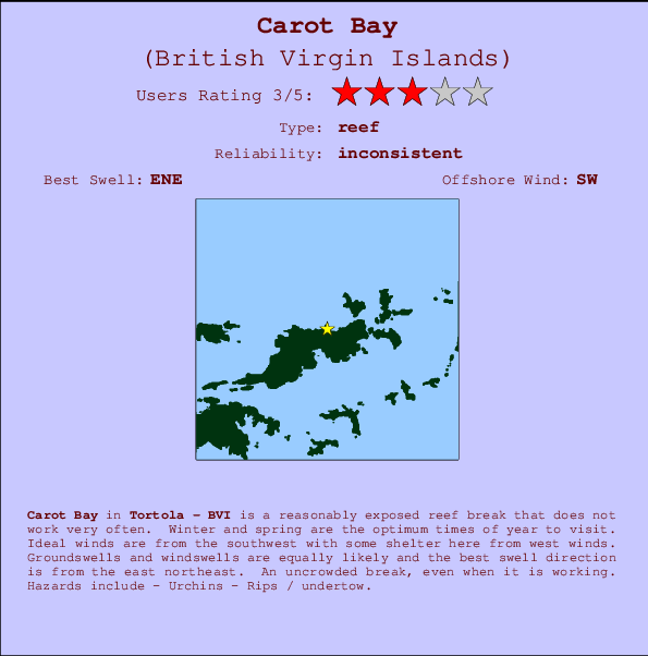
Carot Bay Surf Guide
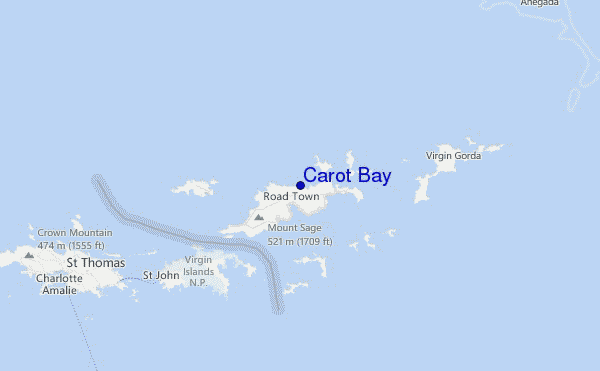
Carot Bay in Tortola - BVI is a fairly exposed reef break that only works once in a while. Winter and spring are the best times of year to visit. Ideal winds are from the southwest with some shelter here from west winds. Windswells and groundswells in equal measure and the best swell direction is from the east northeast. An uncrowded break, even when it is working. Beware of - Urchins - Rips / undertow.
Carot Bay Spot Info
| Type: | Rating: | Reliability: | Todays Sea Temp*: |
|---|---|---|---|
| inconsistent | 28.4°C*ocean temperature recorded from satellite |
Surfing Carot Bay:
The best conditions reported for surf at Carot Bay occur when a East-northeast swell combines with an offshore wind direction from the Southwest.

Previsioni Energia d'onda (Potenza): 12hrs


Carot Bay Surf:
Tuesday, 14 July 2026, 18:43 Local time| Martedì 14 | Mer | |||
| 5PM | 8PM | 11PM | 2AM | |
| Wave (m) | ||||
| Periodo (s) | 8 | 5 | 5 | 5 |
| Vento (km/h) | ||||
| Stato del vento | cross- on |
cross- on |
cross- on |
cross- on |
- /breaks/Carot-Bay/forecasts/latest
Carot Bay Surf Guide
Carot Bay in Tortola - BVI is a fairly exposed reef break that only works once in a while. Winter and spring are the best times of year to visit. Ideal winds are from the southwest with some shelter here from west winds. Windswells and groundswells in equal measure and the best swell direction is from the east northeast. An uncrowded break, even when it is working. Beware of - Urchins - Rips / undertow.
Carot Bay Spot Info
Type: Rating: Reliability: Todays Sea Temp*:  Reef
Reef 3
3inconsistent 28.4°C*ocean temperature recorded from satelliteSurfing Carot Bay:
The best conditions reported for surf at Carot Bay occur when a East-northeast swell combines with an offshore wind direction from the Southwest.
Previsioni Energia d'onda (Potenza): 12hrs
Utilizzare la scheda di navigazione in alto per visualizzare Carot Bay temperatura del mare, Carot Bay fotografie, Carot Bay dettagliate previsioni onde, il vento e le previsioni meteo, Carot Bay webcam, vento corrente da Tortola stazioni meteo e Carot Bay previsioni marea. Il link British Virgin Islands mappe maree apre l'immagine grande, che mostra British Virgin Islands e dei mari circostanti. Queste mappe possono essere animate per mostrare le diverse componenti del moto ondoso, energia delle onde, periodo d'onda, altezza delle onde, insieme con le previsioni del vento e meteo, meteo corrente e osservazioni sullo stato del mare dal British Virgin Islands onda-boe, le navi passanti e stazioni meteo costiere. Ciascuna delle pagine di previsioni per questo surf break rappresenta uno strumento di wavefinder globale e regionale per individuare le migliori condizioni di surf nella zona intorno Carot Bay.
Carot Bay Surf:
Tuesday, 14 July 2026, 18:43 Local timeMartedì 14 Mer 5PM 8PM 11PM 2AM Wave (m) Periodo (s) 8 5 5 5 Vento (km/h) Stato del vento cross-
oncross-
oncross-
oncross-
on- /breaks/Carot-Bay/forecasts/latest
- /breaks/Carot-Bay/forecasts/latest/six_day
Carot Bay Surf Guide
Carot Bay in Tortola - BVI is a fairly exposed reef break that only works once in a while. Winter and spring are the best times of year to visit. Ideal winds are from the southwest with some shelter here from west winds. Windswells and groundswells in equal measure and the best swell direction is from the east northeast. An uncrowded break, even when it is working. Beware of - Urchins - Rips / undertow.
Carot Bay Spot Info
Type: Rating: Reliability: Todays Sea Temp*: Reef3inconsistent 28.4°C*ocean temperature recorded from satelliteSurfing Carot Bay:
The best conditions reported for surf at Carot Bay occur when a East-northeast swell combines with an offshore wind direction from the Southwest.
Previsioni Energia d'onda (Potenza): 12hrs
Utilizzare la scheda di navigazione in alto per visualizzare Carot Bay temperatura del mare, Carot Bay fotografie, Carot Bay dettagliate previsioni onde, il vento e le previsioni meteo, Carot Bay webcam, vento corrente da Tortola stazioni meteo e Carot Bay previsioni marea. Il link British Virgin Islands mappe maree apre l'immagine grande, che mostra British Virgin Islands e dei mari circostanti. Queste mappe possono essere animate per mostrare le diverse componenti del moto ondoso, energia delle onde, periodo d'onda, altezza delle onde, insieme con le previsioni del vento e meteo, meteo corrente e osservazioni sullo stato del mare dal British Virgin Islands onda-boe, le navi passanti e stazioni meteo costiere. Ciascuna delle pagine di previsioni per questo surf break rappresenta uno strumento di wavefinder globale e regionale per individuare le migliori condizioni di surf nella zona intorno Carot Bay.
Carot Bay Surf:
Tuesday, 14 July 2026, 18:43 Local timeMartedì 14 Mer 5PM 8PM 11PM 2AM Wave (m) Periodo (s) 8 5 5 5 Vento (km/h) Stato del vento cross-
oncross-
oncross-
oncross-
on- /breaks/Carot-Bay/forecasts/latest
Carot Bay Surf Guide
Carot Bay in Tortola - BVI is a fairly exposed reef break that only works once in a while. Winter and spring are the best times of year to visit. Ideal winds are from the southwest with some shelter here from west winds. Windswells and groundswells in equal measure and the best swell direction is from the east northeast. An uncrowded break, even when it is working. Beware of - Urchins - Rips / undertow.
Carot Bay Spot Info
Type: Rating: Reliability: Todays Sea Temp*: Reef3inconsistent 28.4°C*ocean temperature recorded from satelliteSurfing Carot Bay:
The best conditions reported for surf at Carot Bay occur when a East-northeast swell combines with an offshore wind direction from the Southwest.
Previsioni Energia d'onda (Potenza): 12hrs
Utilizzare la scheda di navigazione in alto per visualizzare Carot Bay temperatura del mare, Carot Bay fotografie, Carot Bay dettagliate previsioni onde, il vento e le previsioni meteo, Carot Bay webcam, vento corrente da Tortola stazioni meteo e Carot Bay previsioni marea. Il link British Virgin Islands mappe maree apre l'immagine grande, che mostra British Virgin Islands e dei mari circostanti. Queste mappe possono essere animate per mostrare le diverse componenti del moto ondoso, energia delle onde, periodo d'onda, altezza delle onde, insieme con le previsioni del vento e meteo, meteo corrente e osservazioni sullo stato del mare dal British Virgin Islands onda-boe, le navi passanti e stazioni meteo costiere. Ciascuna delle pagine di previsioni per questo surf break rappresenta uno strumento di wavefinder globale e regionale per individuare le migliori condizioni di surf nella zona intorno Carot Bay.
Carot Bay Surf:
Tuesday, 14 July 2026, 18:43 Local timeMartedì 14 Mer 5PM 8PM 11PM 2AM Wave (m) Periodo (s) 8 5 5 5 Vento (km/h) Stato del vento cross-
oncross-
oncross-
oncross-
onTide Times:
Per Road Town, %{dist} %{km} da %{location}.
PROSSIMA È ALLE (ora locale) rimanente alta marea bassa marea Carot Bay Tide Times and Tide Chart
Live Weather:
At Beef Island/Roadtown Airport, 9 km from Carot Bay.
light winds from the NE
(km/h)
Dry and partly cloudyAir temperature
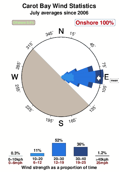
30°COverall Carot Bay Surf Consistency and Wind Distribution in Luglio
foto dall' album
Contorni: Strade e fiumi: seleziona un surf break dal menu 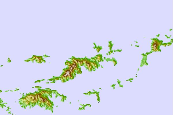
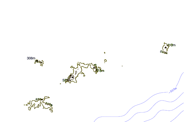
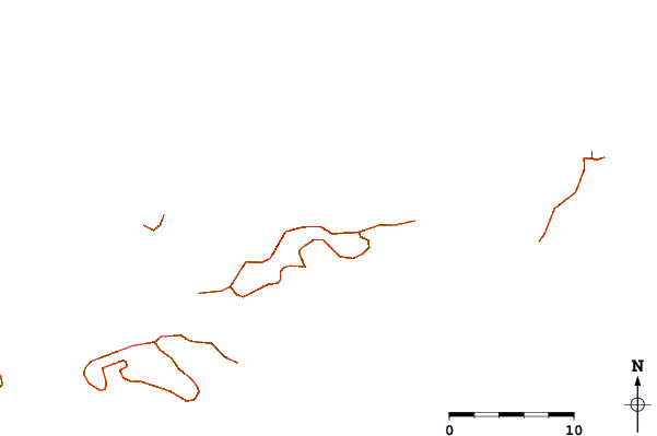
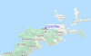
Utilizzare questa mappa sollievo per navigare Tortola surf breaks e stazioni di marea che si trovano nella zona diCarot Bay
Altri surf breaks più vicini al Carot Bay:
(clicca sul nome del luogo per maggiori informazioni)- Closest località surf0 mi
- Second closest località surf1 mi
- Third closest località surf1 mi
- Fourth closest località surf1 mi
- Fifth closest località surf2 mi
Onda boe più vicina a Carot Bay:
- Closest Onda boa17 mi
- Second closest Onda boa58 mi
- Third closest Onda boa98 mi
- Fourth closest Onda boa132 mi
- Fifth closest Onda boa154 mi
Stazioni di marea più vicina alla Carot Bay:
- Closest marea stazioneRoad Town3 mi
- Second closest marea stazioneCoral Harbor, Saint Johns Island11 mi
- Third closest marea stazioneLameshur Bay, Saint Johns12 mi
- Fourth closest marea stazioneRedhook Bay, Saint Thomas Island19 mi
- Fifth closest marea stazioneBenner Bay, Saint Thomas20 mi
Airports
- The closest passenger airport to Carot Bay is Terrance B Lettsome International (Roadtown/beef Island) Airport (EIS) in Virgin Isl., 6 km (4 miles) away (directly).
- The second nearest airport to Carot Bay is Cyril E King (St. Thomas) Airport (STT), also in Virgin Isl., 41 km (25 miles) away.
- Third is Henry E Rohlsen (St. Criox Island) Airport (STX) in Virgin Isl., 86 km (53 miles) away.
- Roosevelt Roads Ns Airport (NRR) in Puerto Rico is 112 km (70 miles) away.
- Diego Jimenez Torres (Fajardo) Airport (FAJ), also in Puerto Rico is the fifth nearest airport to Carot Bay and is 113 km (70 miles) away.
- /breaks/Carot-Bay/forecasts/latest


 Nearest